 |
|
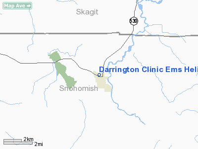
Darrington Clinic Ems Heliport |
Location & QuickFacts
| FAA Information Effective: | 2008-09-25 |
| Airport Identifier: | WA40 |
| Airport Status: | Operational |
| Longitude/Latitude: | 121-36-26.0000W/48-15-26.0000N
-121.607222/48.257222 (Estimated) |
| Elevation: | 550 ft / 167.64 m (Estimated) |
| Land: | 0 acres |
| From nearest city: | 0 nautical miles N of Darrington, WA |
| Location: | Snohomish County, WA |
| Magnetic Variation: | () |
Owner & Manager
| Ownership: | Privately owned |
| Owner: | Cascade Valley Darrington Clinic |
| Address: | 1190 Riddle St
Darrington, WA 98241 |
| Phone number: | 360-436-1055 |
| Manager: | Dr. Gary Schillhammer |
| Address: | 1190 Riddle St
Darrington, WA 98241 |
| Phone number: | 360-436-1055 |
Airport Operations and Facilities
| Airport Use: | Private
MEDICAL USE. |
| Wind indicator: | Yes |
| Control Tower: | No |
| Lighting Schedule: | PHONE REQ
FOR PERIMETER LGTS CALL 360-436-1055. |
| Region: | ANM - Northwest Mountain |
| Boundary ARTCC: | ZSE - Seattle |
| Tie-in FSS: | SEA - Seattle |
| FSS Toll Free: | 1-800-WX-BRIEF |
Runway Information
Helipad H1
| Dimension: | 40 x 40 ft / 12.2 x 12.2 m |
| Surface: | ASPH, |
| |
Runway H1 |
Runway |
| Traffic Pattern: | Left | Left |
|
Radio Navigation Aids
| ID |
Type |
Name |
Ch |
Freq |
Var |
Dist |
| BVS | NDB | Skagit/bay View | | 240.00 | 21E | 34.8 nm |
| LU | NDB | Cultus | | 214.00 | 22E | 49.2 nm |
| NUW | TACAN | Whidbey Island | 085X | | 21E | 42.6 nm |
| PAE | VOR/DME | Paine | 043X | 110.60 | 20E | 33.7 nm |
| CVV | VOR/DME | Penn Cove | 119X | 117.20 | 19E | 44.7 nm |
Remarks
Images and information placed above are from
http://www.airport-data.com/airport/WA40/
We thank them for the data!
|
|


