 |
|
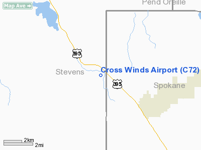
Location & QuickFacts
| FAA Information Effective: | 2008-09-25 |
| Airport Identifier: | C72 |
| Airport Status: | Operational |
| Longitude/Latitude: | 117-32-33.8200W/47-58-59.6130N
-117.542728/47.983226 (Estimated) |
| Elevation: | 2150 ft / 655.32 m (Surveyed) |
| Land: | 110 acres |
| From nearest city: | 2 nautical miles SE of Clayton, WA |
| Location: | Spokane County, WA |
| Magnetic Variation: | 20E (1985) |
Owner & Manager
| Ownership: | Privately owned |
| Owner: | Lynden P Brown |
| Address: | W 8010 Enoch Road
Clayton, WA 99110 |
| Phone number: | 509-276-2552 |
| Manager: | Lynden P Brown |
| Address: | W 8010 Enoch Road
Clayton, WA 99110 |
| Phone number: | 509-276-2552 |
Airport Operations and Facilities
| Airport Use: | Open to public |
| Wind indicator: | Yes |
| Segmented Circle: | Yes |
| Control Tower: | No |
| Landing fee charge: | No |
| Sectional chart: | Seattle |
| Region: | ANM - Northwest Mountain |
| Traffic Pattern Alt: | 1000 ft |
| Boundary ARTCC: | ZSE - Seattle |
| Tie-in FSS: | SEA - Seattle |
| FSS on Airport: | No |
| FSS Toll Free: | 1-800-WX-BRIEF |
| NOTAMs Facility: | SEA (NOTAM-d service avaliable) |
Airport Communications
Runway Information
Runway 13L/31R
| Dimension: | 3800 x 125 ft / 1158.2 x 38.1 m |
| Surface: | TURF, Fair Condition |
| |
Runway 13L |
Runway 31R |
| Traffic Pattern: | Left | Right |
| Displaced threshold: | 0.00 ft | 170.00 ft |
| Obstruction: | 23 ft pline, 100 ft left of centerline | 10 ft road, 0.0 ft from runway
APCH SLOPE 17:1 TO DSPLCD THR. |
|
Runway 13R/31L
| Dimension: | 2065 x 50 ft / 629.4 x 15.2 m |
| Surface: | TURF, Fair Condition |
| |
Runway 13R |
Runway 31L |
| Traffic Pattern: | Right | Left |
| Obstruction: | 4 ft fence, 25 ft right of centerline | 10 ft road, 0.0 ft from runway |
|
Radio Navigation Aids
| ID |
Type |
Name |
Ch |
Freq |
Var |
Dist |
| DPY | NDB | Deer Park | | 216.00 | 19E | 4.8 nm |
| SFF | NDB | Felts | | 365.00 | 19E | 20.1 nm |
| SZT | NDB | Sandpoe | | 264.00 | 20E | 43.4 nm |
| ION | NDB | Ione | | 379.00 | 21E | 44.0 nm |
| SKA | TACAN | Fairchild | 051X | | 19E | 22.9 nm |
| COE | VOR/DME | Coeur D'alene | 025X | 108.80 | 19E | 31.7 nm |
| GEG | VORTAC | Spokane | 102X | 115.50 | 21E | 25.4 nm |
| SFF | VOT | Spokane/felts Field | | 114.00 | | 20.3 nm |
| GEG | VOT | Spokane Intl | | 109.60 | | 21.7 nm |
Remarks
- USE CARE DURING HIGH WIND DUE TO TURBULENCE AND CROSSWIND.
- RWY NOT USEABLE DURING HEAVY SNOW & SPRING MUD.
- WATCH OUT FOR MOLE HOLES ON RY, RY ROUGH.
- ULTRALIGHT TFC ON ARPT.
- ARPT CLSD WINTERS; OPEN ONLY TO SKI EQUIPPED ACFT.
- RADIO CONTROLLED MODEL ACFT ON & INVOF ARPT.
Images and information placed above are from
http://www.airport-data.com/airport/C72/
We thank them for the data!
| General Info
|
| Country |
United States
|
| State |
WASHINGTON
|
| FAA ID |
C72
|
| Latitude |
47-58-59.613N
|
| Longitude |
117-32-33.820W
|
| Elevation |
2150 feet
|
| Near City |
CLAYTON
|
We don't guarantee the information is fresh and accurate. The data may
be wrong or outdated.
For more up-to-date information please refer to other sources.
|
|


