 |
|
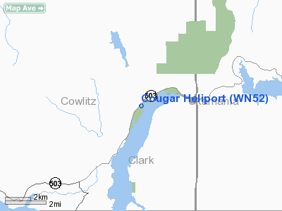
Location & QuickFacts
| FAA Information Effective: | 2008-09-25 |
| Airport Identifier: | WN52 |
| Airport Status: | Operational |
| Longitude/Latitude: | 122-18-04.3480W/46-03-03.3970N
-122.301208/46.050944 (Estimated) |
| Elevation: | 500 ft / 152.40 m (Estimated) |
| Land: | 0 acres |
| From nearest city: | 0 nautical miles W of Cougar, WA |
| Location: | Cowlitz County, WA |
| Magnetic Variation: | 20E (1985) |
Owner & Manager
| Ownership: | Privately owned |
| Owner: | Ken G. Guthrie |
| Address: | Po Box 14
Cougar, WA 98616 |
| Phone number: | 360-238-5326 |
| Manager: | Ken G. Guthrie |
| Address: | Po Box 14
Cougar, WA 98616 |
| Phone number: | 360-238-5326 |
Airport Operations and Facilities
| Airport Use: | Private |
| Segmented Circle: | No |
| Control Tower: | No |
| Sectional chart: | Seattle |
| Region: | ANM - Northwest Mountain |
| Boundary ARTCC: | ZSE - Seattle |
| Tie-in FSS: | SEA - Seattle |
| FSS Toll Free: | 1-800-WX-BRIEF |
Runway Information
Helipad H1
| Dimension: | 100 x 100 ft / 30.5 x 30.5 m |
| Surface: | TURF, |
| |
Runway H1 |
Runway |
| Traffic Pattern: | Left | Left |
|
Radio Navigation Aids
| ID |
Type |
Name |
Ch |
Freq |
Var |
Dist |
| LSO | NDB | Kelso | | 256.00 | 21E | 26.2 nm |
| LBH | NDB | Laker | | 332.00 | 20E | 31.4 nm |
| TDO | NDB | Toledo | | 219.00 | 20E | 33.3 nm |
| PND | NDB | Banks | | 356.00 | 21E | 40.1 nm |
| CBU | TACAN | Columbia | 029X | | 20E | 30.7 nm |
| PDX | VOR/DME | Portland | 055X | 111.80 | 20E | 30.3 nm |
| BTG | VORTAC | Battle Ground | 113X | 116.60 | 21E | 21.9 nm |
| PDX | VOT | Portland Intl | | 111.00 | | 30.0 nm |
| HIO | VOT | Portland-hillsboro | | 115.20 | | 41.0 nm |
Images and information placed above are from
http://www.airport-data.com/airport/WN52/
We thank them for the data!
| General Info
|
| Country |
United States
|
| State |
WASHINGTON
|
| FAA ID |
WN52
|
| Latitude |
46-03-03.397N
|
| Longitude |
122-18-04.348W
|
| Elevation |
500 feet
|
| Near City |
COUGAR
|
We don't guarantee the information is fresh and accurate. The data may
be wrong or outdated.
For more up-to-date information please refer to other sources.
|
|


