 |
|
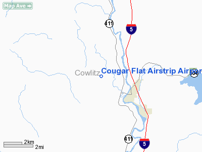
Cougar Flat Airstrip Airport |
Location & QuickFacts
| FAA Information Effective: | 2008-09-25 |
| Airport Identifier: | WN24 |
| Airport Status: | Operational |
| Longitude/Latitude: | 122-57-01.4160W/46-17-33.3960N
-122.950393/46.292610 (Estimated) |
| Elevation: | 180 ft / 54.86 m (Estimated) |
| Land: | 0 acres |
| From nearest city: | 2 nautical miles NW of Castle Rock, WA |
| Location: | Cowlitz County, WA |
| Magnetic Variation: | 20E (1985) |
Owner & Manager
| Ownership: | Privately owned |
| Owner: | Tom Deweese
STRIP IS LEASED TO LEE SMITH AND WAYNE NESS - PRIVATE USE; 224 COUGAR FLAT RD; CASTLE ROCK WA 98611. |
| Address: | 936 Ph 10
Castle Rock, WA 98611 |
| Manager: | Lee Smith |
| Address: | 224 Cougar Flat Rd
Castle Rock, WA 98611 |
| Phone number: | 206-274-7666 |
Airport Operations and Facilities
| Airport Use: | Private |
| Wind indicator: | Yes |
| Segmented Circle: | No |
| Control Tower: | No |
| Landing fee charge: | No |
| Sectional chart: | Seattle |
| Region: | ANM - Northwest Mountain |
| Boundary ARTCC: | ZSE - Seattle |
| Tie-in FSS: | SEA - Seattle |
| FSS on Airport: | No |
| FSS Toll Free: | 1-800-WX-BRIEF |
Runway Information
Runway 09/27
| Dimension: | 1200 x 100 ft / 365.8 x 30.5 m |
| Surface: | TURF, Good Condition |
| |
Runway 09 |
Runway 27 |
| Traffic Pattern: | Left | Left |
|
Radio Navigation Aids
| ID |
Type |
Name |
Ch |
Freq |
Var |
Dist |
| AST | FAN MARKER | Fort Stevens | | | 22E | 42.5 nm |
| LSO | NDB | Kelso | | 256.00 | 21E | 8.4 nm |
| TDO | NDB | Toledo | | 219.00 | 20E | 12.3 nm |
| PEN | NDB | Karpen | | 201.00 | 20E | 28.0 nm |
| PND | NDB | Banks | | 356.00 | 21E | 40.0 nm |
| LAC | NDB | Lacomas | | 328.00 | 18E | 46.0 nm |
| LBH | NDB | Laker | | 332.00 | 20E | 49.6 nm |
| CBU | TACAN | Columbia | 029X | | 20E | 44.6 nm |
| AST | VOR/DME | Astoria | 087X | 114.00 | 19E | 39.5 nm |
| PDX | VOR/DME | Portland | 055X | 111.80 | 20E | 44.4 nm |
| BTG | VORTAC | Battle Ground | 113X | 116.60 | 21E | 36.0 nm |
| OLM | VORTAC | Olympia | 081X | 113.40 | 19E | 40.9 nm |
| PDX | VOT | Portland Intl | | 111.00 | | 44.2 nm |
| HIO | VOT | Portland-hillsboro | | 115.20 | | 45.2 nm |
Images and information placed above are from
http://www.airport-data.com/airport/WN24/
We thank them for the data!
| General Info
|
| Country |
United States
|
| State |
WASHINGTON
|
| FAA ID |
WN24
|
| Latitude |
46-17-33.396N
|
| Longitude |
122-57-01.416W
|
| Elevation |
180 feet
|
| Near City |
CASTLE ROCK
|
We don't guarantee the information is fresh and accurate. The data may
be wrong or outdated.
For more up-to-date information please refer to other sources.
|
|


