 |
|
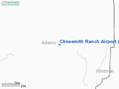
Location & QuickFacts
| FAA Information Effective: | 2008-09-25 |
| Airport Identifier: | WN30 |
| Airport Status: | Operational |
| Longitude/Latitude: | 118-05-31.8370W/46-55-11.5520N
-118.092177/46.919876 (Estimated) |
| Elevation: | 1600 ft / 487.68 m (Estimated) |
| Land: | 10 acres |
| From nearest city: | 1 nautical miles NE of Benge, WA |
| Location: | Adams County, WA |
| Magnetic Variation: | 19E (1985) |
Owner & Manager
| Ownership: | Privately owned |
| Owner: | Robert Clinesmith |
| Address: | P O Box 637
Benge, WA 99105 |
| Phone number: | 509-887-2250 |
| Manager: | Robert Clinesmith |
| Address: | P O Box 637
Benge, WA 99105 |
| Phone number: | 509-887-2250 |
Airport Operations and Facilities
| Airport Use: | Private |
| Wind indicator: | Yes |
| Segmented Circle: | No |
| Control Tower: | No |
| Landing fee charge: | No |
| Sectional chart: | Seattle |
| Region: | ANM - Northwest Mountain |
| Boundary ARTCC: | ZSE - Seattle |
| Tie-in FSS: | SEA - Seattle |
| FSS on Airport: | No |
| FSS Toll Free: | 1-800-WX-BRIEF |
Runway Information
Runway 18/36
| Dimension: | 2300 x 50 ft / 701.0 x 15.2 m |
| Surface: | DIRT-TURF, |
| |
Runway 18 |
Runway 36 |
| Traffic Pattern: | Left | Left |
| Markings: | Nonstandard, | Nonstandard, |
| Displaced threshold: | 100.00 ft | 0.00 ft |
| Obstruction: | 5 ft fence, 35.0 ft from runway | |
|
Radio Navigation Aids
| ID |
Type |
Name |
Ch |
Freq |
Var |
Dist |
| MW | NDB | Pelly | | 408.00 | 18E | 49.9 nm |
| SKA | TACAN | Fairchild | 051X | | 19E | 45.1 nm |
| PUW | VOR/DME | Pullman | 027X | 109.00 | 20E | 38.7 nm |
| GEG | VORTAC | Spokane | 102X | 115.50 | 21E | 43.2 nm |
| GEG | VOT | Spokane Intl | | 109.60 | | 47.9 nm |
Remarks
- ARPT CLSD DURING SEVERE WEATHER CONDITIONS AND AFTER HEAVY RAINS.
- CALL OWNER FOR RWY CONDITIONS.
- 3' FENCE ALONG EACH SIDE OF RWY.
Images and information placed above are from
http://www.airport-data.com/airport/WN30/
We thank them for the data!
| General Info
|
| Country |
United States
|
| State |
WASHINGTON
|
| FAA ID |
WN30
|
| Latitude |
46-55-11.552N
|
| Longitude |
118-05-31.837W
|
| Elevation |
1600 feet
|
| Near City |
BENGE
|
We don't guarantee the information is fresh and accurate. The data may
be wrong or outdated.
For more up-to-date information please refer to other sources.
|
|


