|
|
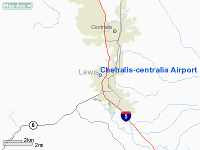
Chehalis-centralia Airport |
 |
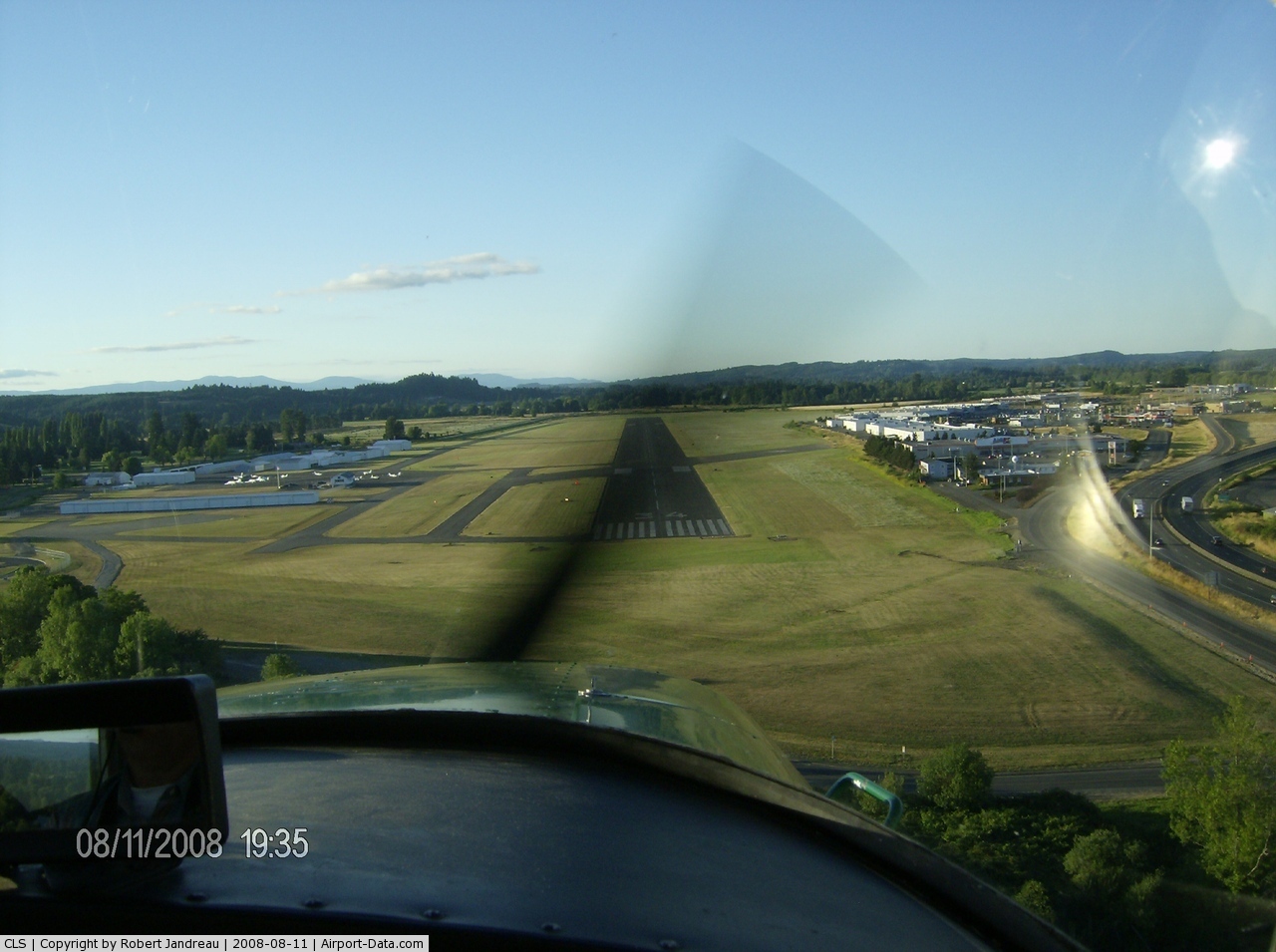
(Click on the photo to enlarge) |
 |
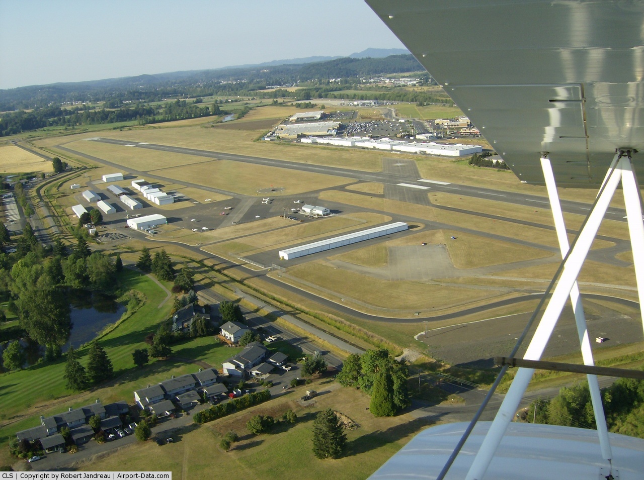
(Click on the photo to enlarge) |
Location & QuickFacts
| FAA Information Effective: | 2008-09-25 |
| Airport Identifier: | CLS |
| Airport Status: | Operational |
| Longitude/Latitude: | 122-58-57.8900W/46-40-37.3050N
-122.982747/46.677029 (Estimated) |
| Elevation: | 176 ft / 53.64 m (Estimated) |
| Land: | 438 acres |
| From nearest city: | 1 nautical miles W of Chehalis, WA |
| Location: | Lewis County, WA |
| Magnetic Variation: | 20E (1985) |
Owner & Manager
| Ownership: | Publicly owned |
| Owner: | Lewis County/chehalis |
| Address: | P.o. Box 1344
Chehalis, WA 98532 |
| Phone number: | 360-748-1230 |
| Manager: | Allyn Roe |
| Address: | 900 Nw Airport Road
Chehalis, WA 98532 |
| Phone number: | 360-748-1230 |
Airport Operations and Facilities
| Airport Use: | Open to public |
| Wind indicator: | Yes |
| Segmented Circle: | Yes |
| Control Tower: | No |
| Lighting Schedule: | DUSK-DAWN
ACTVT MIRL RY 16/34 - CTAF. |
| Beacon Color: | Clear-Green (lighted land airport) |
| Landing fee charge: | No |
| Sectional chart: | Seattle |
| Region: | ANM - Northwest Mountain |
| Boundary ARTCC: | ZSE - Seattle |
| Tie-in FSS: | SEA - Seattle |
| FSS on Airport: | No |
| FSS Toll Free: | 1-800-WX-BRIEF |
| NOTAMs Facility: | SEA (NOTAM-d service avaliable) |
| Federal Agreements: | NGY3 |
Airport Communications
| CTAF: | 122.800 |
| Unicom: | 122.800 |
Airport Services
| Fuel available: | 100LLA
FUEL AVBL 24 HRS. BY CREDIT CARD ONLY. NO DEBIT CARDS. |
| Airframe Repair: | MAJOR |
| Power Plant Repair: | MAJOR |
| Bottled Oxygen: | LOW |
| Bulk Oxygen: | NONE |
Runway Information
Runway 16/34
| Dimension: | 5000 x 150 ft / 1524.0 x 45.7 m |
| Surface: | CONC, Good Condition |
| Weight Limit: | Single wheel: 30000 lbs.
Dual wheel: 30000 lbs.
Dual tandem wheel: 85000 lbs. |
| Edge Lights: | Medium |
| |
Runway 16 |
Runway 34 |
| Longitude: | 122-58-59.2700W | 122-58-56.5100W |
| Latitude: | 46-41-01.9700N | 46-40-12.6400N |
| Elevation: | 168.00 ft | 173.00 ft |
| Alignment: | 127 | 127 |
| Traffic Pattern: | Right | Left |
| Markings: | Non-precision instrument, Good Condition | Basic, Good Condition |
| Crossing Height: | 51.00 ft | 35.00 ft |
| VASI: | 4-light PAPI on left side | 2-box on left side |
| Visual Glide Angle: | 4.00° | 4.50° |
| Runway End Identifier: | | Yes |
| Obstruction: | 113 ft trees, 2010.0 ft from runway, 10 ft left of centerline, 16:1 slope to clear | 65 ft trees, 888.0 ft from runway, 348 ft right of centerline, 10:1 slope to clear |
|
Radio Navigation Aids
| ID |
Type |
Name |
Ch |
Freq |
Var |
Dist |
| AST | FAN MARKER | Fort Stevens | | | 22E | 49.5 nm |
| TDO | NDB | Toledo | | 219.00 | 20E | 13.9 nm |
| LAC | NDB | Lacomas | | 328.00 | 18E | 26.5 nm |
| LSO | NDB | Kelso | | 256.00 | 21E | 31.5 nm |
| GR | NDB | Graye | | 216.00 | 18E | 32.4 nm |
| MNC | NDB | Mason County | | 348.00 | 19E | 34.6 nm |
| PEN | NDB | Karpen | | 201.00 | 20E | 40.9 nm |
| CAN | NDB | Carney | | 274.00 | 20E | 44.5 nm |
| ODD | NDB | Dondo | | 224.00 | 19E | 49.7 nm |
| PWT | NDB | Kitsap | | 206.00 | 20E | 49.9 nm |
| AST | VOR/DME | Astoria | 087X | 114.00 | 19E | 48.4 nm |
| OLM | VORTAC | Olympia | 081X | 113.40 | 19E | 18.0 nm |
| TCM | VORTAC | Mcchord | 033X | 109.60 | 22E | 35.1 nm |
Remarks
- TFC PATTERN TO THE WEST ON ALL RY APCHS.
- POSSIBLE WILDLIFE ON RYS.
- ESTABD PRIOR TO 15 MAY 1959.
Images and information placed above are from
http://www.airport-data.com/airport/CLS/
We thank them for the data!
| General Info
|
| Country |
United States
|
| State |
WASHINGTON
|
| FAA ID |
CLS
|
| Latitude |
46-40-37.305N
|
| Longitude |
122-58-57.890W
|
| Elevation |
173 feet
|
| Near City |
CHEHALIS
|
We don't guarantee the information is fresh and accurate. The data may
be wrong or outdated.
For more up-to-date information please refer to other sources.
|
|