 |
|
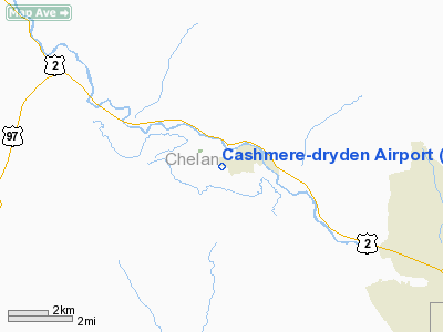
Location & QuickFacts
| FAA Information Effective: | 2008-09-25 |
| Airport Identifier: | 8S2 |
| Airport Status: | Operational |
| Longitude/Latitude: | 120-29-04.7610W/47-30-53.0780N
-120.484656/47.514744 (Estimated) |
| Elevation: | 858 ft / 261.52 m (Estimated) |
| Land: | 24 acres |
| From nearest city: | 0 nautical miles SW of Cashmere, WA |
| Location: | Chelan County, WA |
| Magnetic Variation: | 20E (1985) |
Owner & Manager
| Ownership: | Publicly owned |
| Owner: | Chelan County |
| Address: | Court House
Wenatchee, WA 98801 |
| Phone number: | 509-782-5561 |
| Manager: | Dan Stewart |
| Address: | 5500 Sullivan, Attn: Manager
Cashmere, WA 98815 |
| Phone number: | 509-679-8763 |
Airport Operations and Facilities
| Airport Use: | Open to public |
| Wind indicator: | Yes |
| Segmented Circle: | No |
| Control Tower: | No |
| Lighting Schedule: | DUSK-DAWN
ACTVT MIRL RY 07/25 - 121.7. |
| Beacon Color: | Clear-Green (lighted land airport) |
| Landing fee charge: | No |
| Sectional chart: | Seattle |
| Region: | ANM - Northwest Mountain |
| Boundary ARTCC: | ZSE - Seattle |
| Tie-in FSS: | SEA - Seattle |
| FSS on Airport: | No |
| FSS Toll Free: | 1-800-WX-BRIEF |
| NOTAMs Facility: | SEA (NOTAM-d service avaliable) |
| Federal Agreements: | N1 |
Airport Communications
Airport Services
| Airframe Repair: | MAJOR |
| Power Plant Repair: | MAJOR |
| Bottled Oxygen: | NONE |
| Bulk Oxygen: | NONE |
Runway Information
Runway 07/25
| Dimension: | 1800 x 50 ft / 548.6 x 15.2 m |
| Surface: | ASPH, Good Condition |
| Weight Limit: | Single wheel: 8000 lbs. |
| Edge Lights: | Medium
MIRL RWY 07/25 OUT OF SERVICE INDEFLY. |
| |
Runway 07 |
Runway 25 |
| Elevation: | 853.00 ft | 0.00 ft |
| Traffic Pattern: | Left | Left |
| Markings: | Basic, Fair Condition | Basic, Fair Condition |
| Displaced threshold: | 0.00 ft | 182.00 ft |
| VASI: | | 2-light PAPI on left side |
| Visual Glide Angle: | 0.00° | 3.00° |
| Obstruction: | 9 ft fence, 206.0 ft from runway, 109 ft left of centerline
RY 07 +8 FT FENCE FM 200-100 FT, 100 FT L. | 15 ft trees, 438.0 ft from runway, 10 ft right of centerline, 15:1 slope to clear
APCH SLOPE MEASURED FROM DSPLCD THR 28:1
+4 FT FENCE 90 FT, 40 FT L&R; RD AT 90 FT; 25-30 FT TREES AT 150 FT, 60 FT R. |
|
Radio Navigation Aids
| ID |
Type |
Name |
Ch |
Freq |
Var |
Dist |
| EAT | FAN MARKER | Malaga | | | 21E | 16.9 nm |
| EAT | VOR/DME | Wenatchee | 047X | 111.00 | 19E | 13.1 nm |
| ELN | VORTAC | Ellensburg | 126X | 117.90 | 21E | 29.5 nm |
| EPH | VORTAC | Ephrata | 073X | 112.60 | 21E | 43.9 nm |
Remarks
- NUMEROUS OBJECTS IN TRANSITION SFCS.
- TREES IN PRIM SFC RY 07.
- EXIT RY AT TWYS ONLY.
- GROUND VEHICLES AND PEDESTRIANS USE TWY FOR HANGER AND RESIDENITAL ACCESS.
- RADIO CONTROL MODEL ACTIVITY PERMITTED, ON WEST END OF ARPT.
- ESTBD PRIOR TO MAY 1959.
Images and information placed above are from
http://www.airport-data.com/airport/8S2/
We thank them for the data!
| General Info
|
| Country |
United States
|
| State |
WASHINGTON
|
| FAA ID |
8S2
|
| Latitude |
47-30-53.446N
|
| Longitude |
120-29-05.289W
|
| Elevation |
853 feet
|
| Near City |
CASHMERE
|
We don't guarantee the information is fresh and accurate. The data may
be wrong or outdated.
For more up-to-date information please refer to other sources.
|
|


