 |
|
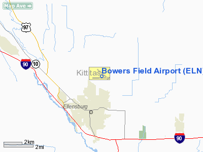
Location & QuickFacts
| FAA Information Effective: | 2008-09-25 |
| Airport Identifier: | ELN |
| Airport Status: | Operational |
| Longitude/Latitude: | 120-31-50.5000W/47-01-58.9000N
-120.530694/47.033028 (Estimated) |
| Elevation: | 1764 ft / 537.67 m (Surveyed) |
| Land: | 1032 acres |
| From nearest city: | 2 nautical miles N of Ellensburg, WA |
| Location: | Kittitas County, WA |
| Magnetic Variation: | 21E (1980) |
Owner & Manager
| Ownership: | Publicly owned |
| Owner: | Kittitas County |
| Address: | 411 N. Ruby St. Suite 1
Ellensburg, WA 98926 |
| Phone number: | 509-962-7523 |
| Manager: | Ms Kelly Carlson |
| Address: | 411 N. Ruby St. Suite 1
Ellensburg, WA 98926 |
| Phone number: | 509-962-7523 |
Airport Operations and Facilities
| Airport Use: | Open to public |
| Wind indicator: | Yes |
| Segmented Circle: | Yes |
| Control Tower: | No |
| Lighting Schedule: | DUSK-DAWN
ACTVT MIRL RY 11/29 - CTAF. |
| Beacon Color: | Clear-Green (lighted land airport) |
| Landing fee charge: | No |
| Sectional chart: | Seattle |
| Region: | ANM - Northwest Mountain |
| Traffic Pattern Alt: | 834 ft |
| Boundary ARTCC: | ZSE - Seattle |
| Tie-in FSS: | SEA - Seattle |
| FSS on Airport: | No |
| FSS Toll Free: | 1-800-WX-BRIEF |
| NOTAMs Facility: | ELN (NOTAM-d service avaliable) |
| Federal Agreements: | NGPY3 |
Airport Communications
| CTAF: | 123.000 |
| Unicom: | 123.000 |
Airport Services
| Fuel available: | 100LLA |
| Airframe Repair: | MAJOR |
| Power Plant Repair: | MAJOR |
| Bottled Oxygen: | NONE |
| Bulk Oxygen: | NONE |
Runway Information
Runway 07/25
| Dimension: | 5590 x 150 ft / 1703.8 x 45.7 m
HAS A 1460 FT STOPWAY NW END. |
| Surface: | ASPH, Good Condition |
| Weight Limit: | Single wheel: 28000 lbs. |
| |
Runway 07 |
Runway 25 |
| Longitude: | 120-32-35.9017W | 120-31-15.2674W |
| Latitude: | 47-01-52.9041N | 47-01-54.8828N |
| Elevation: | 1710.00 ft | 1755.00 ft |
| Alignment: | 88 | 127 |
| Traffic Pattern: | Left | Left |
| Markings: | Basic, Good Condition | Basic, Good Condition |
| Obstruction: | 15 ft tree, 688.0 ft from runway, 70 ft right of centerline, 32:1 slope to clear | 35 ft pline, 1631.0 ft from runway, 40:1 slope to clear |
|
Runway 11/29
| Dimension: | 4301 x 150 ft / 1310.9 x 45.7 m
HAS A 1460 FT STOPWAY NW END. |
| Surface: | CONC, Good Condition |
| Weight Limit: | Single wheel: 35000 lbs.
Dual wheel: 57000 lbs.
Dual tandem wheel: 100000 lbs. |
| Edge Lights: | Medium |
| |
Runway 11 |
Runway 29 |
| Longitude: | 120-32-06.6089W | 120-31-21.1931W |
| Latitude: | 47-02-19.9097N | 47-01-50.9701N |
| Elevation: | 1764.00 ft | 1747.00 ft |
| Alignment: | 127 | 127 |
| Traffic Pattern: | Left | Left |
| Markings: | Basic, Good Condition | Basic, Good Condition |
| Crossing Height: | 0.00 ft | 40.00 ft |
| VASI: | | 2-light PAPI on right side |
| Visual Glide Angle: | 0.00° | 3.00° |
| Runway End Identifier: | | Yes |
|
Radio Navigation Aids
| ID |
Type |
Name |
Ch |
Freq |
Var |
Dist |
| EAT | FAN MARKER | Malaga | | | 21E | 25.4 nm |
| EAT | VOR/DME | Wenatchee | 047X | 111.00 | 19E | 25.6 nm |
| ELN | VORTAC | Ellensburg | 126X | 117.90 | 21E | 3.0 nm |
| YKM | VORTAC | Yakima | 107X | 116.00 | 21E | 28.0 nm |
| EPH | VORTAC | Ephrata | 073X | 112.60 | 21E | 49.7 nm |
Remarks
- DSTC TO GO MKRS NORTH SIDE OF RY 07/25 & RY 11/29.
- RY 07/25 CLOSED DEC 15 THRU FEB 28, NO MAINT. AVAILABLE.
- RY 07/25 HAS WEEDS GROWING IN CRACKS IN PAVEMENT FIRST 2000 FT.
- ESTABD PRIOR TO 15 MAY 1959.
Images and information placed above are from
http://www.airport-data.com/airport/ELN/
We thank them for the data!
| General Info
|
| Country |
United States
|
| State |
WASHINGTON
|
| FAA ID |
ELN
|
| Latitude |
47-01-58.900N
|
| Longitude |
120-31-50.500W
|
| Elevation |
1763 feet
|
| Near City |
ELLENSBURG
|
We don't guarantee the information is fresh and accurate. The data may
be wrong or outdated.
For more up-to-date information please refer to other sources.
|
|


