 |
|
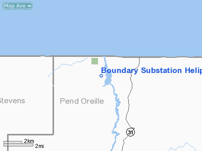
Boundary Substation Heliport |
Location & QuickFacts
| FAA Information Effective: | 2008-09-25 |
| Airport Identifier: | 5WA4 |
| Airport Status: | Operational |
| Longitude/Latitude: | 117-21-26.8850W/48-58-52.7280N
-117.357468/48.981313 (Estimated) |
| Elevation: | 2511 ft / 765.35 m (Estimated) |
| Land: | 0 acres |
| From nearest city: | 10 nautical miles N of Metaline Falls, WA |
| Location: | Pend Oreille County, WA |
| Magnetic Variation: | 20E (1985) |
Owner & Manager
| Ownership: | Privately owned |
| Owner: | Bonneville Power Admin (bpa) |
| Address: | P.o. Box 3621
Portland, OR 97208 |
| Phone number: | 503-230-5161 |
| Manager: | Richard Banning |
| Address: | P.o. Box 3621 - Mc
Portland, OR 97208 |
| Phone number: | 503-230-4107 |
Airport Operations and Facilities
| Airport Use: | Private |
| Segmented Circle: | No |
| Control Tower: | No |
| Sectional chart: | Seattle |
| Region: | ANM - Northwest Mountain |
| Boundary ARTCC: | ZSE - Seattle |
| Tie-in FSS: | SEA - Seattle |
| FSS Toll Free: | 1-800-WX-BRIEF |
Runway Information
Helipad H1
| Dimension: | 100 x 75 ft / 30.5 x 22.9 m |
| Surface: | GRAVEL, |
| |
Runway H1 |
Runway |
| Traffic Pattern: | Left | Left |
|
Radio Navigation Aids
| ID |
Type |
Name |
Ch |
Freq |
Var |
Dist |
| ION | NDB | Ione | | 379.00 | 21E | 16.4 nm |
| EF | NDB | Champion | | 206.00 | 20E | 19.8 nm |
| YK | NDB | Brilliant | | 269.00 | 20E | 23.3 nm |
| CG | NDB | Castlegar | | 227.00 | 20E | 29.3 nm |
Images and information placed above are from
http://www.airport-data.com/airport/5WA4/
We thank them for the data!
| General Info
|
| Country |
United States
|
| State |
WASHINGTON
|
| FAA ID |
5WA4
|
| Latitude |
48-58-52.728N
|
| Longitude |
117-21-26.885W
|
| Elevation |
2511 feet
|
| Near City |
METALINE FALLS
|
We don't guarantee the information is fresh and accurate. The data may
be wrong or outdated.
For more up-to-date information please refer to other sources.
|
|


