 |
|
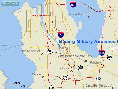
Boeing Military Airplanes Heliport |
Location & QuickFacts
| FAA Information Effective: | 2008-09-25 |
| Airport Identifier: | WA11 |
| Airport Status: | Operational |
| Longitude/Latitude: | 122-18-16.4460W/47-31-21.3560N
-122.304568/47.522599 (Estimated) |
| Elevation: | 6 ft / 1.83 m (Estimated) |
| Land: | 0 acres |
| From nearest city: | 6 nautical miles S of Tukwila, WA |
| Location: | King County, WA |
| Magnetic Variation: | 20E (1985) |
Owner & Manager
| Ownership: | Privately owned |
| Owner: | Boeing |
| Address: | Po Box 3707, M/s 46-87
Seattle, WA 98124-2207 |
| Phone number: | 206-544-2975 |
| Address: |
|
Airport Operations and Facilities
| Airport Use: | Private |
| Wind indicator: | Yes |
| Segmented Circle: | No |
| Control Tower: | No |
| Lighting Schedule: | DUSK-DAWN |
| Sectional chart: | Seattle |
| Region: | ANM - Northwest Mountain |
| Boundary ARTCC: | ZSE - Seattle |
| Tie-in FSS: | SEA - Seattle |
| FSS on Airport: | No |
| FSS Toll Free: | 1-800-WX-BRIEF |
Runway Information
Helipad H1
| Dimension: | 50 x 30 ft / 15.2 x 9.1 m |
| Surface: | ASPH-TRTD, Good Condition |
| |
Runway H1 |
Runway |
| Traffic Pattern: | Left | Left |
| Markings: | Basic, Good Condition | , |
|
Radio Navigation Aids
| ID |
Type |
Name |
Ch |
Freq |
Var |
Dist |
| RNT | NDB | Renton | | 353.00 | 20E | 4.0 nm |
| ODD | NDB | Dondo | | 224.00 | 19E | 9.5 nm |
| PWT | NDB | Kitsap | | 206.00 | 20E | 18.4 nm |
| CAN | NDB | Carney | | 274.00 | 20E | 22.7 nm |
| GR | NDB | Graye | | 216.00 | 18E | 25.5 nm |
| LAC | NDB | Lacomas | | 328.00 | 18E | 32.6 nm |
| MNC | NDB | Mason County | | 348.00 | 19E | 35.8 nm |
| PAE | VOR/DME | Paine | 043X | 110.60 | 20E | 23.9 nm |
| CVV | VOR/DME | Penn Cove | 119X | 117.20 | 19E | 46.6 nm |
| SEA | VORTAC | Seattle | 115X | 116.80 | 19E | 5.2 nm |
| TCM | VORTAC | Mcchord | 033X | 109.60 | 22E | 23.6 nm |
| OLM | VORTAC | Olympia | 081X | 113.40 | 19E | 41.1 nm |
| BFI | VOT | Boeing Field | | 108.60 | | 0.3 nm |
| SEA | VOT | Seattle-tacoma | | 117.50 | | 4.8 nm |
Remarks
- PRVDD PILOTS UTILIZING THIS FACILITY CTCC BOEING FIELD & SEA TAC ATC FOR OPERATING INSTRUCTIONS.
Images and information placed above are from
http://www.airport-data.com/airport/WA11/
We thank them for the data!
| General Info
|
| Country |
United States
|
| State |
WASHINGTON
|
| FAA ID |
WA11
|
| Latitude |
47-31-21.356N
|
| Longitude |
122-18-16.446W
|
| Elevation |
6 feet
|
| Near City |
TUKWILA
|
We don't guarantee the information is fresh and accurate. The data may
be wrong or outdated.
For more up-to-date information please refer to other sources.
|
|


