 |
|
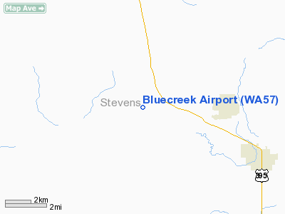
Location & QuickFacts
| FAA Information Effective: | 2008-09-25 |
| Airport Identifier: | WA57 |
| Airport Status: | Operational |
| Longitude/Latitude: | 117-50-25.1000W/48-18-50.2000N
-117.840306/48.313944 (Estimated) |
| Elevation: | 1740 ft / 530.35 m (Estimated) |
| Land: | 10 acres |
| From nearest city: | 3 nautical miles S of Addy, WA |
| Location: | Stevens County, WA |
| Magnetic Variation: | () |
Owner & Manager
| Ownership: | Privately owned |
| Owner: | Tyrone Bryant |
| Address: | 1755 Bluecreek Rd
Addy, WA 99101 |
| Phone number: | 509-935-8982 |
| Manager: | Tyrone Bryant |
| Address: | 1755 Bluecreek Rd
Addy, WA 99101 |
| Phone number: | 509-935-8982 |
Airport Operations and Facilities
| Airport Use: | Private |
| Wind indicator: | Yes |
| Segmented Circle: | No |
| Control Tower: | No |
| Sectional chart: | Seattle |
| Region: | ANM - Northwest Mountain |
| Boundary ARTCC: | ZSE - Seattle |
| Tie-in FSS: | SEA - Seattle |
| FSS Toll Free: | 1-800-WX-BRIEF |
Runway Information
Runway 10/28
| Dimension: | 1300 x 40 ft / 396.2 x 12.2 m |
| Surface: | TURF, |
| |
Runway 10 |
Runway 28 |
| Traffic Pattern: | Left | Left |
| Obstruction: | 60 ft tree, 100.0 ft from runway | 5 ft fence, 0.0 ft from runway |
|
Radio Navigation Aids
| ID |
Type |
Name |
Ch |
Freq |
Var |
Dist |
| DPY | NDB | Deer Park | | 216.00 | 19E | 26.6 nm |
| ION | NDB | Ione | | 379.00 | 21E | 29.3 nm |
| SFF | NDB | Felts | | 365.00 | 19E | 43.3 nm |
| SKA | TACAN | Fairchild | 051X | | 19E | 42.9 nm |
| GEG | VORTAC | Spokane | 102X | 115.50 | 21E | 45.8 nm |
| GEG | VOT | Spokane Intl | | 109.60 | | 43.3 nm |
| SFF | VOT | Spokane/felts Field | | 114.00 | | 43.5 nm |
Images and information placed above are from
http://www.airport-data.com/airport/WA57/
We thank them for the data!
|
|


