 |
|
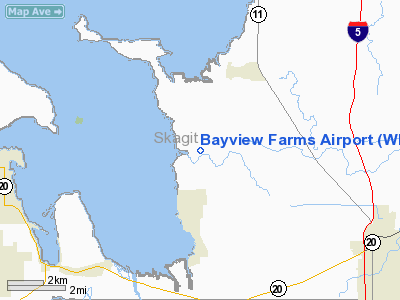
Location & QuickFacts
| FAA Information Effective: | 2008-09-25 |
| Airport Identifier: | WN51 |
| Airport Status: | Operational |
| Longitude/Latitude: | 122-27-54.5970W/48-31-15.3830N
-122.465166/48.520940 (Estimated) |
| Elevation: | 6 ft / 1.83 m (Estimated) |
| Land: | 10 acres |
| From nearest city: | 6 nautical miles NW of Burlington, WA |
| Location: | Skagit County, WA |
| Magnetic Variation: | 21E (1985) |
Owner & Manager
| Ownership: | Privately owned |
| Owner: | Bayview Farms, Inc. |
| Address: | P.o. Box 178
Bow, WA 98232 |
| Phone number: | 360-766-7000 |
| Manager: | Thomas J. Paulus |
| Address: | Po Box 178
Bow, WA 98232 |
| Phone number: | 360-766-7000 |
Airport Operations and Facilities
| Airport Use: | Private |
| Wind indicator: | Yes |
| Segmented Circle: | No |
| Control Tower: | No |
| Sectional chart: | Seattle |
| Region: | ANM - Northwest Mountain |
| Boundary ARTCC: | ZSE - Seattle |
| Tie-in FSS: | SEA - Seattle |
| FSS Toll Free: | 1-800-WX-BRIEF |
Runway Information
Runway 07/25
| Dimension: | 2000 x 120 ft / 609.6 x 36.6 m |
| Surface: | TURF, |
| |
Runway 07 |
Runway 25 |
| Traffic Pattern: | Left | Left |
| Obstruction: | 30 ft pline, 700.0 ft from runway | |
|
Radio Navigation Aids
| ID |
Type |
Name |
Ch |
Freq |
Var |
Dist |
| BVS | NDB | Skagit/bay View | | 240.00 | 21E | 3.7 nm |
| OPZ | NDB | Lopez Island | | 356.00 | 21E | 18.3 nm |
| FHR | NDB | Friday Harbor | | 284.00 | 20E | 22.4 nm |
| XX | NDB | Abbotsford | | 344.00 | 21E | 29.7 nm |
| WC | NDB | White Rock | | 332.00 | 21E | 30.9 nm |
| LU | NDB | Cultus | | 214.00 | 22E | 34.3 nm |
| YJ | NDB | Victoria | | 200.00 | 21E | 37.9 nm |
| AP | NDB | Active Pass | | 378.00 | 21E | 39.0 nm |
| MB | NDB | Mill Bay | | 293.00 | 21E | 43.5 nm |
| VR | NDB | Vancouver | | 266.00 | 21E | 45.6 nm |
| NUW | TACAN | Whidbey Island | 085X | | 21E | 12.7 nm |
| CVV | VOR/DME | Penn Cove | 119X | 117.20 | 19E | 19.6 nm |
| PAE | VOR/DME | Paine | 043X | 110.60 | 20E | 36.9 nm |
| YYJ | VOR/DME | Victoria | 084X | 113.70 | 21E | 42.3 nm |
| HUH | VORTAC | Whatcom | 077X | 113.00 | 20E | 25.9 nm |
| YVR | VORTAC | Vancouver | 44 | 115.90 | 21E | 43.0 nm |
Images and information placed above are from
http://www.airport-data.com/airport/WN51/
We thank them for the data!
| General Info
|
| Country |
United States
|
| State |
WASHINGTON
|
| FAA ID |
WN51
|
| Latitude |
48-31-15.383N
|
| Longitude |
122-27-54.597W
|
| Elevation |
6 feet
|
| Near City |
BURLINGTON
|
We don't guarantee the information is fresh and accurate. The data may
be wrong or outdated.
For more up-to-date information please refer to other sources.
|
|


