 |
|
Location & QuickFacts
| FAA Information Effective: | 2008-09-25 |
| Airport Identifier: | WA16 |
| Airport Status: | Operational |
| Longitude/Latitude: | 123-32-28.0000W/46-47-59.0000N
-123.541111/46.799722 (Estimated) |
| Elevation: | 180 ft / 54.86 m (Estimated) |
| Land: | 0 acres |
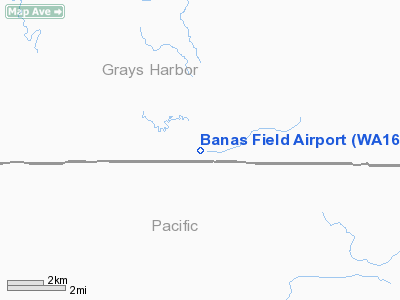
| From nearest city: | 3 nautical miles NW of Brooklyn, WA |
| Location: | Grays Harbor County, WA |
| Magnetic Variation: | 20E (1990) |
Owner & Manager
| Ownership: | Privately owned |
| Owner: | James A Banas |
| Address: | 2132 North River Road
Cosmopolis, WA 98537-9720 |
| Phone number: | 360-537-9696 |
| Manager: | James A Banas |
| Address: | 2132 North River Road
Cosmopolis, WA 98537-9720 |
| Phone number: | 360-537-9696 |
Airport Operations and Facilities
| Airport Use: | Private |
| Wind indicator: | Yes |
| Segmented Circle: | No |
| Control Tower: | No |
| Sectional chart: | Seattle |
| Region: | ANM - Northwest Mountain |
| Boundary ARTCC: | ZSE - Seattle |
| Tie-in FSS: | SEA - Seattle |
| FSS Toll Free: | 1-800-WX-BRIEF |
Runway Information
Runway 14/32
| Dimension: | 1000 x 60 ft / 304.8 x 18.3 m |
| Surface: | TURF, Fair Condition |
| |
Runway 14 |
Runway 32 |
| Traffic Pattern: | Left | Left |
| Obstruction: | | 100 ft trees, 500.0 ft from runway |
|
Radio Navigation Aids
| ID |
Type |
Name |
Ch |
Freq |
Var |
Dist |
| AST | FAN MARKER | Fort Stevens | | | 22E | 39.6 nm |
| MNC | NDB | Mason County | | 348.00 | 19E | 32.8 nm |
| TDO | NDB | Toledo | | 219.00 | 20E | 35.7 nm |
| PEN | NDB | Karpen | | 201.00 | 20E | 39.7 nm |
| LAC | NDB | Lacomas | | 328.00 | 18E | 42.3 nm |
| GR | NDB | Graye | | 216.00 | 18E | 43.8 nm |
| CAN | NDB | Carney | | 274.00 | 20E | 46.6 nm |
| LSO | NDB | Kelso | | 256.00 | 21E | 46.7 nm |
| AST | VOR/DME | Astoria | 087X | 114.00 | 19E | 40.8 nm |
| HQM | VORTAC | Hoquiam | 124X | 117.70 | 19E | 26.5 nm |
| OLM | VORTAC | Olympia | 081X | 113.40 | 19E | 28.2 nm |
| TCM | VORTAC | Mcchord | 033X | 109.60 | 22E | 48.5 nm |
Images and information placed above are from
http://www.airport-data.com/airport/WA16/
We thank them for the data!
| General Info
|
| Country |
United States
|
| State |
WASHINGTON
|
| FAA ID |
WA16
|
| Latitude |
46-47-59.000N
|
| Longitude |
123-32-28.000W
|
| Elevation |
180 feet
|
| Near City |
BROOKLYN
|
We don't guarantee the information is fresh and accurate. The data may
be wrong or outdated.
For more up-to-date information please refer to other sources.
|
|


