 |
|
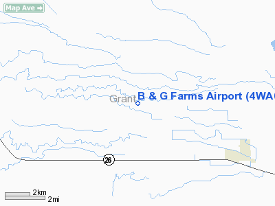
Location & QuickFacts
| FAA Information Effective: | 2008-09-25 |
| Airport Identifier: | 4WA0 |
| Airport Status: | Operational |
| Longitude/Latitude: | 119-44-15.0000W/46-56-25.0000N
-119.737500/46.940278 (Estimated) |
| Elevation: | 1120 ft / 341.38 m (Estimated) |
| Land: | 11 acres |
| From nearest city: | 5 nautical miles W of Royal City, WA |
| Location: | Grant County, WA |
| Magnetic Variation: | 19E (1995) |
Owner & Manager
| Ownership: | Privately owned |
| Owner: | B & G Farms Inc |
| Address: | 12088 Road 11 Sw
Royal City, WA 99357 |
| Phone number: | 509-346-2294 |
| Manager: | Mike Brown |
| Address: | 12088 Road 11 Sw
Royal City, WA 99357 |
| Phone number: | 509-346-2294 |
Airport Operations and Facilities
| Airport Use: | Private |
| Segmented Circle: | No |
| Control Tower: | No |
| Sectional chart: | Seattle |
| Region: | ANM - Northwest Mountain |
| Boundary ARTCC: | ZSE - Seattle |
| Tie-in FSS: | SEA - Seattle |
| FSS on Airport: | No |
| FSS Toll Free: | 1-800-WX-BRIEF |
Runway Information
Runway 07/25
| Dimension: | 3700 x 65 ft / 1127.8 x 19.8 m |
| Surface: | ASPH, |
| |
Runway 07 |
Runway 25 |
| Traffic Pattern: | Left | Left |
| Markings: | Basic, | Basic, |
| Obstruction: | 30 ft bldg, 300.0 ft from runway | 30 ft trees, 700.0 ft from runway |
|
Radio Navigation Aids
| ID |
Type |
Name |
Ch |
Freq |
Var |
Dist |
| EAT | FAN MARKER | Malaga | | | 21E | 30.1 nm |
| MW | NDB | Pelly | | 408.00 | 18E | 21.7 nm |
| MWH | VOR/DME | Moses Lake | 097X | 115.00 | 18E | 23.7 nm |
| EAT | VOR/DME | Wenatchee | 047X | 111.00 | 19E | 33.7 nm |
| PSC | VOR/DME | Pasco | 021X | 108.40 | 20E | 48.1 nm |
| EPH | VORTAC | Ephrata | 073X | 112.60 | 21E | 29.3 nm |
| ELN | VORTAC | Ellensburg | 126X | 117.90 | 21E | 30.0 nm |
| YKM | VORTAC | Yakima | 107X | 116.00 | 21E | 36.6 nm |
Images and information placed above are from
http://www.airport-data.com/airport/4WA0/
We thank them for the data!
| General Info
|
| Country |
United States
|
| State |
WASHINGTON
|
| FAA ID |
4WA0
|
| Latitude |
46-56-25.000N
|
| Longitude |
119-44-15.000W
|
| Elevation |
1120 feet
|
| Near City |
ROYAL CITY
|
We don't guarantee the information is fresh and accurate. The data may
be wrong or outdated.
For more up-to-date information please refer to other sources.
|
|


