 |
|
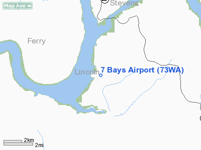
Location & QuickFacts
| FAA Information Effective: | 2008-09-25 |
| Airport Identifier: | 73WA |
| Airport Status: | Operational |
| Longitude/Latitude: | 118-19-48.9560W/47-51-03.5680N
-118.330266/47.850991 (Estimated) |
| Elevation: | 1580 ft / 481.58 m (Surveyed) |
| Land: | 0 acres |
| From nearest city: | 13 nautical miles NW of Davenport, WA |
| Location: | Lincoln County, WA |
| Magnetic Variation: | 20E (1985) |
Owner & Manager
| Ownership: | Privately owned |
| Owner: | 7 Bays Homeowners Assoc |
| Address: | 7 Bays
Davenport, WA 99122 |
| Phone number: | 509-725-1674 |
| Manager: | Loren Lemen |
| Address: | 7 Bays
Davenport, WA 99122 |
| Phone number: | 509-725-1674 |
Airport Operations and Facilities
| Airport Use: | Private |
| Wind indicator: | Yes
WIND INDICATOR BOTH ENDS OF RUNWAY. |
| Segmented Circle: | No |
| Control Tower: | No |
| Landing fee charge: | No |
| Sectional chart: | Seattle |
| Region: | ANM - Northwest Mountain |
| Boundary ARTCC: | ZSE - Seattle |
| Tie-in FSS: | SEA - Seattle |
| FSS on Airport: | No |
| FSS Toll Free: | 1-800-WX-BRIEF |
Airport Services
| Airframe Repair: | MAJOR |
| Power Plant Repair: | MAJOR |
Runway Information
Runway 18/36
| Dimension: | 2600 x 60 ft / 792.5 x 18.3 m |
| Surface: | TURF, |
| |
Runway 18 |
Runway 36 |
| Traffic Pattern: | Right | Left |
|
Radio Navigation Aids
| ID |
Type |
Name |
Ch |
Freq |
Var |
Dist |
| DPY | NDB | Deer Park | | 216.00 | 19E | 37.1 nm |
| SFF | NDB | Felts | | 365.00 | 19E | 42.3 nm |
| SKA | TACAN | Fairchild | 051X | | 19E | 30.6 nm |
| GEG | VORTAC | Spokane | 102X | 115.50 | 21E | 33.2 nm |
| GEG | VOT | Spokane Intl | | 109.60 | | 34.8 nm |
| SFF | VOT | Spokane/felts Field | | 114.00 | | 42.1 nm |
Remarks
- TURN LEFT TO NORTH & RIGHT TO SOUTH AFTER TAKEOFF
- TERRAIN RISES TO NORTH.
Images and information placed above are from
http://www.airport-data.com/airport/73WA/
We thank them for the data!
| General Info
|
| Country |
United States
|
| State |
WASHINGTON
|
| FAA ID |
73WA
|
| Latitude |
47-51-03.568N
|
| Longitude |
118-19-48.956W
|
| Elevation |
1580 feet
|
| Near City |
DAVENPORT
|
We don't guarantee the information is fresh and accurate. The data may
be wrong or outdated.
For more up-to-date information please refer to other sources.
|
|


