 |
|
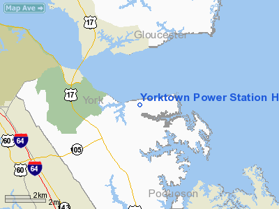
Yorktown Power Station Heliport |
Location & QuickFacts
| FAA Information Effective: | 2008-09-25 |
| Airport Identifier: | VG04 |
| Airport Status: | Operational |
| Longitude/Latitude: | 076-27-12.8140W/37-12-50.5170N
-76.453559/37.214032 (Estimated) |
| Elevation: | 14 ft / 4.27 m (Estimated) |
| Land: | 3 acres |
| From nearest city: | 6 nautical miles NE of Newport News, VA |
| Location: | York County, VA |
| Magnetic Variation: | 10W (1995) |
Owner & Manager
| Ownership: | Privately owned |
| Owner: | Yorktown Power Station |
| Address: | P.o. Box 571
Yorktown, VA 23690 |
| Phone number: | 804-898-2532 |
| Manager: | Joshua J. Bennett |
| Address: | 1600 Waterview Rd.
Yorktown, VA 23692 |
| Phone number: | 757-898-2532 |
Airport Operations and Facilities
| Airport Use: | Private |
| Wind indicator: | Yes |
| Segmented Circle: | No |
| Control Tower: | No |
| Sectional chart: | Washington |
| Region: | AEA - Eastern |
| Boundary ARTCC: | ZDC - Washington |
| Tie-in FSS: | DCA - Leesburg |
| FSS on Airport: | No |
| FSS Toll Free: | 1-800-WX-BRIEF |
Runway Information
Helipad H1
| Dimension: | 64 x 64 ft / 19.5 x 19.5 m |
| Surface: | CONC, |
| |
Runway H1 |
Runway |
| Traffic Pattern: | Left | Left |
|
Radio Navigation Aids
| ID |
Type |
Name |
Ch |
Freq |
Var |
Dist |
| PJS | NDB | Henry | | 375.00 | 09W | 5.2 nm |
| FAF | NDB | Felker | | 226.00 | 08W | 9.1 nm |
| PVG | NDB | Portsmouth | | 241.00 | 10W | 26.1 nm |
| AKQ | NDB | Wakefield | | 274.00 | 09W | 29.7 nm |
| EY | NDB | Chesi | | 233.00 | 09W | 37.1 nm |
| BDB | NDB | Accomack | | 336.00 | 11W | 37.9 nm |
| RK | NDB | Waley | | 249.00 | 10W | 38.1 nm |
| CF | NDB | Pubbs | | 392.00 | 09W | 48.4 nm |
| LFI | TACAN | Langley | 070X | | 10W | 8.9 nm |
| NGU | TACAN | Chambers | 048X | | 10W | 18.5 nm |
| NTU | TACAN | Oceana | 113X | | 10W | 30.8 nm |
| HCM | VORTAC | Harcum | 025X | 108.80 | 07W | 18.7 nm |
| ORF | VORTAC | Norfolk | 116X | 116.90 | 07W | 22.9 nm |
| CCV | VORTAC | Cape Charles | 059X | 112.20 | 10W | 23.2 nm |
| HPW | VORTAC | Hopewell | 057X | 112.00 | 06W | 32.4 nm |
| FKN | VORTAC | Franklin | 043X | 110.60 | 09W | 40.3 nm |
| RIC | VORTAC | Richmond | 088X | 114.10 | 09W | 44.9 nm |
Remarks
- PRVDD HELS OPERG FM THIS FAC ARE LIMITED TO ACFT LESS THAT 12500 LBS MGW; IFR OPNS ARE NOT CONDUCTED; CLEAR 8:1 INGRESS/EGRESS; WINDSOCK MOVED TO NE; PHF ATCT IS CTCD PRIOR TO STARTING AIR OPNS.
Images and information placed above are from
http://www.airport-data.com/airport/VG04/
We thank them for the data!
| General Info
|
| Country |
United States
|
| State |
VIRGINIA
|
| FAA ID |
VG04
|
| Latitude |
37-12-50.517N
|
| Longitude |
076-27-12.814W
|
| Elevation |
14 feet
|
| Near City |
NEWPORT NEWS
|
We don't guarantee the information is fresh and accurate. The data may
be wrong or outdated.
For more up-to-date information please refer to other sources.
|
|


