 |
|
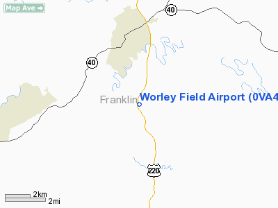
Location & QuickFacts
| FAA Information Effective: | 2008-09-25 |
| Airport Identifier: | 0VA4 |
| Airport Status: | Operational |
| Longitude/Latitude: | 079-52-46.1210W/36-57-00.5030N
-79.879478/36.950140 (Estimated) |
| Elevation: | 1219 ft / 371.55 m (Surveyed) |
| Land: | 0 acres |
| From nearest city: | 3 nautical miles S of Rocky Mount, VA |
| Location: | Franklin County, VA |
| Magnetic Variation: | 06W (1985) |
Owner & Manager
| Ownership: | Privately owned |
| Owner: | Donald E. Or Joyce M. Worley Jr. |
| Address: | 60 Sontag Rd
Rocky Mount, VA 24151-4201 |
| Phone number: | 540-483-9554 |
| Address: |
|
| Phone number: | 540-483-9554 |
Airport Operations and Facilities
| Airport Use: | Private |
| Segmented Circle: | No |
| Control Tower: | No |
| Sectional chart: | Cincinnati |
| Region: | AEA - Eastern |
| Boundary ARTCC: | ZDC - Washington |
| Tie-in FSS: | DCA - Leesburg |
| FSS on Airport: | No |
| FSS Toll Free: | 1-800-WX-BRIEF |
Runway Information
Runway 17/35
| Dimension: | 2100 x 90 ft / 640.1 x 27.4 m |
| Surface: | TURF, |
| |
Runway 17 |
Runway 35 |
| Traffic Pattern: | Left | Left |
| Obstruction: | 50 ft plines, 400.0 ft from runway | |
|
Radio Navigation Aids
| ID |
Type |
Name |
Ch |
Freq |
Var |
Dist |
| OQA | FAN MARKER | Rockingham County | | | | 31.6 nm |
| VIT | NDB | Vinton | | 277.00 | 06W | 15.3 nm |
| UV | NDB | Bales | | 396.00 | 07W | 21.7 nm |
| CNQ | NDB | Callahan | | 379.00 | 05W | 23.0 nm |
| TEC | NDB | Tech | | 368.00 | 06W | 29.5 nm |
| SIF | NDB | Slammer | | 423.00 | 07W | 34.6 nm |
| LY | NDB | Bojar | | 385.00 | 08W | 35.8 nm |
| HLX | NDB | Hillsville | | 269.00 | 06W | 46.7 nm |
| AZW | NDB | Mount Airy | | 223.00 | 07W | 46.7 nm |
| ODR | VOR | Woodrum | | 114.90 | 06W | 23.0 nm |
| DAN | VOR | Danville | | 113.10 | 06W | 34.8 nm |
| ROA | VORTAC | Roanoke | 031X | 109.40 | 04W | 25.3 nm |
| LYH | VORTAC | Lynchburg | 029X | 109.20 | 05W | 35.8 nm |
| PSK | VORTAC | Pulaski | 115X | 116.80 | 06W | 40.8 nm |
| SBV | VORTAC | South Boston | 041X | 110.40 | 05W | 44.8 nm |
Images and information placed above are from
http://www.airport-data.com/airport/0VA4/
We thank them for the data!
| General Info
|
| Country |
United States
|
| State |
VIRGINIA
|
| FAA ID |
0VA4
|
| Latitude |
36-57-00.503N
|
| Longitude |
079-52-46.121W
|
| Elevation |
1219 feet
|
| Near City |
ROCKY MOUNT
|
We don't guarantee the information is fresh and accurate. The data may
be wrong or outdated.
For more up-to-date information please refer to other sources.
|
|


