 |
|
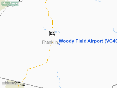
Location & QuickFacts
| FAA Information Effective: | 2008-09-25 |
| Airport Identifier: | VG40 |
| Airport Status: | Operational |
| Longitude/Latitude: | 079-51-08.1800W/36-53-01.0700N
-79.852272/36.883631 (Estimated) |
| Elevation: | 1150 ft / 350.52 m () |
| Land: | 130 acres |
| From nearest city: | 6 nautical miles S of Rocky Mount, VA |
| Location: | Franklin County, VA |
| Magnetic Variation: | 08W (2000) |
Owner & Manager
| Ownership: | Privately owned |
| Owner: | Herbert Dallas Woody |
| Address: | 200 Aviators Circle
Rocky Mount, VA 24151 |
| Phone number: | 540-483-0798 |
| Manager: | Herbert Dallas Woody |
| Address: | 200 Aviators Circle
Rocky Mount, VA 24151 |
| Phone number: | 540-420-0794 |
Airport Operations and Facilities
| Airport Use: | Private |
| Wind indicator: | Yes |
| Segmented Circle: | No |
| Control Tower: | No |
| Sectional chart: | Washington |
| Region: | AEA - Eastern |
| Boundary ARTCC: | ZDC - Washington |
| Tie-in FSS: | DCA - Leesburg |
| FSS Toll Free: | 1-800-WX-BRIEF |
Runway Information
Runway 16/34
| Dimension: | 2000 x 80 ft / 609.6 x 24.4 m |
| Surface: | TURF, |
| |
Runway 16 |
Runway 34 |
| Traffic Pattern: | Left | Left |
| Displaced threshold: | 500.00 ft | 0.00 ft |
| Obstruction: | 25 ft gnd, 20.0 ft from runway | |
|
Radio Navigation Aids
| ID |
Type |
Name |
Ch |
Freq |
Var |
Dist |
| OQA | FAN MARKER | Rockingham County | | | | 27.5 nm |
| UV | NDB | Bales | | 396.00 | 07W | 17.9 nm |
| VIT | NDB | Vinton | | 277.00 | 06W | 19.3 nm |
| CNQ | NDB | Callahan | | 379.00 | 05W | 27.0 nm |
| SIF | NDB | Slammer | | 423.00 | 07W | 30.4 nm |
| TEC | NDB | Tech | | 368.00 | 06W | 32.9 nm |
| LY | NDB | Bojar | | 385.00 | 08W | 37.0 nm |
| AZW | NDB | Mount Airy | | 223.00 | 07W | 44.9 nm |
| HLX | NDB | Hillsville | | 269.00 | 06W | 47.2 nm |
| ODR | VOR | Woodrum | | 114.90 | 06W | 27.2 nm |
| DAN | VOR | Danville | | 113.10 | 06W | 31.2 nm |
| ROA | VORTAC | Roanoke | 031X | 109.40 | 04W | 29.6 nm |
| LYH | VORTAC | Lynchburg | 029X | 109.20 | 05W | 37.0 nm |
| SBV | VORTAC | South Boston | 041X | 110.40 | 05W | 42.2 nm |
| PSK | VORTAC | Pulaski | 115X | 116.80 | 06W | 43.1 nm |
Remarks
- PRVDD VFR; NO IFR OPNS; CLEAR 20:1 APCH/DEP PATH; COORDINATION MUST BE MADE WITH MILITARY FACILITIES IN AREA BEFORE TAKEOFF/LANDING AS TO NOT INTERFERE WITH MILITARY PATTERNS.
Images and information placed above are from
http://www.airport-data.com/airport/VG40/
We thank them for the data!
| General Info
|
| Country |
United States
|
| State |
VIRGINIA
|
| FAA ID |
VG40
|
| Latitude |
36-53-01.070N
|
| Longitude |
079-51-08.180W
|
| Elevation |
1150 feet
|
| Near City |
ROCKY MOUNT
|
We don't guarantee the information is fresh and accurate. The data may
be wrong or outdated.
For more up-to-date information please refer to other sources.
|
|


