 |
|
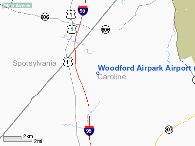
Location & QuickFacts
| FAA Information Effective: | 2008-09-25 |
| Airport Identifier: | 20VA |
| Airport Status: | Operational |
| Longitude/Latitude: | 077-29-17.9380W/38-04-56.4830N
-77.488316/38.082356 (Estimated) |
| Elevation: | 245 ft / 74.68 m (Estimated) |
| Land: | 20 acres |
| From nearest city: | 7 nautical miles NW of Bowling Green, VA |
| Location: | Caroline County, VA |
| Magnetic Variation: | 09W (1985) |
Owner & Manager
| Ownership: | Privately owned |
| Owner: | John L Caton Jr & Sr |
| Address: | 13247 Bull Church Rd.
Woodford, VA 22580 |
| Phone number: | 540-809-2256 |
| Manager: | John L Caton Jr & Sr |
| Address: | Rt 2, Box 820
Woodford, VA 22580 |
| Phone number: | 804-448-0982 |
Airport Operations and Facilities
| Airport Use: | Private |
| Wind indicator: | Yes |
| Segmented Circle: | No |
| Control Tower: | No |
| Landing fee charge: | No |
| Sectional chart: | Washington |
| Region: | AEA - Eastern |
| Boundary ARTCC: | ZDC - Washington |
| Tie-in FSS: | DCA - Leesburg |
| FSS on Airport: | No |
| FSS Toll Free: | 1-800-WX-BRIEF |
Airport Communications
Runway Information
Runway 08/26
| Dimension: | 2600 x 150 ft / 792.5 x 45.7 m |
| Surface: | TURF, |
| |
Runway 08 |
Runway 26 |
| Traffic Pattern: | Left | Left |
| Obstruction: | 50 ft trees, 800.0 ft from runway | 50 ft trees, 800.0 ft from runway |
|
Radio Navigation Aids
| ID |
Type |
Name |
Ch |
Freq |
Var |
Dist |
| APH | NDB | A P Hill | | 396.00 | 10W | 7.7 nm |
| EZF | NDB | Shannon | | 237.00 | 10W | 11.2 nm |
| IQK | NDB | Louisa | | 382.00 | 09W | 17.9 nm |
| LJK | NDB | Ashey | | 280.00 | 09W | 18.6 nm |
| MSQ | NDB | Nailr | | 351.00 | 10W | 29.8 nm |
| CJR | NDB | Culpeper | | 252.00 | 09W | 32.1 nm |
| CF | NDB | Pubbs | | 392.00 | 09W | 45.1 nm |
| DC | NDB | Oxonn | | 332.00 | 11W | 46.5 nm |
| VKX | NDB | Potomac | | 241.00 | 10W | 47.3 nm |
| AZS | NDB | Azalea Park | | 336.00 | 08W | 48.9 nm |
| BRV | VORTAC | Brooke | 092X | 114.50 | 09W | 16.5 nm |
| GVE | VORTAC | Gordonsville | 103X | 115.60 | 06W | 31.7 nm |
| RIC | VORTAC | Richmond | 088X | 114.10 | 09W | 35.8 nm |
| FAK | VORTAC | Flat Rock | 080X | 113.30 | 06W | 37.0 nm |
| CSN | VORTAC | Casanova | 110X | 116.30 | 06W | 38.0 nm |
| HPW | VORTAC | Hopewell | 057X | 112.00 | 06W | 48.6 nm |
Remarks
- PROVIDED USERS ARE AWARE THAT AIRPORT IS IN AIRSPACE USED FOR LOW ALTITUDE/HIGH SPEED MILITARY TRAINING.
Images and information placed above are from
http://www.airport-data.com/airport/20VA/
We thank them for the data!
| General Info
|
| Country |
United States
|
| State |
VIRGINIA
|
| FAA ID |
20VA
|
| Latitude |
38-04-56.483N
|
| Longitude |
077-29-17.938W
|
| Elevation |
245 feet
|
| Near City |
BOWLING GREEN
|
We don't guarantee the information is fresh and accurate. The data may
be wrong or outdated.
For more up-to-date information please refer to other sources.
|
|


