|
|
| Winchester Regional Airport |
| IATA: WGO – ICAO: KOKV – FAA LID: OKV |
| Summary |
| Airport type |
Public |
| Owner |
Winchester Regional Airport Authority |
| Serves |
Winchester, Virginia |
| Elevation AMSL |
726 ft / 221 m |
| Coordinates |
39°08′38″N 078°08′40″W / 39.14389°N 78.14444°W / 39.14389; -78.14444 |
| Website |
websmart66.net/... |
| Runways |
| Direction |
Length |
Surface |
| ft |
m |
| 14/32 |
5,500 |
1,676 |
Asphalt |
| Statistics (2007) |
| Aircraft operations |
36,574 |
| Based aircraft |
108 |
| Source: Federal Aviation Administration |
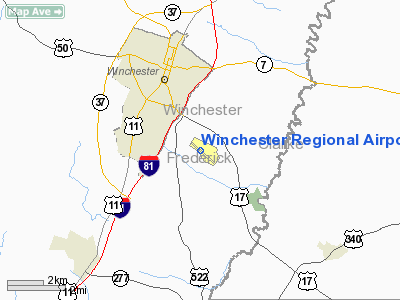
Winchester Regional Airport (IATA: WGO, ICAO: KOKV, FAA LID: OKV) is a public use airport owned by the Winchester Regional Airport Authority and located three nautical miles (6 km) southeast of the central business district of Winchester, a city in Frederick County, Virginia, United States. It was first recognized by the state as a licensed commercial airport in 1937 and was known as Winchester Municipal Airport until 1987.
Although most U.S. airports use the same three-letter location identifier for the FAA and IATA, this airport is assigned OKV by the FAA and WGO by the IATA (which assigned OKV to Okao Airport in Papua New Guinea).
Facilities and aircraft
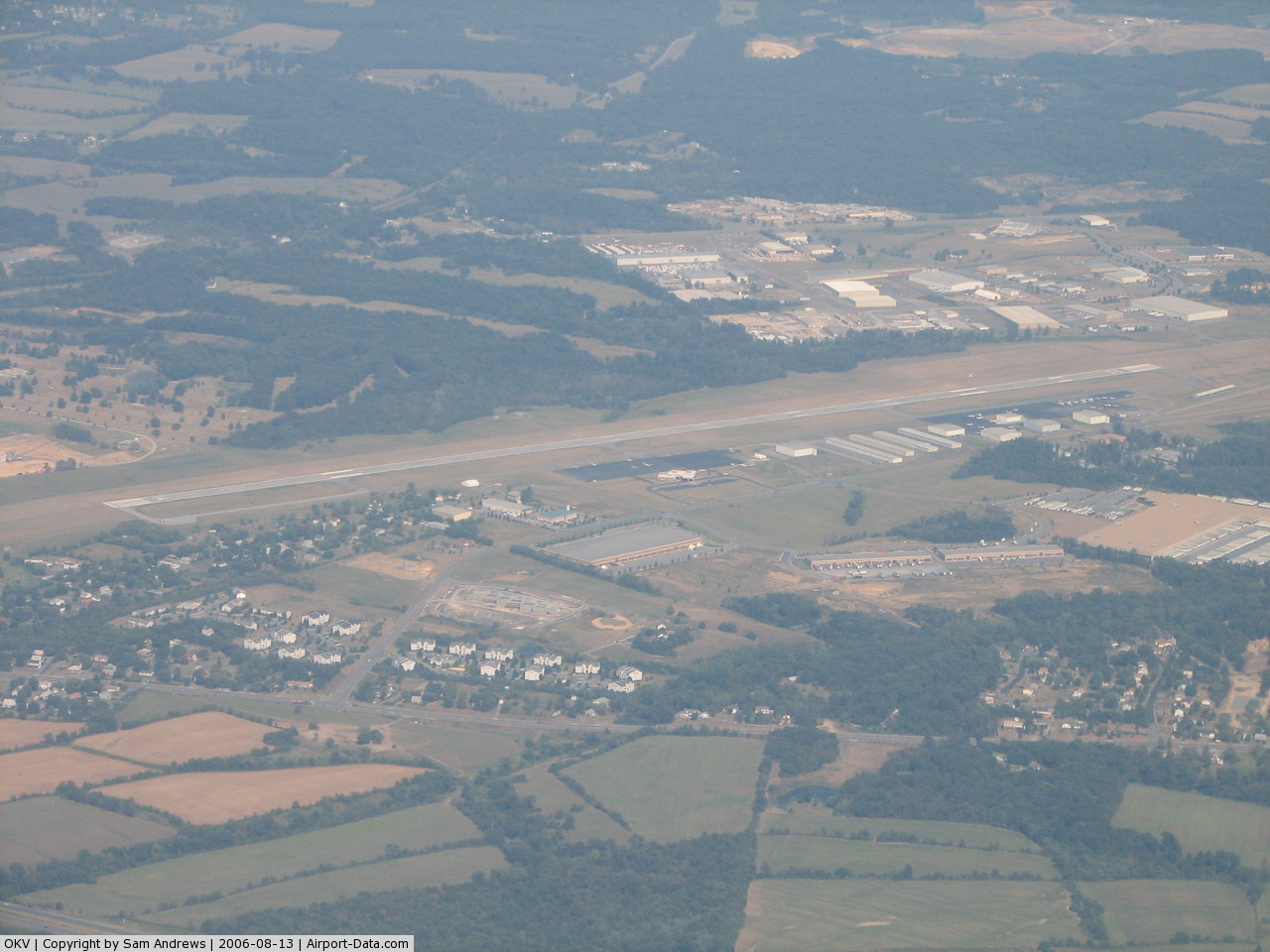
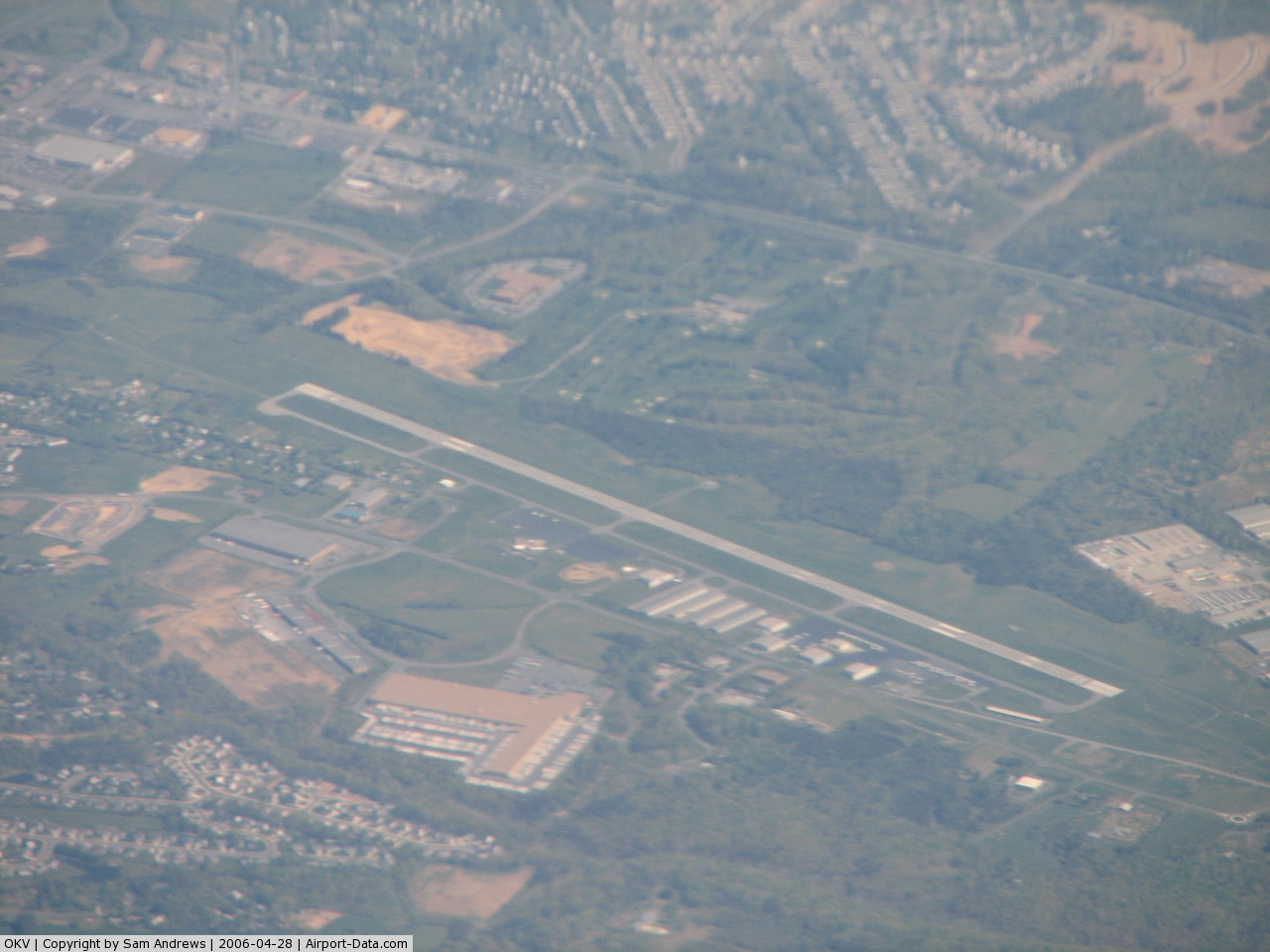
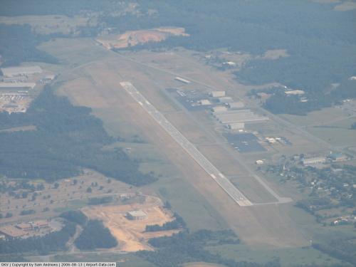
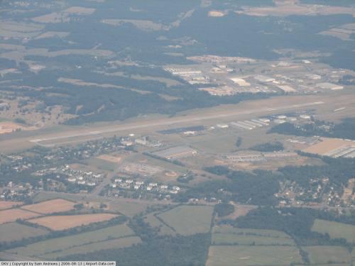
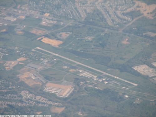
Winchester Regional Airport covers an area of 375 acres (152 ha) at an elevation of 726 feet (221 m) above mean sea level. It has one asphalt paved runway designated 14/32 which measures 5,500 by 100 feet (1,676 x 30 m). The runway supports instrument landing approaches, with the localizer based off the northwest side of the airport.
For the 12-month period ending May 30, 2007, the airport had 36,574 aircraft operations, an average of 100 per day: 97% general aviation and 3% air taxi. At that time there were 108 aircraft based at this airport: 79% single-engine, 18% multi-engine, 2% jet, 1% helicopter and 1% ultralight.
The above content comes from Wikipedia and is published under free licenses – click here to read more.
 |
(Click on the photo to enlarge) |
 |
(Click on the photo to enlarge) |
 |
(Click on the photo to enlarge) |
Location & QuickFacts
| FAA Information Effective: | 2008-09-25 |
| Airport Identifier: | OKV |
| Airport Status: | Operational |
| Longitude/Latitude: | 078-08-40.0000W/39-08-36.6770N
-78.144444/39.143521 (Estimated) |
| Elevation: | 727 ft / 221.59 m (Surveyed) |
| Land: | 375 acres |
| From nearest city: | 3 nautical miles SE of Winchester, VA |
| Location: | Frederick County, VA |
| Magnetic Variation: | 10W (2000) |
Owner & Manager
| Ownership: | Publicly owned |
| Owner: | Winchester Reg Arpt Auth |
| Address: | 491 Airport Rd
Winchester, VA 22602 |
| Phone number: | 540-662-2422 |
| Manager: | Renny Manuel |
| Address: | 491 Airport Rd
Winchester, VA 22602 |
| Phone number: | 540-662-5786 |
Airport Operations and Facilities
| Airport Use: | Open to public |
| Wind indicator: | Yes |
| Segmented Circle: | Yes |
| Control Tower: | No |
| Lighting Schedule: | DUSK-DAWN
ACTVT MIRL RY 14/32; REIL RY 14 & MALSR RY 32 - CTAF. |
| Beacon Color: | Clear-Green (lighted land airport) |
| Landing fee charge: | No |
| Sectional chart: | Washington |
| Region: | AEA - Eastern |
| Boundary ARTCC: | ZDC - Washington |
| Tie-in FSS: | DCA - Leesburg |
| FSS on Airport: | No |
| FSS Toll Free: | 1-800-WX-BRIEF |
| NOTAMs Facility: | OKV (NOTAM-d service avaliable) |
| Federal Agreements: | NGY |
Airport Communications
| CTAF: | 122.700 |
| Unicom: | 122.700 |
Airport Services
| Fuel available: | 100LLA |
| Airframe Repair: | MAJOR |
| Power Plant Repair: | MAJOR |
| Bottled Oxygen: | NONE |
| Bulk Oxygen: | NONE |
Runway Information
Runway 14/32
| Dimension: | 5500 x 100 ft / 1676.4 x 30.5 m |
| Surface: | ASPH, Fair Condition |
| Surface Treatment: | Saw-cut or plastic Grooved |
| Weight Limit: | Single wheel: 45000 lbs.
Dual wheel: 60000 lbs. |
| Edge Lights: | Medium |
| |
Runway 14 |
Runway 32 |
| Longitude: | 078-09-05.2110W | 078-08-14.7990W |
| Latitude: | 39-08-55.5010N | 39-08-17.8980N |
| Elevation: | 726.00 ft | 701.00 ft |
| Alignment: | 127 | 127 |
| ILS Type: | | ILS/DME
|
| Traffic Pattern: | Left | Left |
| Markings: | Non-precision instrument, Fair Condition | Precision instrument, Fair Condition |
| Crossing Height: | 45.00 ft | 45.00 ft |
| VASI: | 2-light PAPI on left side | 2-light PAPI on left side |
| Visual Glide Angle: | 3.00° | 3.00° |
| Approach lights: | | MALSR |
| Runway End Identifier: | Yes | |
| Centerline Lights: | No | No |
| Touchdown Lights: | No | No |
| Obstruction: | 60 ft tree, 1759.0 ft from runway, 285 ft right of centerline, 25:1 slope to clear
TREES 40 FT ABOVE RY END ELEV, 141 FT OFF END OF RY, 393 FT R ON APCH. | 43 ft tree, 1924.0 ft from runway, 427 ft left of centerline, 40:1 slope to clear |
|
Radio Navigation Aids
| ID |
Type |
Name |
Ch |
Freq |
Var |
Dist |
| TZ | NDB | Cogan | | 364.00 | 10W | 4.9 nm |
| GDX | NDB | Goodwin Lake | | 227.00 | 08W | 18.5 nm |
| LUA | NDB | Caverns | | 245.00 | 09W | 30.8 nm |
| CJR | NDB | Culpeper | | 252.00 | 09W | 39.2 nm |
| CBE | NDB | Cumberland | | 317.00 | 07W | 41.3 nm |
| MSQ | NDB | Nailr | | 351.00 | 10W | 42.9 nm |
| GAI | NDB | Gaithersburg | | 385.00 | 09W | 45.6 nm |
| GTN | NDB | Georgetown | | 323.00 | 09W | 49.3 nm |
| HGR | VOR | Hagerstown | | 109.80 | 07W | 35.9 nm |
| FDK | VOR | Frederick | | 109.00 | 08W | 39.3 nm |
| ESL | VOR/DME | Kessel | 045X | 110.80 | 06W | 39.7 nm |
| LDN | VORTAC | Linden | 090X | 114.30 | 06W | 17.6 nm |
| MRB | VORTAC | Martinsburg | 058X | 112.10 | 07W | 20.0 nm |
| CSN | VORTAC | Casanova | 110X | 116.30 | 06W | 32.9 nm |
| AML | VORTAC | Armel | 082X | 113.50 | 08W | 34.0 nm |
| THS | VORTAC | St Thomas | 097X | 115.00 | 07W | 48.3 nm |
Remarks
- ADCUS AVBL 24 HRS MIN ADVN NOTICE RQRD CALL 804-661-3660 MON-FRI; AFT HRS AND WKENDS CALL 703-661-3632.
- DEER ON & INVOF ARPT.
- MED-FLIGHT: IRREGULAR DEPARTURE PATTERN
- IN OPERATION PRIOR 1959
Images and information placed above are from
http://www.airport-data.com/airport/OKV/
We thank them for the data!
| General Info
|
| Country |
United States
|
| State |
VIRGINIA
|
| FAA ID |
OKV
|
| Latitude |
39-08-36.677N
|
| Longitude |
078-08-40.000W
|
| Elevation |
727 feet
|
| Near City |
WINCHESTER
|
We don't guarantee the information is fresh and accurate. The data may
be wrong or outdated.
For more up-to-date information please refer to other sources.
|
|