 |
|
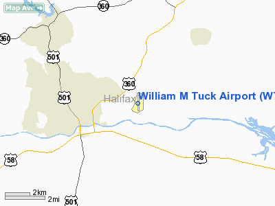
Location & QuickFacts
| FAA Information Effective: | 2008-09-25 |
| Airport Identifier: | W78 |
| Airport Status: | Operational |
| Longitude/Latitude: | 078-50-52.8730W/36-42-36.1620N
-78.848020/36.710045 (Estimated) |
| Elevation: | 420 ft / 128.02 m (Surveyed) |
| Land: | 300 acres |
| From nearest city: | 3 nautical miles E of South Boston, VA |
| Location: | Halifax County, VA |
| Magnetic Variation: | 08W (1995) |
Owner & Manager
| Ownership: | Publicly owned |
| Owner: | County Of Halifax |
| Address: | Po Box 786
Halifax, VA 24558 |
| Phone number: | 434-476-3300 |
| Manager: | Linda Satterfield |
| Address: | 1145 Tuck Airport Road
South Boston, VA 24592 |
| Phone number: | 434-579-3830
CELLPHONE. |
Airport Operations and Facilities
| Airport Use: | Open to public |
| Wind indicator: | Yes |
| Segmented Circle: | No |
| Control Tower: | No |
| Lighting Schedule: | DUSK-DAWN
ACTVT MIRL RY 01/19 & REIL RYS 01 & 19 - CTAF. PAPI RYS 01 & 19 OPER CONT. |
| Beacon Color: | Clear-Green (lighted land airport) |
| Landing fee charge: | No |
| Sectional chart: | Washington |
| Region: | AEA - Eastern |
| Traffic Pattern Alt: | 800 ft |
| Boundary ARTCC: | ZDC - Washington |
| Tie-in FSS: | DCA - Leesburg |
| FSS on Airport: | No |
| FSS Toll Free: | 1-800-WX-BRIEF |
| NOTAMs Facility: | DCA (NOTAM-d service avaliable) |
| Federal Agreements: | NG |
Airport Communications
| CTAF: | 122.800 |
| Unicom: | 122.800 |
Airport Services
| Fuel available: | 100LL |
| Airframe Repair: | MAJOR |
| Power Plant Repair: | MAJOR |
| Bottled Oxygen: | NONE |
| Bulk Oxygen: | NONE |
Runway Information
Runway 01/19
| Dimension: | 4011 x 75 ft / 1222.6 x 22.9 m |
| Surface: | ASPH, Good Condition |
| Weight Limit: | Single wheel: 12500 lbs. |
| Edge Lights: | Medium |
| |
Runway 01 |
Runway 19 |
| Longitude: | 078-50-51.4430W | 078-50-54.3020W |
| Latitude: | 36-42-16.3640N | 36-42-55.9610N |
| Elevation: | 383.00 ft | 420.00 ft |
| Alignment: | 127 | 127 |
| Traffic Pattern: | Left | Left |
| Markings: | Non-precision instrument, Good Condition | Non-precision instrument, Good Condition |
| Crossing Height: | 52.00 ft | 52.00 ft |
| VASI: | 2-light PAPI on left side | 2-light PAPI on left side |
| Visual Glide Angle: | 3.00° | 3.00° |
| Runway End Identifier: | Yes
REIL OTS INDEFLY. | Yes |
| Obstruction: | 25 ft tree, 1058.0 ft from runway, 61 ft left of centerline, 34:1 slope to clear | 25 ft tree, 873.0 ft from runway, 6 ft left of centerline, 26:1 slope to clear
+5-12 FT GND 0-200 FT FM THLD 158 FT LEFT. |
|
Runway 05/23
| Dimension: | 2665 x 200 ft / 812.3 x 61.0 m |
| Surface: | TURF, Good Condition |
| |
Runway 05 |
Runway 23 |
| Longitude: | 078-51-08.0300W | 078-50-43.0300W |
| Latitude: | 36-42-21.4970N | 36-42-38.4970N |
| Elevation: | 371.00 ft | 382.00 ft |
| Alignment: | 50 | 127 |
| Traffic Pattern: | Left | Left |
| Displaced threshold: | 200.00 ft | 400.00 ft |
| Obstruction: | 61 ft tree, 110.0 ft from runway, 156 ft left of centerline, 1:1 slope to clear
RY 05 APRCH SLOPE 5:1 TO THE DSPLCD THRLD. | 72 ft tree, 380.0 ft from runway, 25 ft right of centerline, 5:1 slope to clear
RY 23 APRCH SLOPE 10:1 TO THE DSPLCD THRLD. |
|
Radio Navigation Aids
| ID |
Type |
Name |
Ch |
Freq |
Var |
Dist |
| HXO | NDB | Huntsboro | | 271.00 | 07W | 27.0 nm |
| HUR | NDB | Person | | 220.00 | 08W | 30.5 nm |
| MBV | NDB | Mecklenburg/dcmsnd | | 356.00 | 08W | 38.2 nm |
| LY | NDB | Bojar | | 385.00 | 08W | 38.2 nm |
| AEA | NDB | Jones | | 373.00 | 09W | 38.8 nm |
| FVX | NDB | Farmville | | 367.00 | 07W | 43.4 nm |
| BKT | NDB | Blackstone | | 326.00 | 09W | 46.0 nm |
| LE | NDB | Leevy | | 350.00 | 07W | 47.4 nm |
| SIF | NDB | Slammer | | 423.00 | 07W | 48.4 nm |
| DAN | VOR | Danville | | 113.10 | 06W | 25.0 nm |
| SBV | VORTAC | South Boston | 041X | 110.40 | 05W | 8.3 nm |
| LYH | VORTAC | Lynchburg | 029X | 109.20 | 05W | 37.7 nm |
| LVL | VORTAC | Lawrenceville | 076X | 112.90 | 08W | 46.0 nm |
Remarks
- DEER ON & INVOF RYS.
- SELF-FUELING WITH A CREDIT CARD.
- IN OPERATION PRIOR 1959
Images and information placed above are from
http://www.airport-data.com/airport/W78/
We thank them for the data!
| General Info
|
| Country |
United States
|
| State |
VIRGINIA
|
| FAA ID |
W78
|
| Latitude |
36-42-36.162N
|
| Longitude |
078-50-52.873W
|
| Elevation |
420 feet
|
| Near City |
SOUTH BOSTON
|
We don't guarantee the information is fresh and accurate. The data may
be wrong or outdated.
For more up-to-date information please refer to other sources.
|
|


