 |
|
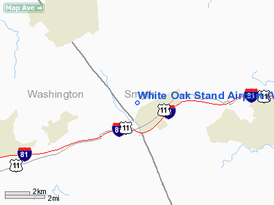
Location & QuickFacts
| FAA Information Effective: | 2008-09-25 |
| Airport Identifier: | VA11 |
| Airport Status: | Operational |
| Longitude/Latitude: | 081-42-04.4290W/36-48-28.4130N
-81.701230/36.807893 (Estimated) |
| Elevation: | 2100 ft / 640.08 m (Estimated) |
| Land: | 0 acres |
| From nearest city: | 1 nautical miles NW of Chilhowie, VA |
| Location: | Smyth County, VA |
| Magnetic Variation: | 05W (1985) |
Owner & Manager
| Ownership: | Privately owned |
| Owner: | Chilhowie Land Co |
| Address: | Drawer 927
Chilhowie, VA 24319 |
| Phone number: | 703-646-8278 |
| Address: |
|
Airport Operations and Facilities
| Airport Use: | Private |
| Wind indicator: | No |
| Segmented Circle: | No |
| Control Tower: | No |
| Landing fee charge: | No |
| Sectional chart: | Cincinnati |
| Region: | AEA - Eastern |
| Boundary ARTCC: | ZTL - Atlanta |
| Tie-in FSS: | DCA - Leesburg |
| FSS on Airport: | No |
| FSS Toll Free: | 1-800-WX-BRIEF |
Airport Services
| Airframe Repair: | NONE |
| Power Plant Repair: | NONE |
Runway Information
Runway 13/31
| Dimension: | 1700 x 80 ft / 518.2 x 24.4 m |
| Surface: | TURF, |
| |
Runway 13 |
Runway 31 |
| Traffic Pattern: | Left | Left |
| Obstruction: | 50 ft plines, 1000.0 ft from runway | 40 ft trees, 300.0 ft from runway |
|
Radio Navigation Aids
| ID |
Type |
Name |
Ch |
Freq |
Var |
Dist |
| VJ | NDB | Whine | | 236.00 | 05W | 12.7 nm |
| MK | NDB | Suzze | | 335.00 | 06W | 23.0 nm |
| JJO | NDB | Mountain City | | 396.00 | 04W | 24.3 nm |
| JU | NDB | Ashee | | 410.00 | 07W | 29.0 nm |
| BAR | NDB | Hemlock | | 320.00 | 02W | 40.3 nm |
| EZT | NDB | Elizabethton | | 275.00 | 02W | 40.4 nm |
| HLX | NDB | Hillsville | | 269.00 | 06W | 42.4 nm |
| BO | NDB | Booie | | 221.00 | 04W | 45.6 nm |
| GZG | VOR/DME | Glade Spring | 039X | 110.20 | 02W | 18.2 nm |
| HMV | VORTAC | Holston Mountain | 093X | 114.60 | 04W | 30.4 nm |
| BLF | VORTAC | Bluefield | 037X | 110.00 | 03W | 38.6 nm |
Images and information placed above are from
http://www.airport-data.com/airport/VA11/
We thank them for the data!
| General Info
|
| Country |
United States
|
| State |
VIRGINIA
|
| FAA ID |
VA11
|
| Latitude |
36-48-28.413N
|
| Longitude |
081-42-04.429W
|
| Elevation |
2100 feet
|
| Near City |
CHILHOWIE
|
We don't guarantee the information is fresh and accurate. The data may
be wrong or outdated.
For more up-to-date information please refer to other sources.
|
|


