 |
|
Location & QuickFacts
| FAA Information Effective: | 2008-09-25 |
| Airport Identifier: | 7VA0 |
| Airport Status: | Operational |
| Longitude/Latitude: | 082-12-29.4980W/37-21-45.3900N
-82.208194/37.362608 (Estimated) |
| Elevation: | 1168 ft / 356.01 m (Estimated) |
| Land: | 0 acres |
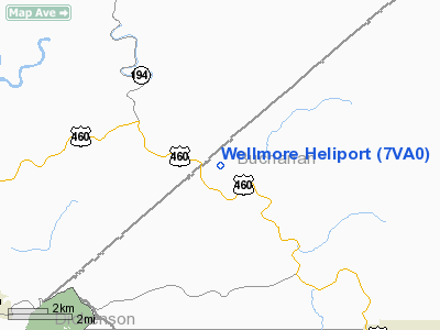
| From nearest city: | 1 nautical miles W of Big Rock, VA |
| Location: | Buchanan County, VA |
| Magnetic Variation: | 05W (1985) |
Owner & Manager
| Ownership: | Privately owned |
| Owner: | Wellmore Coal Company |
| Address: | Po Box 901
Grundy, VA 24614 |
| Phone number: | 703-935-7521 |
| Manager: | Charles W. White |
| Address: | Po Box 1280
Bristol, VA 24203 |
| Phone number: | 703-466-3322 |
Airport Operations and Facilities
| Airport Use: | Private |
| Wind indicator: | Yes |
| Segmented Circle: | No |
| Control Tower: | No |
| Landing fee charge: | No |
| Sectional chart: | Cincinnati |
| Region: | AEA - Eastern |
| Boundary ARTCC: | ZID - Indianapolis |
| Tie-in FSS: | DCA - Leesburg |
| FSS on Airport: | No |
| FSS Toll Free: | 1-800-WX-BRIEF |
Airport Services
Runway Information
Helipad H1
| Dimension: | 25 x 25 ft / 7.6 x 7.6 m |
| Surface: | CONC, |
| |
Runway H1 |
Runway |
| Traffic Pattern: | Left | Left |
|
Radio Navigation Aids
| ID |
Type |
Name |
Ch |
Freq |
Var |
Dist |
| GTC | NDB | Guyandot | | 293.00 | 03W | 29.0 nm |
| VJ | NDB | Whine | | 236.00 | 05W | 39.8 nm |
| GZG | VOR/DME | Glade Spring | 039X | 110.20 | 02W | 32.9 nm |
| BLF | VORTAC | Bluefield | 037X | 110.00 | 03W | 48.6 nm |
Images and information placed above are from
http://www.airport-data.com/airport/7VA0/
We thank them for the data!
| General Info
|
| Country |
United States
|
| State |
VIRGINIA
|
| FAA ID |
7VA0
|
| Latitude |
37-21-45.390N
|
| Longitude |
082-12-29.498W
|
| Elevation |
1168 feet
|
| Near City |
BIG ROCK
|
We don't guarantee the information is fresh and accurate. The data may
be wrong or outdated.
For more up-to-date information please refer to other sources.
|
|


