 |
|
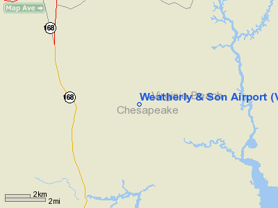
Location & QuickFacts
| FAA Information Effective: | 2008-09-25 |
| Airport Identifier: | VA59 |
| Airport Status: | Operational |
| Longitude/Latitude: | 076-09-05.7630W/36-38-08.5430N
-76.151601/36.635706 (Estimated) |
| Elevation: | 10 ft / 3.05 m (Estimated) |
| Land: | 0 acres |
| From nearest city: | 7 nautical miles NE of Chesapeake, VA |
| Location: | Chesapeake County, VA |
| Magnetic Variation: | 10W (1990) |
Owner & Manager
| Ownership: | Privately owned |
| Owner: | Jon C. Davis |
| Address: | 10414 River Rd.
Matoaca, VA 23803 |
| Phone number: | 804-590-2688 |
| Manager: | Jon C. Davis |
| Address: | 10414 River Rd.
Matoaca, VA 23803 |
| Phone number: | 804-491-3830 |
Airport Operations and Facilities
| Airport Use: | Private |
| Segmented Circle: | No |
| Control Tower: | No |
| Sectional chart: | Washington |
| Region: | AEA - Eastern |
| Boundary ARTCC: | ZDC - Washington |
| Tie-in FSS: | DCA - Leesburg |
| FSS Toll Free: | 1-800-WX-BRIEF |
Runway Information
Runway 03/21
| Dimension: | 1500 x 150 ft / 457.2 x 45.7 m |
| Surface: | TURF, |
| |
Runway 03 |
Runway 21 |
| Traffic Pattern: | Left | Left |
| Obstruction: | | 15 ft bldg, 2000.0 ft from runway |
|
Radio Navigation Aids
| ID |
Type |
Name |
Ch |
Freq |
Var |
Dist |
| EY | NDB | Chesi | | 233.00 | 09W | 11.3 nm |
| PVG | NDB | Portsmouth | | 241.00 | 10W | 16.6 nm |
| LLW | NDB | Woodville | | 254.00 | 10W | 23.5 nm |
| RK | NDB | Waley | | 249.00 | 10W | 24.1 nm |
| PJS | NDB | Henry | | 375.00 | 09W | 34.1 nm |
| FAF | NDB | Felker | | 226.00 | 08W | 37.7 nm |
| EDE | NDB | Edenton | | 265.00 | 10W | 41.8 nm |
| AKQ | NDB | Wakefield | | 274.00 | 09W | 45.9 nm |
| MQI | NDB | Manteo | | 370.00 | 09W | 48.6 nm |
| NTU | TACAN | Oceana | 113X | | 10W | 12.6 nm |
| NGU | TACAN | Chambers | 048X | | 10W | 19.3 nm |
| LFI | TACAN | Langley | 070X | | 10W | 28.8 nm |
| ECG | VOR/DME | Elizabeth City | 072X | 112.50 | 07W | 22.8 nm |
| RBX | VOR/DME | Wright Brothers | 053X | 111.60 | 08W | 48.3 nm |
| ORF | VORTAC | Norfolk | 116X | 116.90 | 07W | 15.6 nm |
| CVI | VORTAC | Cofield | 093X | 114.60 | 09W | 38.2 nm |
| FKN | VORTAC | Franklin | 043X | 110.60 | 09W | 41.8 nm |
| CCV | VORTAC | Cape Charles | 059X | 112.20 | 10W | 43.4 nm |
Remarks
- DALGT VFR USE ONLY; COORDINATE YOUR OPS WITH THOSE OF THE NAVY'S UTILIZING NALF FENTRESS; & NO COMMERCIAL ACTIVITY IS CONDUCTED.
Images and information placed above are from
http://www.airport-data.com/airport/VA59/
We thank them for the data!
| General Info
|
| Country |
United States
|
| State |
VIRGINIA
|
| FAA ID |
VA59
|
| Latitude |
36-38-08.543N
|
| Longitude |
076-09-05.763W
|
| Elevation |
10 feet
|
| Near City |
CHESAPEAKE
|
We don't guarantee the information is fresh and accurate. The data may
be wrong or outdated.
For more up-to-date information please refer to other sources.
|
|


