 |
|
Warrenton-fauquier Airport |
| Warrenton-Fauquier Airport |
| IATA: none – ICAO: KHWY – FAA LID: HWY |
| Summary |
| Airport type |
Public |
| Owner |
Fauquier County |
| Serves |
Warrenton, Virginia |
| Elevation AMSL |
336 ft / 102 m |
| Coordinates |
38°35′11″N 077°42′38″W / 38.58639°N 77.71056°W / 38.58639; -77.71056 |
| Runways |
| Direction |
Length |
Surface |
| ft |
m |
| 15/33 |
5,000 |
1,524 |
Asphalt |
| Statistics (2007) |
| Aircraft operations |
42,184 |
| Based aircraft |
119 |
| Source: Federal Aviation Administration |
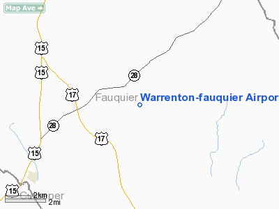
Warrenton-Fauquier Airport (ICAO: KHWY, FAA LID: HWY, formerly W66) is a county-owned, public-use airport located 12 nautical miles (22 km) southeast of the central business district of Warrenton, a town in Fauquier County, Virginia, United States.
Although most U.S. airports use the same three-letter location identifier for the FAA and IATA, this airport is assigned HWY by the FAA but has no designation from the IATA.
Facilities and aircraft
Warrenton-Fauquier Airport covers an area of 407 acres (165 ha) at an elevation of 336 feet (102 m) above mean sea level. It has one runway designated 15/33 with a 5,000 x 100 ft (1,524 x 30 m) asphalt surface.
For the 12-month period ending June 29, 2007, the airport had 42,184 aircraft operations, an average of 115 per day: 98% general aviation, 1% air taxi and <1% military. At that time there were 119 aircraft based at this airport: 84% single-engine (100), 13% multi-engine, 3% ultralight and 1% helicopter.
The above content comes from Wikipedia and is published under free licenses – click here to read more.
Location & QuickFacts
| FAA Information Effective: | 2008-09-25 |
| Airport Identifier: | HWY |
| Airport Status: | Operational |
| Longitude/Latitude: | 077-42-38.3000W/38-35-10.6000N
-77.710639/38.586278 (Estimated) |
| Elevation: | 336 ft / 102.41 m (Surveyed) |
| Land: | 407 acres |
| From nearest city: | 12 nautical miles SE of Warrenton, VA |
| Location: | Fauquier County, VA |
| Magnetic Variation: | 10W (2005) |
Owner & Manager
| Ownership: | Publicly owned |
| Owner: | Fauquier County |
| Address: | 10 Hotel St, Suite 204
Warrenton, VA 20186 |
| Phone number: | 540-347-4323 |
| Manager: | Mike Anderson |
| Address: | 5075 Arpt Rd, Po Box 198
Midland, VA 22728-0068 |
| Phone number: | 540-347-2421 |
Airport Operations and Facilities
| Airport Use: | Open to public |
| Wind indicator: | Yes |
| Segmented Circle: | Yes |
| Control Tower: | No |
| Lighting Schedule: | DUSK-DAWN
ACTVT HIRL RY 15/33 - CTAF. |
| Beacon Color: | Clear-Green (lighted land airport) |
| Landing fee charge: | No |
| Sectional chart: | Washington |
| Region: | AEA - Eastern |
| Boundary ARTCC: | ZDC - Washington |
| Tie-in FSS: | DCA - Leesburg |
| FSS on Airport: | No |
| FSS Toll Free: | 1-800-WX-BRIEF |
| NOTAMs Facility: | DCA (NOTAM-d service avaliable) |
| Federal Agreements: | N |
Airport Communications
| CTAF: | 122.700 |
| Unicom: | 122.700 |
Airport Services
| Fuel available: | 100LLA |
| Airframe Repair: | MAJOR |
| Power Plant Repair: | MAJOR |
| Bottled Oxygen: | NONE |
| Bulk Oxygen: | NONE |
Runway Information
Runway 15/33
| Dimension: | 5000 x 100 ft / 1524.0 x 30.5 m |
| Surface: | ASPH, Good Condition |
| Surface Treatment: | Saw-cut or plastic Grooved |
| Weight Limit: | Single wheel: 15000 lbs.
Dual wheel: 70000 lbs. |
| Edge Lights: | High |
| |
Runway 15 |
Runway 33 |
| Longitude: | 077-42-59.0011W | 077-42-17.5437W |
| Latitude: | 38-35-29.2257N | 38-34-52.0260N |
| Elevation: | 313.00 ft | 336.00 ft |
| Alignment: | 127 | 127 |
| Traffic Pattern: | Left | Left |
| Markings: | Precision instrument, Good Condition | Precision instrument, Good Condition |
| Crossing Height: | 53.00 ft | 40.00 ft |
| VASI: | 4-light PAPI on left side | 4-light PAPI on left side |
| Visual Glide Angle: | 3.00° | 3.00° |
| Runway End Identifier: | Yes | Yes |
| Obstruction: | 99 ft tree, 2745.0 ft from runway, 120 ft right of centerline, 25:1 slope to clear | 79 ft tree, 2239.0 ft from runway, 534 ft right of centerline, 25:1 slope to clear |
|
Radio Navigation Aids
| ID |
Type |
Name |
Ch |
Freq |
Var |
Dist |
| CJR | NDB | Culpeper | | 252.00 | 09W | 7.7 nm |
| MSQ | NDB | Nailr | | 351.00 | 10W | 12.1 nm |
| EZF | NDB | Shannon | | 237.00 | 10W | 22.8 nm |
| GDX | NDB | Goodwin Lake | | 227.00 | 08W | 22.8 nm |
| DC | NDB | Oxonn | | 332.00 | 11W | 33.9 nm |
| GTN | NDB | Georgetown | | 323.00 | 09W | 34.4 nm |
| TZ | NDB | Cogan | | 364.00 | 10W | 34.4 nm |
| IQK | NDB | Louisa | | 382.00 | 09W | 34.7 nm |
| APH | NDB | A P Hill | | 396.00 | 10W | 35.0 nm |
| LUA | NDB | Caverns | | 245.00 | 09W | 36.4 nm |
| VKX | NDB | Potomac | | 241.00 | 10W | 36.7 nm |
| GAI | NDB | Gaithersburg | | 385.00 | 09W | 43.4 nm |
| DCA | VOR/DME | Washington | 047X | 111.00 | 09W | 35.6 nm |
| CSN | VORTAC | Casanova | 110X | 116.30 | 06W | 8.0 nm |
| BRV | VORTAC | Brooke | 092X | 114.50 | 09W | 22.6 nm |
| AML | VORTAC | Armel | 082X | 113.50 | 08W | 23.9 nm |
| LDN | VORTAC | Linden | 090X | 114.30 | 06W | 28.3 nm |
| GVE | VORTAC | Gordonsville | 103X | 115.60 | 06W | 40.3 nm |
| ADW | VORTAC | Andrews | 078X | 113.10 | 10W | 41.8 nm |
| OTT | VORTAC | Nottingham | 084X | 113.70 | 10W | 45.9 nm |
| MRB | VORTAC | Martinsburg | 058X | 112.10 | 07W | 48.5 nm |
| DCA | VOT | Washington National | | 109.40 | | 35.4 nm |
| ADW | VOT | Andrews Afb | | 109.60 | | 40.8 nm |
Remarks
- ULTRALIGHT ACTIVITY ON & INVOF ARPT.
- GCO AVBL ON FREQ 135.075 THRU PCT CLEARANCE DELIVERY.
- AEROBATIC ACTIVITY (3 BOXES AVBL).
- AEROBATIC DEMO AREA WITHIN 1.5 NMR OF ARPT 3500 FT & BLO; 1000-2200.
Images and information placed above are from
http://www.airport-data.com/airport/HWY/
We thank them for the data!
|
|


