 |
|
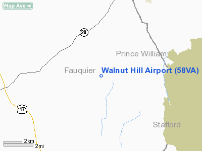
Location & QuickFacts
| FAA Information Effective: | 2008-09-25 |
| Airport Identifier: | 58VA |
| Airport Status: | Operational |
| Longitude/Latitude: | 077-38-45.9630W/38-35-42.4380N
-77.646101/38.595122 (Estimated) |
| Elevation: | 285 ft / 86.87 m (Estimated) |
| Land: | 5 acres |
| From nearest city: | 3 nautical miles SE of Calverton, VA |
| Location: | Fauquier County, VA |
| Magnetic Variation: | 08W (1980) |
Owner & Manager
| Ownership: | Privately owned |
| Owner: | Walnut Hill Farm Llc |
| Address: | 10593 Shenandoah Path
Catlett, VA 20119 |
| Phone number: | 540-788-4452 |
| Manager: | Janice L. Wiley |
| Address: | 10593 Shenandoah Path
Catlett, VA 22019 |
| Phone number: | 540-788-4452 |
Airport Operations and Facilities
| Airport Use: | Private |
| Wind indicator: | Yes |
| Segmented Circle: | No |
| Control Tower: | No |
| Sectional chart: | Washington |
| Region: | AEA - Eastern |
| Boundary ARTCC: | ZDC - Washington |
| Tie-in FSS: | DCA - Leesburg |
| FSS Toll Free: | 1-800-WX-BRIEF |
Runway Information
Runway 18/36
| Dimension: | 2490 x 50 ft / 759.0 x 15.2 m |
| Surface: | TURF, |
| |
Runway 18 |
Runway 36 |
| Traffic Pattern: | Left | Left |
| Displaced threshold: | 500.00 ft | 200.00 ft |
| Obstruction: | 40 ft trees, 70.0 ft from runway | 70 ft trees, 600.0 ft from runway |
|
Radio Navigation Aids
| ID |
Type |
Name |
Ch |
Freq |
Var |
Dist |
| CJR | NDB | Culpeper | | 252.00 | 09W | 10.7 nm |
| MSQ | NDB | Nailr | | 351.00 | 10W | 14.8 nm |
| EZF | NDB | Shannon | | 237.00 | 10W | 21.8 nm |
| GDX | NDB | Goodwin Lake | | 227.00 | 08W | 23.2 nm |
| DC | NDB | Oxonn | | 332.00 | 11W | 30.8 nm |
| GTN | NDB | Georgetown | | 323.00 | 09W | 31.7 nm |
| VKX | NDB | Potomac | | 241.00 | 10W | 33.7 nm |
| APH | NDB | A P Hill | | 396.00 | 10W | 34.0 nm |
| TZ | NDB | Cogan | | 364.00 | 10W | 35.5 nm |
| IQK | NDB | Louisa | | 382.00 | 09W | 36.0 nm |
| LUA | NDB | Caverns | | 245.00 | 09W | 39.3 nm |
| GAI | NDB | Gaithersburg | | 385.00 | 09W | 41.2 nm |
| DCA | VOR/DME | Washington | 047X | 111.00 | 09W | 32.7 nm |
| CSN | VORTAC | Casanova | 110X | 116.30 | 06W | 10.7 nm |
| BRV | VORTAC | Brooke | 092X | 114.50 | 09W | 20.8 nm |
| AML | VORTAC | Armel | 082X | 113.50 | 08W | 22.1 nm |
| LDN | VORTAC | Linden | 090X | 114.30 | 06W | 30.5 nm |
| ADW | VORTAC | Andrews | 078X | 113.10 | 10W | 38.7 nm |
| GVE | VORTAC | Gordonsville | 103X | 115.60 | 06W | 42.3 nm |
| OTT | VORTAC | Nottingham | 084X | 113.70 | 10W | 42.8 nm |
| MRB | VORTAC | Martinsburg | 058X | 112.10 | 07W | 48.4 nm |
| DCA | VOT | Washington National | | 109.40 | | 32.4 nm |
| ADW | VOT | Andrews Afb | | 109.60 | | 37.8 nm |
Remarks
- PVDD OBSTRUCTIONS ARE REMOVED/LOWERED TO PROVIDE 20:1 APCH CLNC; LETTER OF AGREEMENT WITH FAUQUIER & WHITMAN FIELD ARPTS REGARDING TFC PAT & COORDINATE WITH DULLES ATCT.
Images and information placed above are from
http://www.airport-data.com/airport/58VA/
We thank them for the data!
| General Info
|
| Country |
United States
|
| State |
VIRGINIA
|
| FAA ID |
58VA
|
| Latitude |
38-35-42.438N
|
| Longitude |
077-38-45.963W
|
| Elevation |
285 feet
|
| Near City |
CALVERTON
|
We don't guarantee the information is fresh and accurate. The data may
be wrong or outdated.
For more up-to-date information please refer to other sources.
|
|


