 |
|
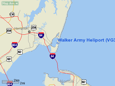
Location & QuickFacts
| FAA Information Effective: | 2008-09-25 |
| Airport Identifier: | VG35 |
| Airport Status: | Operational |
| Longitude/Latitude: | 076-18-00.0000W/37-01-00.0000N
-76.300000/37.016667 (Estimated) |
| Elevation: | 7 ft / 2.13 m (Estimated) |
| Land: | 0 acres |
| From nearest city: | 10 nautical miles N of Fort Monroe, VA |
| Location: | Norfolk County, VA |
| Magnetic Variation: | 10W (1990) |
Owner & Manager
| Ownership: | Privately owned |
| Owner: | Dept Of Army Hq, Darrell Milton |
| Address: | Hq-tra-doc, Attn: G-3-5-7, Flight Ops
Ft Monroe, VA 23651 |
| Phone number: | 757-788-3187 |
| Manager: | Darrell Milton |
| Address: | Hq-tra-doc, Attn: G-3-5-7, Flight Ops
Ft Monroe, VA 23651 |
| Phone number: | 757-788-3187 |
Airport Operations and Facilities
| Airport Use: | Private |
| Segmented Circle: | No |
| Control Tower: | No |
| Sectional chart: | Washington |
| Region: | AEA - Eastern |
| Boundary ARTCC: | ZDC - Washington |
| Tie-in FSS: | DCA - Leesburg |
| FSS Toll Free: | 1-800-WX-BRIEF |
Runway Information
Helipad H1
| Dimension: | 35 x 35 ft / 10.7 x 10.7 m |
| Surface: | CONC, |
| |
Runway H1 |
Runway |
| Traffic Pattern: | Left | Left |
|
Radio Navigation Aids
| ID |
Type |
Name |
Ch |
Freq |
Var |
Dist |
| PJS | NDB | Henry | | 375.00 | 09W | 11.6 nm |
| PVG | NDB | Portsmouth | | 241.00 | 10W | 15.8 nm |
| FAF | NDB | Felker | | 226.00 | 08W | 16.9 nm |
| EY | NDB | Chesi | | 233.00 | 09W | 25.4 nm |
| RK | NDB | Waley | | 249.00 | 10W | 30.2 nm |
| AKQ | NDB | Wakefield | | 274.00 | 09W | 33.7 nm |
| BDB | NDB | Accomack | | 336.00 | 11W | 41.0 nm |
| LLW | NDB | Woodville | | 254.00 | 10W | 45.3 nm |
| NGU | TACAN | Chambers | 048X | | 10W | 4.7 nm |
| LFI | TACAN | Langley | 070X | | 10W | 5.0 nm |
| NTU | TACAN | Oceana | 113X | | 10W | 17.1 nm |
| ECG | VOR/DME | Elizabeth City | 072X | 112.50 | 07W | 46.0 nm |
| ORF | VORTAC | Norfolk | 116X | 116.90 | 07W | 8.9 nm |
| CCV | VORTAC | Cape Charles | 059X | 112.20 | 10W | 24.6 nm |
| HCM | VORTAC | Harcum | 025X | 108.80 | 07W | 32.6 nm |
| FKN | VORTAC | Franklin | 043X | 110.60 | 09W | 38.8 nm |
| HPW | VORTAC | Hopewell | 057X | 112.00 | 06W | 43.4 nm |
| CVI | VORTAC | Cofield | 093X | 114.60 | 09W | 47.5 nm |
Remarks
- HELICOPTER ONLY.
- NUMEROUS BIRDS INVOF ARPT. DO NOT OVERFLY POST.
- 24 HOUR PPR TRADOC PROTOCOL OFFICE FOR LDG/LGT V680-3187/2517. CTC TRADOC OPS 20 MIN PRIOR TO LDG ON 122.9 TO PASS ETA TO TRADOC EXECUTIVE SVC FOR PICKUP OF PASSENGERS AND HELIPAD LIGHTING.
Images and information placed above are from
http://www.airport-data.com/airport/VG35/
We thank them for the data!
| General Info
|
| Country |
United States
|
| State |
VIRGINIA
|
| FAA ID |
VG35
|
| Latitude |
37-01-00.000N
|
| Longitude |
076-18-00.000W
|
| Elevation |
7 feet
|
| Near City |
FORT MONROE
|
We don't guarantee the information is fresh and accurate. The data may
be wrong or outdated.
For more up-to-date information please refer to other sources.
|
|


