 |
|
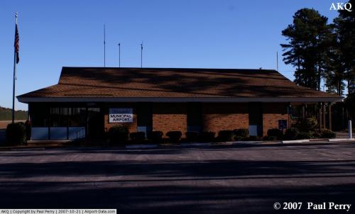 |
(Click on the photo to enlarge) |
Location & QuickFacts
| FAA Information Effective: | 2008-09-25 |
| Airport Identifier: | AKQ |
| Airport Status: | Operational |
| Longitude/Latitude: | 077-00-04.0590W/36-59-13.9430N
-77.001127/36.987206 (Estimated) |
| Elevation: | 113 ft / 34.44 m (Estimated) |
| Land: | 122 acres |
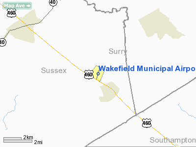
| From nearest city: | 2 nautical miles NW of Wakefield, VA |
| Location: | Sussex County, VA |
| Magnetic Variation: | 06W (1965) |
Owner & Manager
| Ownership: | Publicly owned |
| Owner: | Town Of Wakefield |
| Address: | P O Box 550
Wakefield, VA 23888 |
| Phone number: | 757-899-2030 |
| Manager: | Sandra Wall |
| Address: | P.o. Box 811
Wakefield, VA 23888 |
| Phone number: | 757-899-4002 |
Airport Operations and Facilities
| Airport Use: | Open to public |
| Wind indicator: | Yes |
| Segmented Circle: | Yes |
| Control Tower: | No |
| Lighting Schedule: | DUSK-DAWN |
| Beacon Color: | Clear-Green (lighted land airport) |
| Landing fee charge: | No |
| Sectional chart: | Washington |
| Region: | AEA - Eastern |
| Boundary ARTCC: | ZDC - Washington |
| Tie-in FSS: | DCA - Leesburg |
| FSS on Airport: | No |
| FSS Toll Free: | 1-800-WX-BRIEF |
| NOTAMs Facility: | AKQ (NOTAM-d service avaliable) |
Airport Communications
| CTAF: | 122.800 |
| Unicom: | 122.800 |
Airport Services
| Fuel available: | 100LL
FOR FUEL AFTER HRS CALL 757-899-6066. |
| Airframe Repair: | NONE |
| Power Plant Repair: | NONE |
| Bottled Oxygen: | NONE |
| Bulk Oxygen: | NONE |
Runway Information
Runway 02/20
| Dimension: | 4337 x 75 ft / 1321.9 x 22.9 m |
| Surface: | ASPH, Good Condition |
| Weight Limit: | Single wheel: 12500 lbs. |
| Edge Lights: | Medium |
| |
Runway 02 |
Runway 20 |
| Longitude: | 077-00-11.7510W | 076-59-56.2890W |
| Latitude: | 36-58-53.4560N | 36-59-34.5020N |
| Elevation: | 109.00 ft | 113.00 ft |
| Alignment: | 17 | 127 |
| Traffic Pattern: | Left | Left |
| Markings: | Non-precision instrument, Fair Condition | Non-precision instrument, Fair Condition |
| Crossing Height: | 17.00 ft | 17.00 ft |
| Displaced threshold: | 298.00 ft | 470.00 ft |
| VASI: | system of panels on left side that may or may not be lighted | system of panels on left side that may or may not be lighted |
| Visual Glide Angle: | 3.00° | 3.00° |
| Runway End Identifier: | No | No |
| Obstruction: | 25 ft trees, 200.0 ft from runway, 24 ft left of centerline
CLEARANCE SLOPE TO DSPLCD THLD 6:1.
RD +15' 70' FM THR CROSSING END. | 68 ft trees, 440.0 ft from runway, 275 ft right of centerline, 3:1 slope to clear
CTLG OBS TO DSPLCD THLD 91 FT TREE, 443 FT FM THLD, 234 FT LEFT OF CNTRLN. CLEARANCE SLOPE 2:1
ROAD +15 FT 42 FT FM RY END. |
|
Radio Navigation Aids
| ID |
Type |
Name |
Ch |
Freq |
Var |
Dist |
| AKQ | NDB | Wakefield | | 274.00 | 09W | 0.2 nm |
| FAF | NDB | Felker | | 226.00 | 08W | 20.5 nm |
| PJS | NDB | Henry | | 375.00 | 09W | 25.9 nm |
| RK | NDB | Waley | | 249.00 | 10W | 28.8 nm |
| PTB | NDB | Petersburg | | 284.00 | 08W | 28.8 nm |
| PVG | NDB | Portsmouth | | 241.00 | 10W | 29.5 nm |
| CF | NDB | Pubbs | | 392.00 | 09W | 30.0 nm |
| ELQ | NDB | Emporia | | 261.00 | 10W | 30.2 nm |
| EY | NDB | Chesi | | 233.00 | 09W | 37.8 nm |
| ASJ | NDB | Ahoskie | | 415.00 | 10W | 42.2 nm |
| RZZ | NDB | Rapids | | 407.00 | 08W | 47.3 nm |
| LFI | TACAN | Langley | 070X | | 10W | 31.4 nm |
| NGU | TACAN | Chambers | 048X | | 10W | 34.9 nm |
| NTU | TACAN | Oceana | 113X | | 10W | 47.4 nm |
| FKN | VORTAC | Franklin | 043X | 110.60 | 09W | 16.4 nm |
| HPW | VORTAC | Hopewell | 057X | 112.00 | 06W | 21.3 nm |
| HCM | VORTAC | Harcum | 025X | 108.80 | 07W | 31.0 nm |
| RIC | VORTAC | Richmond | 088X | 114.10 | 09W | 34.5 nm |
| CVI | VORTAC | Cofield | 093X | 114.60 | 09W | 37.4 nm |
| ORF | VORTAC | Norfolk | 116X | 116.90 | 07W | 38.9 nm |
| LVL | VORTAC | Lawrenceville | 076X | 112.90 | 08W | 44.5 nm |
Remarks
- APRON PAVEMENT CRACKED AND IN POOR CONDITION.
Images and information placed above are from
http://www.airport-data.com/airport/AKQ/
We thank them for the data!
| General Info
|
| Country |
United States
|
| State |
VIRGINIA
|
| FAA ID |
AKQ
|
| Latitude |
36-59-13.943N
|
| Longitude |
077-00-04.059W
|
| Elevation |
113 feet
|
| Near City |
WAKEFIELD
|
We don't guarantee the information is fresh and accurate. The data may
be wrong or outdated.
For more up-to-date information please refer to other sources.
|
|


