 |
|
Virginia Tech/montgomery Executive Airport |
Coordinates: 37°12′28″N 080°24′28″W / 37.20778°N 80.40778°W / 37.20778; -80.40778
| Virginia Tech Montgomery Executive Airport |
| IATA: BCB – ICAO: KBCB – FAA LID: BCB |
| Summary |
| Airport type |
Public |
| Owner |
Virginia Tech Montgomery Regional Airport Authority |
| Serves |
Blacksburg, Virginia |
| Elevation AMSL |
2,132 ft / 650 m |
| Website |
www.VTBCB.com |
| Runways |
| Direction |
Length |
Surface |
| ft |
m |
| 12/30 |
4,539 |
1,383 |
Asphalt |
| Statistics (2007) |
| Aircraft operations |
16,700 |
| Source: Federal Aviation Administration |
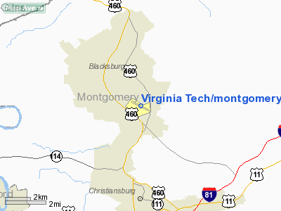
Virginia Tech Montgomery Executive Airport (IATA: BCB, ICAO: KBCB) is a public airport located three miles (5 km) south of the central business district of Blacksburg, a town in Montgomery County, Virginia, United States.
Facilities and aircraft
Virginia Tech Montgomery Executive Airport covers an area of 248 acres (100 ha) and contains one asphalt paved runway designated 12/30 which measures 4,539 x 100 ft (1,383 x 30 m). For the 12-month period ending April 30, 2007, the airport had 16,700 aircraft operations, an average of 45 per day: 96% general aviation, 2% air taxi and 2% military. BCB is an IFR airport with GPS approaches to both runways, a LOC/DME approach to runway 12, and a non-precision NDB approach.
The airport officially opened in 1931 as VPI Airport (using the former initials of the university). University cadets trained to fly there during World War II. A new terminal building was completed in 1996, and the airport took its current name in 2002.
The above content comes from Wikipedia and is published under free licenses – click here to read more.
Location & QuickFacts
| FAA Information Effective: | 2008-09-25 |
| Airport Identifier: | BCB |
| Airport Status: | Operational |
| Longitude/Latitude: | 080-24-28.2000W/37-12-27.5000N
-80.407833/37.207639 (Estimated) |
| Elevation: | 2132 ft / 649.83 m (Surveyed) |
| Land: | 248 acres |
| From nearest city: | 3 nautical miles S of Blacksburg, VA |
| Location: | Montgomery County, VA |
| Magnetic Variation: | 06W (1985) |
Owner & Manager
| Ownership: | Publicly owned |
| Owner: | Vtmraa |
| Address: | 1601 Tech Center Drive
Blacksburg, VA 24060 |
| Phone number: | 540-231-4444 |
| Manager: | Michael St. Jean |
| Address: | 1601 Tech Center Drive
Blacksburg, VA 24060 |
| Phone number: | 540-231-4444 |
Airport Operations and Facilities
| Airport Use: | Open to public |
| Wind indicator: | Yes |
| Segmented Circle: | Yes |
| Control Tower: | No |
| Lighting Schedule: | DUSK-DAWN
MIRL RY 12/30 PRESET LOW INTST; ACTVT HIGHER INTST; ODALS RY 12; PAPI RY 30 & REIL RY 30 - CTAF. |
| Beacon Color: | Clear-Green (lighted land airport) |
| Landing fee charge: | No |
| Sectional chart: | Cincinnati |
| Region: | AEA - Eastern |
| Traffic Pattern Alt: | 1000 ft |
| Boundary ARTCC: | ZDC - Washington |
| Tie-in FSS: | DCA - Leesburg |
| FSS on Airport: | No |
| FSS Toll Free: | 1-800-WX-BRIEF |
| NOTAMs Facility: | BCB (NOTAM-d service avaliable) |
| Federal Agreements: | NGY |
Airport Communications
| CTAF: | 123.050 |
| Unicom: | 123.050 |
Airport Services
| Fuel available: | 100LLA
PPR FOR FUEL WHEN ARPT UNATNDD; PHONE 540-231-4444. |
| Airframe Repair: | NONE |
| Power Plant Repair: | NONE |
| Bottled Oxygen: | NONE |
| Bulk Oxygen: | NONE |
Runway Information
Runway 12/30
| Dimension: | 4539 x 100 ft / 1383.5 x 30.5 m |
| Surface: | ASPH, Fair Condition |
| Edge Lights: | Medium |
| |
Runway 12 |
Runway 30 |
| Longitude: | 080-24-53.1854W | 080-24-03.2801W |
| Latitude: | 37-12-37.7586N | 37-12-17.2597N |
| Elevation: | 2113.00 ft | 2132.00 ft |
| Alignment: | 117 | 127 |
| ILS Type: | LOC/DME
| |
| Traffic Pattern: | Left | Left |
| Markings: | Non-precision instrument, Fair Condition | Non-precision instrument, Fair Condition |
| Crossing Height: | 40.00 ft | 0.00 ft |
| VASI: | 4-light PAPI on left side | 2-light PAPI on left side |
| Visual Glide Angle: | 3.00° | 3.75° |
| Approach lights: | ODALS | NSTD |
| Runway End Identifier: | | Yes |
| Obstruction: | 24 ft road, 600.0 ft from runway, 309 ft right of centerline, 16:1 slope to clear | 12 ft brush, 275.0 ft from runway, 154 ft right of centerline, 6:1 slope to clear |
|
Radio Navigation Aids
| ID |
Type |
Name |
Ch |
Freq |
Var |
Dist |
| TEC | NDB | Tech | | 368.00 | 06W | 0.2 nm |
| CNQ | NDB | Callahan | | 379.00 | 05W | 12.4 nm |
| VIT | NDB | Vinton | | 277.00 | 06W | 25.2 nm |
| HLX | NDB | Hillsville | | 269.00 | 06W | 33.3 nm |
| LW | NDB | Bushi | | 346.00 | 06W | 34.7 nm |
| MK | NDB | Suzze | | 335.00 | 06W | 43.6 nm |
| UV | NDB | Bales | | 396.00 | 07W | 44.0 nm |
| ODR | VOR | Woodrum | | 114.90 | 06W | 21.7 nm |
| RNL | VOR | Rainelle | | 116.60 | 04W | 49.9 nm |
| LWB | VOR/DME | Greenbrier | 107Y | 116.05 | 08W | 39.4 nm |
| PSK | VORTAC | Pulaski | 115X | 116.80 | 06W | 16.3 nm |
| ROA | VORTAC | Roanoke | 031X | 109.40 | 04W | 18.1 nm |
| BLF | VORTAC | Bluefield | 037X | 110.00 | 03W | 38.1 nm |
| BKW | VORTAC | Beckley | 124X | 117.70 | 06W | 48.5 nm |
Remarks
- OCCASIONAL WILDLIFE ON ARPT
- VFR DEPARTURES MAINTAIN RY HEADING UNTIL REACHING 1000 FT AGL.
- NOISE SENSITIVE AREA NORTH OF ARPT
Images and information placed above are from
http://www.airport-data.com/airport/BCB/
We thank them for the data!
| General Info
|
| Country |
United States
|
| State |
VIRGINIA
|
| FAA ID |
BCB
|
| Latitude |
37-12-27.500N
|
| Longitude |
080-24-28.200W
|
| Elevation |
2132 feet
|
| Near City |
BLACKSBURG
|
We don't guarantee the information is fresh and accurate. The data may
be wrong or outdated.
For more up-to-date information please refer to other sources.
|
|


