 |
|
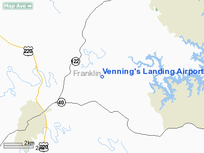
Venning's Landing Airport |
Location & QuickFacts
| FAA Information Effective: | 2008-09-25 |
| Airport Identifier: | VG53 |
| Airport Status: | Operational |
| Longitude/Latitude: | 079-48-05.0000W/37-02-37.0000N
-79.801389/37.043611 (Estimated) |
| Elevation: | 1100 ft / 335.28 m (Estimated) |
| Land: | 86 acres |
| From nearest city: | 5 nautical miles NE of Rocky Mount, VA |
| Location: | Franklin County, VA |
| Magnetic Variation: | 10W (2000) |
Owner & Manager
| Ownership: | Privately owned |
| Owner: | S. Gregory Venning |
| Address: | 695 Lakewood Forest Rd
Moneta, VA 24121 |
| Phone number: | 540-721-3550 |
| Manager: | S. Gregory Venning |
| Address: | 695 Lakewood Forest Rd
Moneta, VA 24121 |
| Phone number: | 540-721-3550 |
Airport Operations and Facilities
| Airport Use: | Private |
| Wind indicator: | Yes |
| Segmented Circle: | No |
| Control Tower: | No |
| Sectional chart: | Cincinnati |
| Region: | AEA - Eastern |
| Boundary ARTCC: | ZDC - Washington |
| Tie-in FSS: | DCA - Leesburg |
| FSS Toll Free: | 1-800-WX-BRIEF |
Runway Information
Runway 05/23
| Dimension: | 1976 x 80 ft / 602.3 x 24.4 m |
| Surface: | TURF, |
| |
Runway 05 |
Runway 23 |
| Traffic Pattern: | Left | Left |
|
Radio Navigation Aids
| ID |
Type |
Name |
Ch |
Freq |
Var |
Dist |
| OQA | FAN MARKER | Rockingham County | | | | 37.1 nm |
| VIT | NDB | Vinton | | 277.00 | 06W | 10.4 nm |
| CNQ | NDB | Callahan | | 379.00 | 05W | 21.5 nm |
| UV | NDB | Bales | | 396.00 | 07W | 27.8 nm |
| LY | NDB | Bojar | | 385.00 | 08W | 29.8 nm |
| TEC | NDB | Tech | | 368.00 | 06W | 30.5 nm |
| SIF | NDB | Slammer | | 423.00 | 07W | 39.8 nm |
| ODR | VOR | Woodrum | | 114.90 | 06W | 18.9 nm |
| DAN | VOR | Danville | | 113.10 | 06W | 36.3 nm |
| ROA | VORTAC | Roanoke | 031X | 109.40 | 04W | 22.2 nm |
| LYH | VORTAC | Lynchburg | 029X | 109.20 | 05W | 29.9 nm |
| PSK | VORTAC | Pulaski | 115X | 116.80 | 06W | 43.8 nm |
| SBV | VORTAC | South Boston | 041X | 110.40 | 05W | 43.9 nm |
Remarks
- PRVDD DALGT OPNS ONLY, CLEAR 20:1 APCH/DEP APATH FOR EACH RY, & OPR TO MINIMIZE NOISE.
Images and information placed above are from
http://www.airport-data.com/airport/VG53/
We thank them for the data!
| General Info
|
| Country |
United States
|
| State |
VIRGINIA
|
| FAA ID |
VG53
|
| Latitude |
37-02-37.000N
|
| Longitude |
079-48-05.000W
|
| Elevation |
1100 feet
|
| Near City |
ROCKY MOUNT
|
We don't guarantee the information is fresh and accurate. The data may
be wrong or outdated.
For more up-to-date information please refer to other sources.
|
|


