 |
|
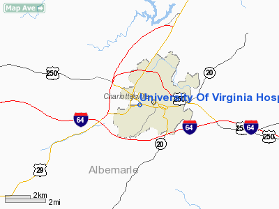
University Of Virginia Hospital Heliport |
Location & QuickFacts
| FAA Information Effective: | 2008-09-25 |
| Airport Identifier: | 8VA5 |
| Airport Status: | Operational |
| Longitude/Latitude: | 078-29-59.0430W/38-01-58.0000N
-78.499734/38.032778 (Estimated) |
| Elevation: | 490 ft / 149.35 m (Estimated) |
| Land: | 0 acres |
| From nearest city: | 0 nautical miles NW of Charlottesville, VA |
| Location: | Albemarle County, VA |
| Magnetic Variation: | 08W (1985) |
Owner & Manager
| Ownership: | Privately owned |
| Owner: | Univ. Of Virginia Hospital |
| Address: | Jefferson Park Avenue
Charlottesville, VA 22908 |
| Phone number: | 804-924-9287 |
| Manager: | Marge Sidebottom |
| Address: | 304 Bowen Loop
Charlottesville, VA 22901
UNIV. OF VIRGINIA HOSPITAL. |
| Phone number: | 804-982-0219 |
Airport Operations and Facilities
| Airport Use: | Private
MEDICAL USE. |
| Wind indicator: | Yes |
| Segmented Circle: | Yes |
| Control Tower: | No |
| Lighting Schedule: | PHONE REQ
FOR HELIPAD LGTS & ROTG BCN CALL 804-924-9287. |
| Beacon Color: | Clear-Green (lighted land airport) |
| Sectional chart: | Washington |
| Region: | AEA - Eastern |
| Boundary ARTCC: | ZDC - Washington |
| Tie-in FSS: | DCA - Leesburg |
| FSS on Airport: | No |
| FSS Toll Free: | 1-800-WX-BRIEF |
Airport Communications
Runway Information
Helipad H1
| Dimension: | 64 x 64 ft / 19.5 x 19.5 m |
| Surface: | CONC, |
| |
Runway H1 |
Runway |
| Traffic Pattern: | Left | Left |
| Markings: | Basic, Good Condition | , |
|
Radio Navigation Aids
| ID |
Type |
Name |
Ch |
Freq |
Var |
Dist |
| AZS | NDB | Azalea Park | | 336.00 | 08W | 1.6 nm |
| VBW | NDB | Bridgewater | | 241.00 | 07W | 29.6 nm |
| IQK | NDB | Louisa | | 382.00 | 09W | 30.3 nm |
| MSQ | NDB | Nailr | | 351.00 | 10W | 37.8 nm |
| LUA | NDB | Caverns | | 245.00 | 09W | 40.1 nm |
| FVX | NDB | Farmville | | 367.00 | 07W | 41.0 nm |
| CJR | NDB | Culpeper | | 252.00 | 09W | 42.6 nm |
| MOL | VOR/DME | Montebello | 100X | 115.30 | 05W | 29.8 nm |
| GVE | VORTAC | Gordonsville | 103X | 115.60 | 06W | 16.5 nm |
| FAK | VORTAC | Flat Rock | 080X | 113.30 | 06W | 44.0 nm |
| CSN | VORTAC | Casanova | 110X | 116.30 | 06W | 47.2 nm |
Remarks
- ARRIVING ACFT SHOULD CTC CHARLOTTESVILLE ATCT FOR TRAFFIC ADVISORIES.
- RESTRICTED TO MEDICAL EMERGENCIES ONLY.
Images and information placed above are from
http://www.airport-data.com/airport/8VA5/
We thank them for the data!
| General Info
|
| Country |
United States
|
| State |
VIRGINIA
|
| FAA ID |
8VA5
|
| Latitude |
38-01-58.000N
|
| Longitude |
078-29-59.043W
|
| Elevation |
490 feet
|
| Near City |
CHARLOTTESVILLE
|
We don't guarantee the information is fresh and accurate. The data may
be wrong or outdated.
For more up-to-date information please refer to other sources.
|
|


