 |
|
Location & QuickFacts
| FAA Information Effective: | 2008-09-25 |
| Airport Identifier: | 4VA7 |
| Airport Status: | Operational |
| Longitude/Latitude: | 082-07-43.4850W/37-17-48.3970N
-82.128746/37.296777 (Estimated) |
| Elevation: | 1020 ft / 310.90 m (Estimated) |
| Land: | 0 acres |
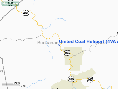
| From nearest city: | 3 nautical miles NW of Grundy, VA |
| Location: | Buchanan County, VA |
| Magnetic Variation: | 05W (1985) |
Owner & Manager
| Ownership: | Privately owned |
| Owner: | Wellmore Coal Corp. |
| Address: | Po Box 901
Grundy, VA 24614 |
| Phone number: | 703-935-7521 |
| Manager: | Charles W. White |
| Address: | Po Box 1280
Bristol, VA 24203 |
| Phone number: | 703-466-3322 |
Airport Operations and Facilities
| Airport Use: | Private |
| Wind indicator: | Yes |
| Segmented Circle: | No |
| Control Tower: | No |
| Landing fee charge: | No |
| Sectional chart: | Cincinnati |
| Region: | AEA - Eastern |
| Boundary ARTCC: | ZID - Indianapolis |
| Tie-in FSS: | DCA - Leesburg |
| FSS on Airport: | No |
| FSS Toll Free: | 1-800-WX-BRIEF |
Runway Information
Helipad H1
| Dimension: | 125 x 60 ft / 38.1 x 18.3 m |
| Surface: | CONC-TURF, |
| |
Runway H1 |
Runway |
| Traffic Pattern: | Left | Left |
|
Radio Navigation Aids
| ID |
Type |
Name |
Ch |
Freq |
Var |
Dist |
| GTC | NDB | Guyandot | | 293.00 | 03W | 31.0 nm |
| VJ | NDB | Whine | | 236.00 | 05W | 34.9 nm |
| MK | NDB | Suzze | | 335.00 | 06W | 48.1 nm |
| GZG | VOR/DME | Glade Spring | 039X | 110.20 | 02W | 28.5 nm |
| BLF | VORTAC | Bluefield | 037X | 110.00 | 03W | 44.7 nm |
Images and information placed above are from
http://www.airport-data.com/airport/4VA7/
We thank them for the data!
| General Info
|
| Country |
United States
|
| State |
VIRGINIA
|
| FAA ID |
4VA7
|
| Latitude |
37-17-48.397N
|
| Longitude |
082-07-43.485W
|
| Elevation |
1020 feet
|
| Near City |
GRUNDY
|
We don't guarantee the information is fresh and accurate. The data may
be wrong or outdated.
For more up-to-date information please refer to other sources.
|
|


