 |
|
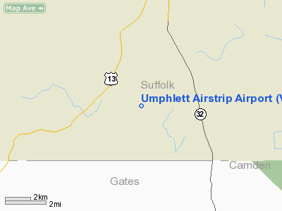
Umphlett Airstrip Airport |
Location & QuickFacts
| FAA Information Effective: | 2008-09-25 |
| Airport Identifier: | VG37 |
| Airport Status: | Operational |
| Longitude/Latitude: | 076-38-16.8300W/36-35-21.5460N
-76.638008/36.589318 (Estimated) |
| Elevation: | 75 ft / 22.86 m (Estimated) |
| Land: | 8 acres |
| From nearest city: | 2 nautical miles E of Whaleyville, VA |
| Location: | Nansemond County, VA |
| Magnetic Variation: | 09W (1985) |
Owner & Manager
| Ownership: | Privately owned |
| Owner: | Floyd Umphlett |
| Address: | Greenway Dr
Suffolk, VA 23438 |
| Phone number: | 804-986-4655 |
| Address: |
|
Airport Operations and Facilities
| Airport Use: | Private |
| Wind indicator: | Yes |
| Segmented Circle: | No |
| Control Tower: | No |
| Landing fee charge: | No |
| Sectional chart: | Washington |
| Region: | AEA - Eastern |
| Boundary ARTCC: | ZDC - Washington |
| Tie-in FSS: | DCA - Leesburg |
| FSS on Airport: | No |
| FSS Toll Free: | 1-800-WX-BRIEF |
| NOTAMs Facility: | (NOTAM-d service avaliable) |
Airport Services
| Bottled Oxygen: | NONE |
| Bulk Oxygen: | NONE |
Runway Information
Runway 01/19
| Dimension: | 2550 x 60 ft / 777.2 x 18.3 m |
| Surface: | TURF, Good Condition |
| |
Runway 01 |
Runway 19 |
| Traffic Pattern: | Left | Left |
| Displaced threshold: | 0.00 ft | 360.00 ft
DSPLCD THR MKD BY CONES. |
| Obstruction: | 36 ft pline, 535.0 ft from runway, 14:1 slope to clear | 30 ft pline, 0.0 ft from runway
12:1 FM DSPLCD THR TO M-PLINE. |
|
Radio Navigation Aids
| ID |
Type |
Name |
Ch |
Freq |
Var |
Dist |
| RK | NDB | Waley | | 249.00 | 10W | 0.8 nm |
| EY | NDB | Chesi | | 233.00 | 09W | 12.4 nm |
| PVG | NDB | Portsmouth | | 241.00 | 10W | 14.8 nm |
| LLW | NDB | Woodville | | 254.00 | 10W | 25.6 nm |
| AKQ | NDB | Wakefield | | 274.00 | 09W | 29.4 nm |
| ASJ | NDB | Ahoskie | | 415.00 | 10W | 31.3 nm |
| FAF | NDB | Felker | | 226.00 | 08W | 33.0 nm |
| PJS | NDB | Henry | | 375.00 | 09W | 33.4 nm |
| EDE | NDB | Edenton | | 265.00 | 10W | 34.1 nm |
| ELQ | NDB | Emporia | | 261.00 | 10W | 38.0 nm |
| PMZ | NDB | Plymouth | | 221.00 | 10W | 47.2 nm |
| NGU | TACAN | Chambers | 048X | | 10W | 27.3 nm |
| NTU | TACAN | Oceana | 113X | | 10W | 32.2 nm |
| LFI | TACAN | Langley | 070X | | 10W | 32.7 nm |
| ECG | VOR/DME | Elizabeth City | 072X | 112.50 | 07W | 30.0 nm |
| CVI | VORTAC | Cofield | 093X | 114.60 | 09W | 17.2 nm |
| FKN | VORTAC | Franklin | 043X | 110.60 | 09W | 19.5 nm |
| ORF | VORTAC | Norfolk | 116X | 116.90 | 07W | 27.8 nm |
Images and information placed above are from
http://www.airport-data.com/airport/VG37/
We thank them for the data!
| General Info
|
| Country |
United States
|
| State |
VIRGINIA
|
| FAA ID |
VG37
|
| Latitude |
36-35-21.546N
|
| Longitude |
076-38-16.830W
|
| Elevation |
75 feet
|
| Near City |
WHALEYVILLE
|
We don't guarantee the information is fresh and accurate. The data may
be wrong or outdated.
For more up-to-date information please refer to other sources.
|
|


