 |
|
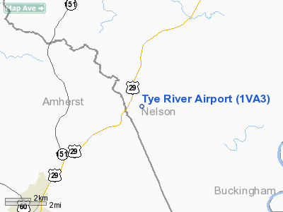
Location & QuickFacts
| FAA Information Effective: | 2008-09-25 |
| Airport Identifier: | 1VA3 |
| Airport Status: | Operational |
| Longitude/Latitude: | 078-56-44.0800W/37-39-29.5100N
-78.945578/37.658197 (Estimated) |
| Elevation: | 650 ft / 198.12 m (Estimated) |
| Land: | 0 acres |
| From nearest city: | 7 nautical miles SW of Lovingston, VA |
| Location: | Nelson County, VA |
| Magnetic Variation: | 07W (1985) |
Owner & Manager
| Ownership: | Privately owned |
| Owner: | Carol Walsh |
| Address: | 485 Tye River Rd
Arrington, VA 22922 |
| Phone number: | 804-263-5229 |
| Manager: | Carol Walsh |
| Address: | 485 Tye River Rd
Arrington, VA 22922 |
| Phone number: | 804-263-5229 |
Airport Operations and Facilities
| Airport Use: | Private |
| Segmented Circle: | No |
| Control Tower: | No |
| Sectional chart: | Washington |
| Region: | AEA - Eastern |
| Boundary ARTCC: | ZDC - Washington |
| Tie-in FSS: | DCA - Leesburg |
| FSS on Airport: | No |
| FSS Toll Free: | 1-800-WX-BRIEF |
Runway Information
Runway 04/22
| Dimension: | 1750 x 100 ft / 533.4 x 30.5 m |
| Surface: | TURF, |
| |
Runway 04 |
Runway 22 |
| Traffic Pattern: | Left | Left |
|
Radio Navigation Aids
| ID |
Type |
Name |
Ch |
Freq |
Var |
Dist |
| LY | NDB | Bojar | | 385.00 | 08W | 27.7 nm |
| AZS | NDB | Azalea Park | | 336.00 | 08W | 29.3 nm |
| FVX | NDB | Farmville | | 367.00 | 07W | 30.4 nm |
| VBW | NDB | Bridgewater | | 241.00 | 07W | 42.5 nm |
| MOL | VOR/DME | Montebello | 100X | 115.30 | 05W | 16.5 nm |
| LYH | VORTAC | Lynchburg | 029X | 109.20 | 05W | 27.9 nm |
| GVE | VORTAC | Gordonsville | 103X | 115.60 | 06W | 43.3 nm |
Remarks
- PRVDD ARPT USED FOR VFR OPNS ONLY; COORDINATE WITH OWNER OF STARR ARPT; PRIOR TO COMMENCING OPNS CTC THE USAF MILITARY REP FOR THE FAA EASTERN REGION FOR A BRIEFING REGARDING MTR VR96; PILOTS OPERATING OUT OF THIS ARPT SHALL BE BRIEFED REGARDING THE MTR.
Images and information placed above are from
http://www.airport-data.com/airport/1VA3/
We thank them for the data!
| General Info
|
| Country |
United States
|
| State |
VIRGINIA
|
| FAA ID |
1VA3
|
| Latitude |
37-39-29.510N
|
| Longitude |
078-56-44.080W
|
| Elevation |
650 feet
|
| Near City |
LOVINGSTON
|
We don't guarantee the information is fresh and accurate. The data may
be wrong or outdated.
For more up-to-date information please refer to other sources.
|
|


