 |
|
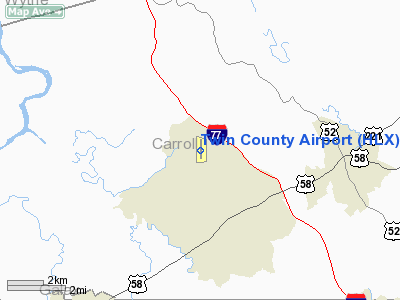
Location & QuickFacts
| FAA Information Effective: | 2008-09-25 |
| Airport Identifier: | HLX |
| Airport Status: | Operational |
| Longitude/Latitude: | 080-49-24.8360W/36-45-58.0130N
-80.823566/36.766115 (Estimated) |
| Elevation: | 2693 ft / 820.83 m (Surveyed) |
| Land: | 140 acres |
| From nearest city: | 7 nautical miles NE of Galax Hillsville, VA |
| Location: | Carroll County, VA |
| Magnetic Variation: | 06W (1995) |
Owner & Manager
| Ownership: | Publicly owned |
| Owner: | Twin County Arpt Comsn |
| Address: | 504 Hangar Rd.
Hillsville, VA 24343-5264 |
| Phone number: | 276-728-4504
FAX 276-728-4544 |
| Manager: | Transition |
| Address: | 504 Hangar Rd.
Hillsville, VA 24343-5264 |
| Phone number: | 276-728-4504
OR 276-236-3412 FAX OR VOICE. |
Airport Operations and Facilities
| Airport Use: | Open to public |
| Wind indicator: | Yes |
| Segmented Circle: | No |
| Control Tower: | No |
| Lighting Schedule: | DUSK-DAWN
MIRL RY 01/19 PRESET LOW INTST; TO INCR INTST & ACTVT REIL RYS 01 & 19 - CTAF. PAPI RYS 01 & 19 OPERATE CONT. |
| Beacon Color: | Clear-Green (lighted land airport) |
| Landing fee charge: | No |
| Sectional chart: | Cincinnati |
| Region: | AEA - Eastern |
| Boundary ARTCC: | ZTL - Atlanta |
| Responsible ARTCC: | ZDC - Washington |
| Tie-in FSS: | DCA - Leesburg |
| FSS on Airport: | No |
| FSS Toll Free: | 1-800-WX-BRIEF |
| NOTAMs Facility: | HLX (NOTAM-d service avaliable) |
| Federal Agreements: | NGY |
Airport Communications
| CTAF: | 122.800 |
| Unicom: | 122.800 |
Airport Services
| Fuel available: | 100LLA
SELF-SVC CREDIT CARD FUEL AVLB 24 HRS |
| Airframe Repair: | MINOR |
| Power Plant Repair: | MAJOR |
| Bottled Oxygen: | NONE |
| Bulk Oxygen: | NONE |
Runway Information
Runway 01/19
| Dimension: | 4204 x 75 ft / 1281.4 x 22.9 m |
| Surface: | ASPH, Good Condition |
| Weight Limit: | Single wheel: 12500 lbs. |
| Edge Lights: | Medium |
| |
Runway 01 |
Runway 19 |
| Longitude: | 080-49-24.2910W | 080-49-25.3820W |
| Latitude: | 36-45-37.2360N | 36-46-18.7900N |
| Elevation: | 2693.00 ft | 2642.00 ft |
| Alignment: | 127 | 127 |
| Traffic Pattern: | Left | Left |
| Markings: | Non-precision instrument, Good Condition | Non-precision instrument, Good Condition |
| Crossing Height: | 21.00 ft | 39.00 ft |
| VASI: | 4-light PAPI on left side | 2-light PAPI on left side |
| Visual Glide Angle: | 3.00° | 3.00° |
| Runway End Identifier: | Yes | Yes |
| Obstruction: | 51 ft trees, 1596.0 ft from runway, 259 ft left of centerline, 27:1 slope to clear | 29 ft pole, 447.0 ft from runway, 268 ft right of centerline, 8:1 slope to clear |
|
Radio Navigation Aids
| ID |
Type |
Name |
Ch |
Freq |
Var |
Dist |
| HLX | NDB | Hillsville | | 269.00 | 06W | 0.2 nm |
| MK | NDB | Suzze | | 335.00 | 06W | 22.2 nm |
| AZW | NDB | Mount Airy | | 223.00 | 07W | 26.9 nm |
| ZEF | NDB | Zephyr | | 326.00 | 05W | 27.7 nm |
| JU | NDB | Ashee | | 410.00 | 07W | 31.3 nm |
| TEC | NDB | Tech | | 368.00 | 06W | 33.4 nm |
| UKF | NDB | Wilki | | 209.00 | 06W | 41.4 nm |
| CNQ | NDB | Callahan | | 379.00 | 05W | 43.7 nm |
| UV | NDB | Bales | | 396.00 | 07W | 45.0 nm |
| PSK | VORTAC | Pulaski | 115X | 116.80 | 06W | 20.0 nm |
| BLF | VORTAC | Bluefield | 037X | 110.00 | 03W | 37.0 nm |
Remarks
- GCO AVBL ON FREQ 135.075 THRU ROA CLEARANCE DELIVERY.
- DEER ON & INVOF ARPT.
Images and information placed above are from
http://www.airport-data.com/airport/HLX/
We thank them for the data!
| General Info
|
| Country |
United States
|
| State |
VIRGINIA
|
| FAA ID |
HLX
|
| Latitude |
36-45-58.013N
|
| Longitude |
080-49-24.836W
|
| Elevation |
2693 feet
|
| Near City |
GALAX HILLSVILLE
|
We don't guarantee the information is fresh and accurate. The data may
be wrong or outdated.
For more up-to-date information please refer to other sources.
|
|


