 |
|
Location & QuickFacts
| FAA Information Effective: | 2008-09-25 |
| Airport Identifier: | 6VA4 |
| Airport Status: | Operational |
| Longitude/Latitude: | 080-04-11.1450W/37-17-05.4840N
-80.069763/37.284857 (Estimated) |
| Elevation: | 1030 ft / 313.94 m (Estimated) |
| Land: | 0 acres |
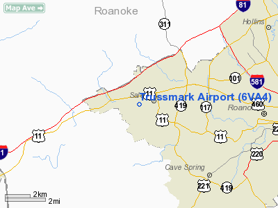
| From nearest city: | 0 nautical miles SW of Salem, VA |
| Location: | Roanoke County, VA |
| Magnetic Variation: | 06W (1985) |
Owner & Manager
| Ownership: | Privately owned |
| Owner: | Timber Truss Housing Sys Inc |
| Address: | 525 Mc Clelland St Po Box 996
Salem, VA 24153 |
| Phone number: | 703-387-0273 |
| Manager: | W. A. James |
| Address: | 8417 Barrens Rd.
Roanoke, VA 24019 |
| Phone number: | 703-387-0273 |
Airport Operations and Facilities
| Airport Use: | Private |
| Wind indicator: | Yes |
| Segmented Circle: | No |
| Control Tower: | No |
| Landing fee charge: | No |
| Sectional chart: | Cincinnati |
| Region: | AEA - Eastern |
| Boundary ARTCC: | ZDC - Washington |
| Tie-in FSS: | DCA - Leesburg |
| FSS on Airport: | No |
| FSS Toll Free: | 1-800-WX-BRIEF |
Runway Information
Runway 12/30
| Dimension: | 1400 x 60 ft / 426.7 x 18.3 m |
| Surface: | TURF, Good Condition |
| |
Runway 12 |
Runway 30 |
| Traffic Pattern: | Left | Left |
| Obstruction: | 60 ft pline, 400.0 ft from runway | 60 ft trees, 400.0 ft from runway |
|
Radio Navigation Aids
| ID |
Type |
Name |
Ch |
Freq |
Var |
Dist |
| CNQ | NDB | Callahan | | 379.00 | 05W | 4.5 nm |
| VIT | NDB | Vinton | | 277.00 | 06W | 10.2 nm |
| TEC | NDB | Tech | | 368.00 | 06W | 16.6 nm |
| LW | NDB | Bushi | | 346.00 | 06W | 35.4 nm |
| LY | NDB | Bojar | | 385.00 | 08W | 39.6 nm |
| UV | NDB | Bales | | 396.00 | 07W | 42.4 nm |
| HLX | NDB | Hillsville | | 269.00 | 06W | 47.9 nm |
| ODR | VOR | Woodrum | | 114.90 | 06W | 4.9 nm |
| LWB | VOR/DME | Greenbrier | 107Y | 116.05 | 08W | 38.0 nm |
| ROA | VORTAC | Roanoke | 031X | 109.40 | 04W | 3.5 nm |
| PSK | VORTAC | Pulaski | 115X | 116.80 | 06W | 33.0 nm |
| LYH | VORTAC | Lynchburg | 029X | 109.20 | 05W | 39.9 nm |
Remarks
- E111: PRVDD OPNS ARE CONDUCTED IN VFR DALGT CONDS. TRAFFIC PATTERN DOES NOT EXCEED 800'.
Images and information placed above are from
http://www.airport-data.com/airport/6VA4/
We thank them for the data!
| General Info
|
| Country |
United States
|
| State |
VIRGINIA
|
| FAA ID |
6VA4
|
| Latitude |
37-17-05.484N
|
| Longitude |
080-04-11.145W
|
| Elevation |
1020 feet
|
| Near City |
SALEM
|
We don't guarantee the information is fresh and accurate. The data may
be wrong or outdated.
For more up-to-date information please refer to other sources.
|
|


