 |
|
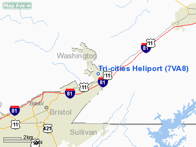
Location & QuickFacts
| FAA Information Effective: | 2008-09-25 |
| Airport Identifier: | 7VA8 |
| Airport Status: | Operational |
| Longitude/Latitude: | 082-06-38.4690W/36-38-45.3900N
-82.110686/36.645942 (Estimated) |
| Elevation: | 1880 ft / 573.02 m (Estimated) |
| Land: | 0 acres |
| From nearest city: | 4 nautical miles NE of Bristol, VA |
| Location: | Washington County, VA |
| Magnetic Variation: | 05W (1985) |
Owner & Manager
| Ownership: | Privately owned |
| Owner: | Simmons-rand Company |
| Address: | 4201 Lee Highway
Bristol, VA 24201 |
| Phone number: | 703-669-9171 |
| Manager: | J R Allison |
| Address: | Rt 3 Box 70
Cedar Bluff, VA 24609 |
| Phone number: | 703-963-0841 |
Airport Operations and Facilities
| Airport Use: | Private |
| Wind indicator: | Yes |
| Segmented Circle: | No |
| Control Tower: | No |
| Landing fee charge: | No |
| Sectional chart: | Cincinnati |
| Region: | AEA - Eastern |
| Boundary ARTCC: | ZTL - Atlanta |
| Tie-in FSS: | DCA - Leesburg |
| FSS on Airport: | No |
| FSS Toll Free: | 1-800-WX-BRIEF |
Runway Information
Helipad H1
| Dimension: | 45 x 45 ft / 13.7 x 13.7 m |
| Surface: | CONC, |
| |
Runway H1 |
Runway |
| Traffic Pattern: | Left | Left |
|
Radio Navigation Aids
| ID |
Type |
Name |
Ch |
Freq |
Var |
Dist |
| VJ | NDB | Whine | | 236.00 | 05W | 9.4 nm |
| JJO | NDB | Mountain City | | 396.00 | 04W | 19.5 nm |
| EZT | NDB | Elizabethton | | 275.00 | 02W | 21.3 nm |
| BO | NDB | Booie | | 221.00 | 04W | 23.8 nm |
| BAR | NDB | Hemlock | | 320.00 | 02W | 31.6 nm |
| RVN | NDB | Rogersville | | 329.00 | 04W | 39.1 nm |
| JU | NDB | Ashee | | 410.00 | 07W | 40.2 nm |
| MK | NDB | Suzze | | 335.00 | 06W | 44.9 nm |
| LQV | NDB | Long Hollow | | 252.00 | 03W | 46.6 nm |
| DYQ | NDB | Dulaney | | 263.00 | 04W | 48.6 nm |
| GZG | VOR/DME | Glade Spring | 039X | 110.20 | 02W | 10.9 nm |
| HMV | VORTAC | Holston Mountain | 093X | 114.60 | 04W | 12.6 nm |
Images and information placed above are from
http://www.airport-data.com/airport/7VA8/
We thank them for the data!
| General Info
|
| Country |
United States
|
| State |
VIRGINIA
|
| FAA ID |
7VA8
|
| Latitude |
36-38-45.390N
|
| Longitude |
082-06-38.469W
|
| Elevation |
1880 feet
|
| Near City |
BRISTOL
|
We don't guarantee the information is fresh and accurate. The data may
be wrong or outdated.
For more up-to-date information please refer to other sources.
|
|


