 |
|
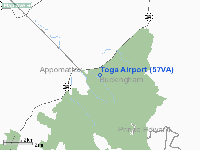
Location & QuickFacts
| FAA Information Effective: | 2008-09-25 |
| Airport Identifier: | 57VA |
| Airport Status: | Operational |
| Longitude/Latitude: | 078-40-43.0310W/37-27-03.5220N
-78.678620/37.450978 (Estimated) |
| Elevation: | 725 ft / 220.98 m (Estimated) |
| Land: | 10 acres |
| From nearest city: | 9 nautical miles SW of Buckingham Courthouse, VA |
| Location: | Buckingham County, VA |
| Magnetic Variation: | 07W (1980) |
Owner & Manager
| Ownership: | Privately owned |
| Owner: | George T. Hoag |
| Address: | Route 3, Box 119c
Dillwyn, VA 23936 |
| Phone number: | 804-969-4477 |
| Manager: | George T. Hoag |
| Address: | Route 3, Box 119c
Dillwyn, VA 23936 |
| Phone number: | 804-969-4477 |
Airport Operations and Facilities
| Airport Use: | Private |
| Wind indicator: | Yes |
| Segmented Circle: | No |
| Control Tower: | No |
| Landing fee charge: | No |
| Sectional chart: | Washington |
| Region: | AEA - Eastern |
| Boundary ARTCC: | ZDC - Washington |
| Tie-in FSS: | DCA - Leesburg |
| FSS Toll Free: | 1-800-WX-BRIEF |
| NOTAMs Facility: | DCA |
Runway Information
Runway 16/34
| Dimension: | 2400 x 50 ft / 731.5 x 15.2 m |
| Surface: | TURF, |
| |
Runway 16 |
Runway 34 |
| Traffic Pattern: | Left | Left |
|
Radio Navigation Aids
| ID |
Type |
Name |
Ch |
Freq |
Var |
Dist |
| FVX | NDB | Farmville | | 367.00 | 07W | 12.9 nm |
| LY | NDB | Bojar | | 385.00 | 08W | 29.3 nm |
| AZS | NDB | Azalea Park | | 336.00 | 08W | 34.5 nm |
| BKT | NDB | Blackstone | | 326.00 | 09W | 36.0 nm |
| MOL | VOR/DME | Montebello | 100X | 115.30 | 05W | 33.8 nm |
| LYH | VORTAC | Lynchburg | 029X | 109.20 | 05W | 29.1 nm |
| FAK | VORTAC | Flat Rock | 080X | 113.30 | 06W | 40.8 nm |
| GVE | VORTAC | Gordonsville | 103X | 115.60 | 06W | 42.0 nm |
| SBV | VORTAC | South Boston | 041X | 110.40 | 05W | 49.3 nm |
Remarks
- PROVIDED TREES ARE REMOVED/LOWERED TO PROVIDE 20:1 APCH SURFACE.
Images and information placed above are from
http://www.airport-data.com/airport/57VA/
We thank them for the data!
| General Info
|
| Country |
United States
|
| State |
VIRGINIA
|
| FAA ID |
57VA
|
| Latitude |
37-27-03.522N
|
| Longitude |
078-40-43.031W
|
| Elevation |
725 feet
|
| Near City |
BUCKINGHAM COURTHOUSE
|
We don't guarantee the information is fresh and accurate. The data may
be wrong or outdated.
For more up-to-date information please refer to other sources.
|
|


