 |
|
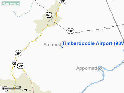
Location & QuickFacts
| FAA Information Effective: | 2008-09-25 |
| Airport Identifier: | 93VA |
| Airport Status: | Operational |
| Longitude/Latitude: | 079-01-24.0830W/37-32-10.5120N
-79.023356/37.536253 (Estimated) |
| Elevation: | 810 ft / 246.89 m (Estimated) |
| Land: | 3 acres |
| From nearest city: | 3 nautical miles SE of Amherst, VA |
| Location: | Amherst County, VA |
| Magnetic Variation: | 08W (1990) |
Owner & Manager
| Ownership: | Privately owned |
| Owner: | C T Holt |
| Address: | Rt 2 Box 353
Amherst, VA 24521 |
| Phone number: | 804-946-5935 |
| Manager: | K D Scott |
| Address: | Rt 2 Box 354a
Amherst, VA 24521 |
| Phone number: | 804-946-2673 |
Airport Operations and Facilities
| Airport Use: | Private |
| Wind indicator: | Yes |
| Segmented Circle: | No |
| Control Tower: | No |
| Sectional chart: | Cincinnati |
| Region: | AEA - Eastern |
| Boundary ARTCC: | ZDC - Washington |
| Tie-in FSS: | DCA - Leesburg |
| FSS on Airport: | No |
| FSS Toll Free: | 1-800-WX-BRIEF |
Runway Information
Runway 04/22
| Dimension: | 1400 x 75 ft / 426.7 x 22.9 m |
| Surface: | TURF, |
| |
Runway 04 |
Runway 22 |
| Traffic Pattern: | Left | Left |
| Obstruction: | | 35 ft trees, 100.0 ft from runway |
|
Radio Navigation Aids
| ID |
Type |
Name |
Ch |
Freq |
Var |
Dist |
| LY | NDB | Bojar | | 385.00 | 08W | 19.5 nm |
| FVX | NDB | Farmville | | 367.00 | 07W | 30.0 nm |
| AZS | NDB | Azalea Park | | 336.00 | 08W | 37.3 nm |
| VIT | NDB | Vinton | | 277.00 | 06W | 45.6 nm |
| VBW | NDB | Bridgewater | | 241.00 | 07W | 49.9 nm |
| ODR | VOR | Woodrum | | 114.90 | 06W | 47.4 nm |
| MOL | VOR/DME | Montebello | 100X | 115.30 | 05W | 22.3 nm |
| LYH | VORTAC | Lynchburg | 029X | 109.20 | 05W | 19.8 nm |
Remarks
- VFR DAYLIGHT USE ONLY; TAKEOFFS DOWNHILL & LANDINGS UPHILL; OBTAIN BRIEFING OF MILTARY OPERATIONS IN THE AREA.
Images and information placed above are from
http://www.airport-data.com/airport/93VA/
We thank them for the data!
| General Info
|
| Country |
United States
|
| State |
VIRGINIA
|
| FAA ID |
93VA
|
| Latitude |
37-32-10.512N
|
| Longitude |
079-01-24.083W
|
| Elevation |
810 feet
|
| Near City |
AMHERST
|
We don't guarantee the information is fresh and accurate. The data may
be wrong or outdated.
For more up-to-date information please refer to other sources.
|
|


