 |
|
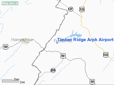
Timber Ridge Arpk Airport |
Location & QuickFacts
| FAA Information Effective: | 2008-09-25 |
| Airport Identifier: | VA46 |
| Airport Status: | Operational |
| Longitude/Latitude: | 078-21-44.0210W/39-17-46.3640N
-78.362228/39.296212 (Estimated) |
| Elevation: | 1024 ft / 312.12 m (Surveyed) |
| Land: | 0 acres |
| From nearest city: | 3 nautical miles NW of Gore, VA |
| Location: | Frederick County, VA |
| Magnetic Variation: | 08W (1985) |
Owner & Manager
| Ownership: | Privately owned |
| Owner: | Briarwood Enterprises, Inc. |
| Address: | Westwood Circle Rt 1 Box 64
Winchester, VA 22601 |
| Phone number: | 703-858-3411 |
| Manager: | C. Eugene Bayliss |
| Address: | Timber Ridge, Box 186, Hc61
Gore, VA 22637 |
| Phone number: | 703-858-3411 |
Airport Operations and Facilities
| Airport Use: | Private |
| Wind indicator: | Yes |
| Segmented Circle: | No |
| Control Tower: | No |
| Landing fee charge: | No |
| Sectional chart: | Washington |
| Region: | AEA - Eastern |
| Boundary ARTCC: | ZDC - Washington |
| Tie-in FSS: | DCA - Leesburg |
| FSS on Airport: | No |
| FSS Toll Free: | 1-800-WX-BRIEF |
Airport Services
| Airframe Repair: | NONE |
| Power Plant Repair: | NONE |
Runway Information
Runway 09/27
| Dimension: | 2700 x 80 ft / 823.0 x 24.4 m |
| Surface: | GRAVEL,
RWY SFC IS COMPACTED SHALE. |
| |
Runway 09 |
Runway 27 |
| Traffic Pattern: | Left | Left |
|
Radio Navigation Aids
| ID |
Type |
Name |
Ch |
Freq |
Var |
Dist |
| TZ | NDB | Cogan | | 364.00 | 10W | 18.6 nm |
| CBE | NDB | Cumberland | | 317.00 | 07W | 27.7 nm |
| GDX | NDB | Goodwin Lake | | 227.00 | 08W | 32.2 nm |
| LUA | NDB | Caverns | | 245.00 | 09W | 36.2 nm |
| HGR | VOR | Hagerstown | | 109.80 | 07W | 33.7 nm |
| FDK | VOR | Frederick | | 109.00 | 08W | 46.4 nm |
| ESL | VOR/DME | Kessel | 045X | 110.80 | 06W | 29.5 nm |
| GRV | VOR/DME | Grantsville | 070X | 112.30 | 06W | 37.9 nm |
| MRB | VORTAC | Martinsburg | 058X | 112.10 | 07W | 24.5 nm |
| LDN | VORTAC | Linden | 090X | 114.30 | 06W | 27.5 nm |
| THS | VORTAC | St Thomas | 097X | 115.00 | 07W | 42.8 nm |
| CSN | VORTAC | Casanova | 110X | 116.30 | 06W | 45.7 nm |
| AML | VORTAC | Armel | 082X | 113.50 | 08W | 47.1 nm |
Images and information placed above are from
http://www.airport-data.com/airport/VA46/
We thank them for the data!
| General Info
|
| Country |
United States
|
| State |
VIRGINIA
|
| FAA ID |
VA46
|
| Latitude |
39-17-46.364N
|
| Longitude |
078-21-44.021W
|
| Elevation |
1024 feet
|
| Near City |
GORE
|
We don't guarantee the information is fresh and accurate. The data may
be wrong or outdated.
For more up-to-date information please refer to other sources.
|
|


