 |
|
Location & QuickFacts
| FAA Information Effective: | 2008-09-25 |
| Airport Identifier: | 02VA |
| Airport Status: | Operational |
| Longitude/Latitude: | 077-51-25.9790W/38-26-08.4580N
-77.857216/38.435683 (Estimated) |
| Elevation: | 320 ft / 97.54 m (Estimated) |
| Land: | 80 acres |
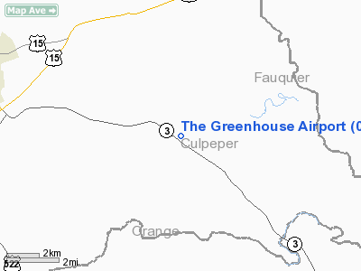
| From nearest city: | 7 nautical miles SE of Culpeper, VA |
| Location: | Culpeper County, VA |
| Magnetic Variation: | 09W (1985) |
Owner & Manager
| Ownership: | Privately owned |
| Owner: | Joe Van Wingerden |
| Address: | 21513 Germanna Hwy
Stevensburg, VA 22741 |
| Phone number: | 703-399-1919 |
| Manager: | Joe Van Wingerden |
| Address: | 21513 Germanna Hwy
Stevensburg, VA 22741 |
| Phone number: | 703-399-1919 |
Airport Operations and Facilities
| Airport Use: | Private |
| Wind indicator: | No |
| Segmented Circle: | No |
| Control Tower: | No |
| Lighting Schedule: | NONE |
| Landing fee charge: | No |
| Sectional chart: | Washington |
| Region: | AEA - Eastern |
| Boundary ARTCC: | ZDC - Washington |
| Tie-in FSS: | DCA - Leesburg |
| FSS on Airport: | No |
| FSS Toll Free: | 1-800-WX-BRIEF |
Runway Information
Runway 18/36
| Dimension: | 3000 x 80 ft / 914.4 x 24.4 m |
| Surface: | TURF, |
| |
Runway 18 |
Runway 36 |
| Traffic Pattern: | Left | Left |
| Displaced threshold: | 0.00 ft | 500.00 ft |
|
Radio Navigation Aids
| ID |
Type |
Name |
Ch |
Freq |
Var |
Dist |
| MSQ | NDB | Nailr | | 351.00 | 10W | 2.5 nm |
| CJR | NDB | Culpeper | | 252.00 | 09W | 5.7 nm |
| EZF | NDB | Shannon | | 237.00 | 10W | 21.7 nm |
| IQK | NDB | Louisa | | 382.00 | 09W | 25.0 nm |
| GDX | NDB | Goodwin Lake | | 227.00 | 08W | 31.2 nm |
| APH | NDB | A P Hill | | 396.00 | 10W | 32.7 nm |
| LUA | NDB | Caverns | | 245.00 | 09W | 32.9 nm |
| AZS | NDB | Azalea Park | | 336.00 | 08W | 40.3 nm |
| TZ | NDB | Cogan | | 364.00 | 10W | 40.4 nm |
| LJK | NDB | Ashey | | 280.00 | 09W | 43.6 nm |
| DC | NDB | Oxonn | | 332.00 | 11W | 43.8 nm |
| GTN | NDB | Georgetown | | 323.00 | 09W | 45.4 nm |
| VKX | NDB | Potomac | | 241.00 | 10W | 46.3 nm |
| DCA | VOR/DME | Washington | 047X | 111.00 | 09W | 46.2 nm |
| CSN | VORTAC | Casanova | 110X | 116.30 | 06W | 12.4 nm |
| BRV | VORTAC | Brooke | 092X | 114.50 | 09W | 24.5 nm |
| GVE | VORTAC | Gordonsville | 103X | 115.60 | 06W | 29.0 nm |
| LDN | VORTAC | Linden | 090X | 114.30 | 06W | 30.0 nm |
| AML | VORTAC | Armel | 082X | 113.50 | 08W | 35.1 nm |
| DCA | VOT | Washington National | | 109.40 | | 45.8 nm |
Remarks
- PROVIDED PLINE IS MKD & A CLEARLY MKD DSPLCD THR IS MAINTAINED ON THE SOUTH END OF RWY.
Images and information placed above are from
http://www.airport-data.com/airport/02VA/
We thank them for the data!
| General Info
|
| Country |
United States
|
| State |
VIRGINIA
|
| FAA ID |
02VA
|
| Latitude |
38-26-08.458N
|
| Longitude |
077-51-25.979W
|
| Elevation |
320 feet
|
| Near City |
CULPEPER
|
We don't guarantee the information is fresh and accurate. The data may
be wrong or outdated.
For more up-to-date information please refer to other sources.
|
|


