 |
|
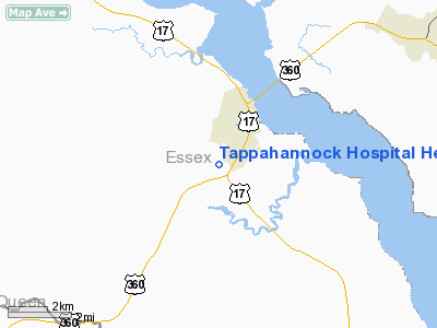
Tappahannock Hospital Heliport |
Location & QuickFacts
| FAA Information Effective: | 2008-09-25 |
| Airport Identifier: | VG49 |
| Airport Status: | Operational |
| Longitude/Latitude: | 076-52-37.0000W/37-54-04.0000N
-76.876944/37.901111 (Estimated) |
| Elevation: | 42 ft / 12.80 m (Estimated) |
| Land: | 42 acres |
| From nearest city: | 2 nautical miles S of Tappahannock, VA |
| Location: | Essex County, VA |
| Magnetic Variation: | 11W (2000) |
Owner & Manager
| Ownership: | Privately owned |
| Owner: | Riverside Tappahannock Hospital |
| Address: | 618 Hospital Rd
Tapahannock, VA 22560 |
| Phone number: | 804-443-3311 |
| Manager: | Elizabeth Martin |
| Address: | 486 Hospital Rd
Tapahannock, VA 22560 |
| Phone number: | 804-443-3311 |
Airport Operations and Facilities
| Airport Use: | Private
MEDICAL USE. |
| Wind indicator: | Yes |
| Segmented Circle: | No |
| Control Tower: | No |
| Lighting Schedule: | PHONE REQ
FOR PERIMETER LGTS CALL 804-443-3311. |
| Sectional chart: | Washington |
| Region: | AEA - Eastern |
| Boundary ARTCC: | ZDC - Washington |
| Tie-in FSS: | DCA - Leesburg |
| FSS Toll Free: | 1-800-WX-BRIEF |
Runway Information
Helipad H1
| Dimension: | 40 x 40 ft / 12.2 x 12.2 m |
| Surface: | CONC, |
| |
Runway H1 |
Runway |
| Traffic Pattern: | Left | Left |
|
Radio Navigation Aids
| ID |
Type |
Name |
Ch |
Freq |
Var |
Dist |
| APH | NDB | A P Hill | | 396.00 | 10W | 24.0 nm |
| LJK | NDB | Ashey | | 280.00 | 09W | 29.6 nm |
| NHK | NDB | Patuxent | | 400.00 | 10W | 32.2 nm |
| EZF | NDB | Shannon | | 237.00 | 10W | 34.9 nm |
| CF | NDB | Pubbs | | 392.00 | 09W | 43.8 nm |
| IQK | NDB | Louisa | | 382.00 | 09W | 47.1 nm |
| FAF | NDB | Felker | | 226.00 | 08W | 47.5 nm |
| PJS | NDB | Henry | | 375.00 | 09W | 49.7 nm |
| HCM | VORTAC | Harcum | 025X | 108.80 | 07W | 28.3 nm |
| RIC | VORTAC | Richmond | 088X | 114.10 | 09W | 31.9 nm |
| PXT | VORTAC | Patuxent | 123X | 117.60 | 10W | 32.4 nm |
| BRV | VORTAC | Brooke | 092X | 114.50 | 09W | 34.5 nm |
| HPW | VORTAC | Hopewell | 057X | 112.00 | 06W | 36.2 nm |
| OTT | VORTAC | Nottingham | 084X | 113.70 | 10W | 48.8 nm |
Remarks
- SEE AIRSPACE LTR FOR CONDITIONS.
Images and information placed above are from
http://www.airport-data.com/airport/VG49/
We thank them for the data!
| General Info
|
| Country |
United States
|
| State |
VIRGINIA
|
| FAA ID |
VG49
|
| Latitude |
37-54-04.000N
|
| Longitude |
076-52-37.000W
|
| Elevation |
42 feet
|
| Near City |
TAPPAHANNOCK
|
We don't guarantee the information is fresh and accurate. The data may
be wrong or outdated.
For more up-to-date information please refer to other sources.
|
|


