 |
|
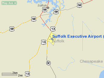
Suffolk Executive Airport |
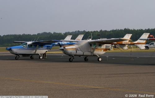 |
(Click on the photo to enlarge) |
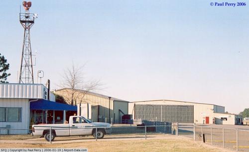 |
(Click on the photo to enlarge) |
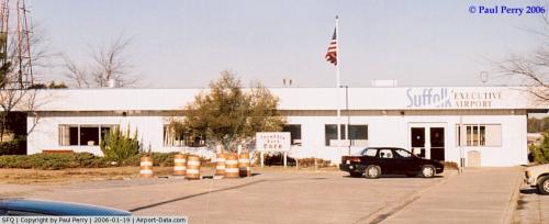 |
(Click on the photo to enlarge) |
Location & QuickFacts
| FAA Information Effective: | 2008-09-25 |
| Airport Identifier: | SFQ |
| Airport Status: | Operational |
| Longitude/Latitude: | 076-36-06.7440W/36-40-56.4730N
-76.601873/36.682354 (Estimated) |
| Elevation: | 72 ft / 21.95 m (Estimated) |
| Land: | 655 acres |
| From nearest city: | 3 nautical miles SW of Suffolk, VA |
| Location: | Suffolk County, VA |
| Magnetic Variation: | 10W (1995) |
Owner & Manager
| Ownership: | Publicly owned |
| Owner: | City Of Suffolk |
| Address: | Po Box 1858
Suffolk, VA 23434 |
| Phone number: | 757-514-4000 |
| Manager: | Kent Marshall |
| Address: | 1200 Gene Bolton Drive
Suffolk, VA 23434 |
| Phone number: | 757-514-4411 |
Airport Operations and Facilities
| Airport Use: | Open to public |
| Wind indicator: | Yes |
| Segmented Circle: | Yes |
| Control Tower: | No |
| Lighting Schedule: | DUSK-DAWN
ACTVT MIRL RY 07/25, HIRL RY 04/22, PAPI RYS 04 & 22, & REIL RYS 04 & 22 - CTAF. |
| Beacon Color: | Clear-Green (lighted land airport) |
| Landing fee charge: | No |
| Sectional chart: | Washington |
| Region: | AEA - Eastern |
| Boundary ARTCC: | ZDC - Washington |
| Tie-in FSS: | DCA - Leesburg |
| FSS on Airport: | No |
| FSS Toll Free: | 1-800-WX-BRIEF |
| NOTAMs Facility: | SFQ (NOTAM-d service avaliable) |
| Federal Agreements: | NGYP3 |
Airport Communications
| CTAF: | 122.700 |
| Unicom: | 122.700 |
Airport Services
| Fuel available: | 100LLA MOGAS |
| Airframe Repair: | MINOR |
| Power Plant Repair: | MINOR |
| Bottled Oxygen: | NONE |
| Bulk Oxygen: | NONE |
Runway Information
Runway 04/22
| Dimension: | 5007 x 100 ft / 1526.1 x 30.5 m |
| Surface: | ASPH, Good Condition |
| Weight Limit: | Single wheel: 30000 lbs.
Dual wheel: 60000 lbs.
Dual tandem wheel: 60000 lbs. |
| Edge Lights: | High |
| |
Runway 04 |
Runway 22 |
| Longitude: | 076-36-11.8260W | 076-35-41.7990W |
| Latitude: | 36-40-28.5420N | 36-41-11.7410N |
| Elevation: | 67.00 ft | 69.00 ft |
| Alignment: | 29 | 127 |
| ILS Type: | LOCALIZER
| |
| Traffic Pattern: | Right | Left |
| Markings: | Non-precision instrument, Good Condition | Non-precision instrument, Good Condition |
| Crossing Height: | 38.00 ft | 40.00 ft |
| VASI: | 4-light PAPI on left side | 4-light PAPI on left side |
| Visual Glide Angle: | 3.00° | 3.00° |
| Runway End Identifier: | Yes | Yes |
| Obstruction: | 49 ft trees, 1953.0 ft from runway, 14 ft left of centerline, 35:1 slope to clear | 52 ft trees, 1269.0 ft from runway, 80 ft left of centerline, 20:1 slope to clear |
|
Runway 07/25
| Dimension: | 4700 x 100 ft / 1432.6 x 30.5 m |
| Surface: | ASPH, Fair Condition |
| Weight Limit: | Single wheel: 30000 lbs.
Dual wheel: 50000 lbs.
Dual tandem wheel: 85000 lbs. |
| Edge Lights: | Medium |
| |
Runway 07 |
Runway 25 |
| Longitude: | 076-36-36.8410W | 076-35-45.1280W |
| Latitude: | 36-40-49.7780N | 36-41-10.3940N |
| Elevation: | 72.00 ft | 69.00 ft |
| Alignment: | 64 | 127 |
| Traffic Pattern: | Left | Right |
| Markings: | Non-precision instrument, Good Condition
MARKINGS BADLY FADED | Basic, Good Condition
MARKINGS BADLY FADED |
| Displaced threshold: | 950.00 ft | 300.00 ft |
| VASI: | system of panels on left side that may or may not be lighted | system of panels on right side that may or may not be lighted |
| Obstruction: | 86 ft tree, 1968.0 ft from runway, 379 ft left of centerline, 20:1 slope to clear
APCH SLOPE 20:1 TO DSPLCD THLD. | 26 ft trees, 633.0 ft from runway, 218 ft left of centerline, 16:1 slope to clear
APCH RATIO 16:1 TO DSPLCD THLD. |
|
Radio Navigation Aids
| ID |
Type |
Name |
Ch |
Freq |
Var |
Dist |
| RK | NDB | Waley | | 249.00 | 10W | 5.5 nm |
| PVG | NDB | Portsmouth | | 241.00 | 10W | 9.6 nm |
| EY | NDB | Chesi | | 233.00 | 09W | 11.7 nm |
| AKQ | NDB | Wakefield | | 274.00 | 09W | 26.4 nm |
| FAF | NDB | Felker | | 226.00 | 08W | 27.4 nm |
| PJS | NDB | Henry | | 375.00 | 09W | 27.6 nm |
| LLW | NDB | Woodville | | 254.00 | 10W | 29.2 nm |
| ASJ | NDB | Ahoskie | | 415.00 | 10W | 36.0 nm |
| EDE | NDB | Edenton | | 265.00 | 10W | 39.5 nm |
| ELQ | NDB | Emporia | | 261.00 | 10W | 39.9 nm |
| NGU | TACAN | Chambers | 048X | | 10W | 22.0 nm |
| LFI | TACAN | Langley | 070X | | 10W | 26.9 nm |
| NTU | TACAN | Oceana | 113X | | 10W | 28.5 nm |
| ECG | VOR/DME | Elizabeth City | 072X | 112.50 | 07W | 32.8 nm |
| FKN | VORTAC | Franklin | 043X | 110.60 | 09W | 19.9 nm |
| CVI | VORTAC | Cofield | 093X | 114.60 | 09W | 22.7 nm |
| ORF | VORTAC | Norfolk | 116X | 116.90 | 07W | 23.1 nm |
| HPW | VORTAC | Hopewell | 057X | 112.00 | 06W | 46.0 nm |
| HCM | VORTAC | Harcum | 025X | 108.80 | 07W | 46.4 nm |
| CCV | VORTAC | Cape Charles | 059X | 112.20 | 10W | 49.4 nm |
Remarks
- DEER ON & INVOF ARPT.
- GCO AVBL ON FREQ 135.075 THRU ORF CLEARANCE DELIVERY.
- IN OPERATION PRIOR 1959
Images and information placed above are from
http://www.airport-data.com/airport/SFQ/
We thank them for the data!
| General Info
|
| Country |
United States
|
| State |
VIRGINIA
|
| FAA ID |
SFQ
|
| Latitude |
36-40-56.473N
|
| Longitude |
076-36-06.744W
|
| Elevation |
72 feet
|
| Near City |
SUFFOLK
|
We don't guarantee the information is fresh and accurate. The data may
be wrong or outdated.
For more up-to-date information please refer to other sources.
|
|


