 |
|
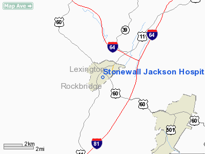
Stonewall Jackson Hospital Heliport |
Location & QuickFacts
| FAA Information Effective: | 2008-09-25 |
| Airport Identifier: | 8VA7 |
| Airport Status: | Operational |
| Longitude/Latitude: | 079-26-32.1360W/37-46-42.4750N
-79.442260/37.778465 (Estimated) |
| Elevation: | 1200 ft / 365.76 m (Estimated) |
| Land: | 0 acres |
| From nearest city: | 0 nautical miles N of Lexington, VA |
| Location: | Rockbridge County, VA |
| Magnetic Variation: | 07W (1990) |
Owner & Manager
| Ownership: | Privately owned |
| Owner: | Stonewall Jackson Hospital |
| Address: |
Lexington, VA 24450-2492 |
| Phone number: | 703-463-1449 |
| Manager: | L.e. Richardson |
| Address: |
Lexington, VA 24450-2492 |
| Phone number: | 703-463-1449 |
Airport Operations and Facilities
| Airport Use: | Private
MEDICAL USE. |
| Segmented Circle: | No |
| Control Tower: | No |
| Sectional chart: | Cincinnati |
| Region: | AEA - Eastern |
| Boundary ARTCC: | ZDC - Washington |
| Tie-in FSS: | DCA - Leesburg |
| FSS Toll Free: | 1-800-WX-BRIEF |
Runway Information
Helipad H1
| Dimension: | 30 x 30 ft / 9.1 x 9.1 m |
| Surface: | TURF, |
| |
Runway H1 |
Runway |
| Traffic Pattern: | Left | Left |
|
Radio Navigation Aids
| ID |
Type |
Name |
Ch |
Freq |
Var |
Dist |
| LY | NDB | Bojar | | 385.00 | 08W | 32.4 nm |
| VIT | NDB | Vinton | | 277.00 | 06W | 40.4 nm |
| VBW | NDB | Bridgewater | | 241.00 | 07W | 42.0 nm |
| AZS | NDB | Azalea Park | | 336.00 | 08W | 46.0 nm |
| CNQ | NDB | Callahan | | 379.00 | 05W | 46.2 nm |
| LW | NDB | Bushi | | 346.00 | 06W | 48.8 nm |
| ODR | VOR | Woodrum | | 114.90 | 06W | 37.4 nm |
| MOL | VOR/DME | Montebello | 100X | 115.30 | 05W | 17.5 nm |
| LWB | VOR/DME | Greenbrier | 107Y | 116.05 | 08W | 45.4 nm |
| LYH | VORTAC | Lynchburg | 029X | 109.20 | 05W | 33.0 nm |
| ROA | VORTAC | Roanoke | 031X | 109.40 | 04W | 39.7 nm |
Images and information placed above are from
http://www.airport-data.com/airport/8VA7/
We thank them for the data!
| General Info
|
| Country |
United States
|
| State |
VIRGINIA
|
| FAA ID |
8VA7
|
| Latitude |
37-46-42.475N
|
| Longitude |
079-26-32.136W
|
| Elevation |
1200 feet
|
| Near City |
LEXINGTON
|
We don't guarantee the information is fresh and accurate. The data may
be wrong or outdated.
For more up-to-date information please refer to other sources.
|
|


