 |
|
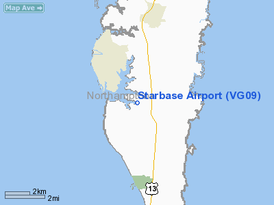
Location & QuickFacts
| FAA Information Effective: | 2008-09-25 |
| Airport Identifier: | VG09 |
| Airport Status: | Operational |
| Longitude/Latitude: | 075-59-00.0000W/37-13-40.0000N
-75.983333/37.227778 (Estimated) |
| Elevation: | 20 ft / 6.10 m (Estimated) |
| Land: | 380 acres |
| From nearest city: | 4 nautical miles SE of Cape Charles, VA |
| Location: | Northampton County, VA |
| Magnetic Variation: | 10W (1995) |
Owner & Manager
| Ownership: | Privately owned |
| Owner: | Bayview Corp |
| Address: | 660 Newtown-yardley Rd 204
Newtown, PA 18940 |
| Phone number: | 215-968-1629 |
| Manager: | Robt L Starer |
| Address: | 4939 Dalby's La
Cape Charles, VA 23310 |
| Phone number: | 757-331-1333 |
Airport Operations and Facilities
| Airport Use: | Private |
| Wind indicator: | Yes |
| Segmented Circle: | No |
| Control Tower: | No |
| Lighting Schedule: | RDO-CTL
ACTVT LIRL RY 09/27 - 122.9. |
| Sectional chart: | Washington |
| Region: | AEA - Eastern |
| Boundary ARTCC: | ZDC - Washington |
| Tie-in FSS: | DCA - Leesburg |
| FSS on Airport: | No |
| FSS Toll Free: | 1-800-WX-BRIEF |
Runway Information
Runway 09/27
| Dimension: | 5000 x 80 ft / 1524.0 x 24.4 m |
| Surface: | TURF, Good Condition |
| Edge Lights: | Low |
| |
Runway 09 |
Runway 27 |
| Traffic Pattern: | Left | Right |
| Displaced threshold: | 0.00 ft | 1000.00 ft |
| Obstruction: | 30 ft plines, 500.0 ft from runway | 30 ft trees, 500.0 ft from runway |
|
Radio Navigation Aids
| ID |
Type |
Name |
Ch |
Freq |
Var |
Dist |
| BDB | NDB | Accomack | | 336.00 | 11W | 22.4 nm |
| PJS | NDB | Henry | | 375.00 | 09W | 25.1 nm |
| FAF | NDB | Felker | | 226.00 | 08W | 30.9 nm |
| PVG | NDB | Portsmouth | | 241.00 | 10W | 34.9 nm |
| EY | NDB | Chesi | | 233.00 | 09W | 42.3 nm |
| RK | NDB | Waley | | 249.00 | 10W | 49.5 nm |
| LFI | TACAN | Langley | 070X | | 10W | 19.9 nm |
| NGU | TACAN | Chambers | 048X | | 10W | 22.3 nm |
| NTU | TACAN | Oceana | 113X | | 10W | 24.4 nm |
| CCV | VORTAC | Cape Charles | 059X | 112.20 | 10W | 7.2 nm |
| ORF | VORTAC | Norfolk | 116X | 116.90 | 07W | 22.7 nm |
| HCM | VORTAC | Harcum | 025X | 108.80 | 07W | 37.2 nm |
Remarks
- VFR ONLY; 20:1 APCH RATIO OVER OBSTN; LETTER OF AGREEMENT WITH PAGE SCOTT'S ARPT.
Images and information placed above are from
http://www.airport-data.com/airport/VG09/
We thank them for the data!
| General Info
|
| Country |
United States
|
| State |
VIRGINIA
|
| FAA ID |
VG09
|
| Latitude |
37-13-40.000N
|
| Longitude |
075-59-00.000W
|
| Elevation |
20 feet
|
| Near City |
CAPE CHARLES
|
We don't guarantee the information is fresh and accurate. The data may
be wrong or outdated.
For more up-to-date information please refer to other sources.
|
|


