 |
|
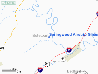
Springwood Airstrip Gliderport Airport |
Location & QuickFacts
| FAA Information Effective: | 2008-09-25 |
| Airport Identifier: | 08VA |
| Airport Status: | Operational |
| Longitude/Latitude: | 079-44-59.1480W/37-33-14.4790N
-79.749763/37.554022 (Estimated) |
| Elevation: | 1000 ft / 304.80 m (Estimated) |
| Land: | 2 acres |
| From nearest city: | 5 nautical miles NW of Buchanan, VA |
| Location: | Botetourt County, VA |
| Magnetic Variation: | 07W (1985) |
Owner & Manager
| Ownership: | Privately owned |
| Owner: | William Sanford Stewart |
| Address: | Route 2, Box 90q
Buchanan, VA 24066 |
| Phone number: | 703-473-3545 |
| Manager: | William Sanford Stewart |
| Address: | Route 2, Box 90q
Buchanan, VA 24066 |
| Phone number: | 703-473-3545 |
Airport Operations and Facilities
| Airport Use: | Private |
| Wind indicator: | Yes |
| Segmented Circle: | No |
| Control Tower: | No |
| Landing fee charge: | No |
| Sectional chart: | Cincinnati |
| Region: | AEA - Eastern |
| Boundary ARTCC: | ZDC - Washington |
| Tie-in FSS: | DCA - Leesburg |
| FSS on Airport: | No |
| FSS Toll Free: | 1-800-WX-BRIEF |
Runway Information
Runway 09/27
| Dimension: | 1500 x 50 ft / 457.2 x 15.2 m |
| Surface: | TURF, |
| |
Runway 09 |
Runway 27 |
| Traffic Pattern: | Left | Left |
|
Radio Navigation Aids
| ID |
Type |
Name |
Ch |
Freq |
Var |
Dist |
| VIT | NDB | Vinton | | 277.00 | 06W | 22.0 nm |
| CNQ | NDB | Callahan | | 379.00 | 05W | 26.3 nm |
| LY | NDB | Bojar | | 385.00 | 08W | 29.9 nm |
| LW | NDB | Bushi | | 346.00 | 06W | 36.8 nm |
| TEC | NDB | Tech | | 368.00 | 06W | 37.5 nm |
| ODR | VOR | Woodrum | | 114.90 | 06W | 17.6 nm |
| LWB | VOR/DME | Greenbrier | 107Y | 116.05 | 08W | 35.8 nm |
| MOL | VOR/DME | Montebello | 100X | 115.30 | 05W | 37.0 nm |
| ROA | VORTAC | Roanoke | 031X | 109.40 | 04W | 19.9 nm |
| LYH | VORTAC | Lynchburg | 029X | 109.20 | 05W | 30.4 nm |
Remarks
- AIRSPACE DETERMINATION PENDING.
Images and information placed above are from
http://www.airport-data.com/airport/08VA/
We thank them for the data!
| General Info
|
| Country |
United States
|
| State |
VIRGINIA
|
| FAA ID |
08VA
|
| Latitude |
37-33-14.479N
|
| Longitude |
079-44-59.148W
|
| Elevation |
1000 feet
|
| Near City |
BUCHANAN
|
We don't guarantee the information is fresh and accurate. The data may
be wrong or outdated.
For more up-to-date information please refer to other sources.
|
|


