 |
|
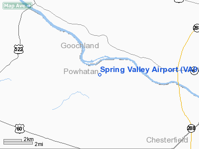
Location & QuickFacts
| FAA Information Effective: | 2008-09-25 |
| Airport Identifier: | VA95 |
| Airport Status: | Operational |
| Longitude/Latitude: | 077-48-00.9830W/37-35-49.5300N
-77.800273/37.597092 (Estimated) |
| Elevation: | 275 ft / 83.82 m (Estimated) |
| Land: | 0 acres |
| From nearest city: | 7 nautical miles NE of Powhatan, VA |
| Location: | Powhatan County, VA |
| Magnetic Variation: | 08W (1985) |
Owner & Manager
| Ownership: | Privately owned |
| Owner: | D. E. Wheless |
| Address: | 2248 Huguenot Trail
Powhatan, VA 23139 |
| Phone number: | 804-794-5200 |
| Manager: | D. E. Wheless |
| Address: | 2248 Huguenot
Powhatan, VA 23139 |
| Phone number: | 804-794-5200 |
Airport Operations and Facilities
| Airport Use: | Private |
| Wind indicator: | Yes |
| Segmented Circle: | No |
| Control Tower: | No |
| Landing fee charge: | No |
| Sectional chart: | Washington |
| Region: | AEA - Eastern |
| Boundary ARTCC: | ZDC - Washington |
| Tie-in FSS: | DCA - Leesburg |
| FSS on Airport: | No |
| FSS Toll Free: | 1-800-WX-BRIEF |
Runway Information
Runway 02/20
| Dimension: | 2300 x 100 ft / 701.0 x 30.5 m |
| Surface: | TURF, |
| |
Runway 02 |
Runway 20 |
| Traffic Pattern: | Left | Left |
|
Radio Navigation Aids
| ID |
Type |
Name |
Ch |
Freq |
Var |
Dist |
| LJK | NDB | Ashey | | 280.00 | 09W | 18.6 nm |
| CF | NDB | Pubbs | | 392.00 | 09W | 22.9 nm |
| IQK | NDB | Louisa | | 382.00 | 09W | 25.6 nm |
| PTB | NDB | Petersburg | | 284.00 | 08W | 30.1 nm |
| BKT | NDB | Blackstone | | 326.00 | 09W | 30.5 nm |
| FVX | NDB | Farmville | | 367.00 | 07W | 33.8 nm |
| APH | NDB | A P Hill | | 396.00 | 10W | 37.1 nm |
| AZS | NDB | Azalea Park | | 336.00 | 08W | 42.2 nm |
| EZF | NDB | Shannon | | 237.00 | 10W | 43.5 nm |
| FAK | VORTAC | Flat Rock | 080X | 113.30 | 06W | 4.3 nm |
| RIC | VORTAC | Richmond | 088X | 114.10 | 09W | 23.6 nm |
| GVE | VORTAC | Gordonsville | 103X | 115.60 | 06W | 30.1 nm |
| HPW | VORTAC | Hopewell | 057X | 112.00 | 06W | 36.4 nm |
| LVL | VORTAC | Lawrenceville | 076X | 112.90 | 08W | 47.1 nm |
| BRV | VORTAC | Brooke | 092X | 114.50 | 09W | 49.2 nm |
Images and information placed above are from
http://www.airport-data.com/airport/VA95/
We thank them for the data!
| General Info
|
| Country |
United States
|
| State |
VIRGINIA
|
| FAA ID |
VA95
|
| Latitude |
37-35-49.530N
|
| Longitude |
077-48-00.983W
|
| Elevation |
275 feet
|
| Near City |
POWHATAN
|
We don't guarantee the information is fresh and accurate. The data may
be wrong or outdated.
For more up-to-date information please refer to other sources.
|
|


