 |
|
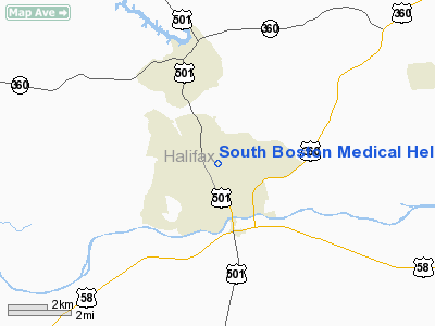
South Boston Medical Heliport |
Location & QuickFacts
| FAA Information Effective: | 2008-09-25 |
| Airport Identifier: | 5VA0 |
| Airport Status: | Operational |
| Longitude/Latitude: | 078-54-31.0360W/36-43-06.4960N
-78.908621/36.718471 (Estimated) |
| Elevation: | 460 ft / 140.21 m (Estimated) |
| Land: | 0 acres |
| From nearest city: | 0 nautical miles N of South Boston, VA |
| Location: | Halifax County, VA |
| Magnetic Variation: | 07W (1985) |
Owner & Manager
| Ownership: | Publicly owned |
| Owner: | City Of South Boston |
| Address: | Po Box 417
South Boston, VA 24592 |
| Phone number: | 804-575-4240 |
| Manager: | G. Cabell Carrington |
| Address: | Po Box 417
South Boston, VA 24592 |
| Phone number: | 804-575-4240 |
Airport Operations and Facilities
| Airport Use: | Private
MEDICAL USE. |
| Wind indicator: | Yes |
| Segmented Circle: | No |
| Control Tower: | No |
| Sectional chart: | Washington |
| Region: | AEA - Eastern |
| Boundary ARTCC: | ZDC - Washington |
| Tie-in FSS: | DCA - Leesburg |
| FSS on Airport: | No |
| FSS Toll Free: | 1-800-WX-BRIEF |
Runway Information
Helipad H1
| Dimension: | 40 x 40 ft / 12.2 x 12.2 m |
| Surface: | CONC, |
| |
Runway H1 |
Runway |
| Traffic Pattern: | Left | Left |
|
Radio Navigation Aids
| ID |
Type |
Name |
Ch |
Freq |
Var |
Dist |
| OQA | FAN MARKER | Rockingham County | | | | 47.8 nm |
| HXO | NDB | Huntsboro | | 271.00 | 07W | 28.8 nm |
| HUR | NDB | Person | | 220.00 | 08W | 30.1 nm |
| LY | NDB | Bojar | | 385.00 | 08W | 36.4 nm |
| MBV | NDB | Mecklenburg/dcmsnd | | 356.00 | 08W | 41.1 nm |
| AEA | NDB | Jones | | 373.00 | 09W | 41.7 nm |
| FVX | NDB | Farmville | | 367.00 | 07W | 44.3 nm |
| SIF | NDB | Slammer | | 423.00 | 07W | 46.0 nm |
| BKT | NDB | Blackstone | | 326.00 | 09W | 48.3 nm |
| LE | NDB | Leevy | | 350.00 | 07W | 48.4 nm |
| UV | NDB | Bales | | 396.00 | 07W | 49.2 nm |
| DAN | VOR | Danville | | 113.10 | 06W | 22.5 nm |
| SBV | VORTAC | South Boston | 041X | 110.40 | 05W | 5.7 nm |
| LYH | VORTAC | Lynchburg | 029X | 109.20 | 05W | 35.9 nm |
| LVL | VORTAC | Lawrenceville | 076X | 112.90 | 08W | 48.8 nm |
Remarks
- PRVDD VFR OPNS ONLY; USERS BRIEFED ON CLOSE PROXIMITY TO HIGH SPEED, LOW ALT MILITARY TRNG ROUTES IR715, IR719 & VR1722.
Images and information placed above are from
http://www.airport-data.com/airport/5VA0/
We thank them for the data!
| General Info
|
| Country |
United States
|
| State |
VIRGINIA
|
| FAA ID |
5VA0
|
| Latitude |
36-43-06.496N
|
| Longitude |
078-54-31.036W
|
| Elevation |
460 feet
|
| Near City |
SOUTH BOSTON
|
We don't guarantee the information is fresh and accurate. The data may
be wrong or outdated.
For more up-to-date information please refer to other sources.
|
|


