 |
|
Smith Mountain Lake Airport |
| Smith Mountain Lake Airport |
| IATA: none – ICAO: none – FAA LID: W91 |
| Summary |
| Operator |
Virginia Air Services |
| Serves |
Smith Mountain Lake |
| Location |
Moneta, Virginia |
| Elevation AMSL |
892 ft / 271.9 m |
| Coordinates |
37°08′14.44″N 80°40′42.53″W / 37.1373444°N 80.6784806°W / 37.1373444; -80.6784806 |
| Runways |
| Direction |
Length |
Surface |
| ft |
m |
| 5/23 |
3,058 |
932 |
Asphalt |
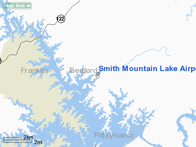
The Smith Mountain Lake Airport (FAA W91) is a public airport located 4 miles (6.4 km) southeast of Moneta, in Bedford County, Virginia, USA. The facility serves primarily general aviation for the areas around Smith Mountain Lake.
The above content comes from Wikipedia and is published under free licenses – click here to read more.
Location & QuickFacts
| FAA Information Effective: | 2008-09-25 |
| Airport Identifier: | W91 |
| Airport Status: | Operational |
| Longitude/Latitude: | 079-35-32.9000W/37-06-27.8000N
-79.592472/37.107722 (Estimated) |
| Elevation: | 892 ft / 271.88 m (Surveyed) |
| Land: | 42 acres |
| From nearest city: | 4 nautical miles SE of Moneta, VA |
| Location: | Bedford County, VA |
| Magnetic Variation: | 07W (1985) |
Owner & Manager
| Ownership: | Privately owned |
| Owner: | Virginia Air Services |
| Address: | 1090 Cutlass Rd
Moneta, VA 24121 |
| Phone number: | 540-297-4500 |
| Manager: | Joseph Borgess |
| Address: | 1090 Cutlass Rd
Moneta, VA 24121 |
| Phone number: | 540-297-4500 |
Airport Operations and Facilities
| Airport Use: | Open to public |
| Wind indicator: | Yes |
| Segmented Circle: | No |
| Control Tower: | No |
| Lighting Schedule: | DUSK-DAWN |
| Beacon Color: | Clear-Green (lighted land airport) |
| Landing fee charge: | No |
| Sectional chart: | Cincinnati |
| Region: | AEA - Eastern |
| Boundary ARTCC: | ZDC - Washington |
| Tie-in FSS: | DCA - Leesburg |
| FSS on Airport: | No |
| FSS Toll Free: | 1-800-WX-BRIEF |
| NOTAMs Facility: | ROA (NOTAM-d service avaliable) |
Airport Communications
| CTAF: | 122.800 |
| Unicom: | 122.800 |
Airport Services
| Fuel available: | 100LL |
| Airframe Repair: | MAJOR |
| Power Plant Repair: | MAJOR |
| Bottled Oxygen: | NONE |
| Bulk Oxygen: | NONE |
Runway Information
Runway 05/23
| Dimension: | 3058 x 50 ft / 932.1 x 15.2 m |
| Surface: | ASPH, Good Condition |
| Edge Lights: | Medium
MIRL OTS INDEFLY. |
| |
Runway 05 |
Runway 23 |
| Longitude: | 079-35-46.2470W | 079-35-19.5940W |
| Latitude: | 37-06-17.1160N | 37-06-38.5190N |
| Elevation: | 855.00 ft | 892.00 ft |
| Alignment: | 45 | 127 |
| Traffic Pattern: | Left | Left |
| Markings: | Basic, Good Condition | Non-precision instrument, Good Condition |
| Displaced threshold: | 250.00 ft | 0.00 ft |
| Runway End Identifier: | No | Yes
REIL OTS INDEFLY. |
| Obstruction: | 57 ft tree, 200.0 ft from runway, 145 ft right of centerline
APCH SLOPE 0:1 TO DSPLCD THR BASED ON +23 FT TREES, 150 FT LEFT OF CENTERLINE.
+12 FT ROAD AT THLD 100 FT R. | 41 ft tree, 211.0 ft from runway, 144 ft left of centerline
+15 FT ROAD AT THLD 125 FT L. |
|
Radio Navigation Aids
| ID |
Type |
Name |
Ch |
Freq |
Var |
Dist |
| OQA | FAN MARKER | Rockingham County | | | | 42.5 nm |
| VIT | NDB | Vinton | | 277.00 | 06W | 15.0 nm |
| LY | NDB | Bojar | | 385.00 | 08W | 19.1 nm |
| CNQ | NDB | Callahan | | 379.00 | 05W | 28.6 nm |
| UV | NDB | Bales | | 396.00 | 07W | 34.8 nm |
| TEC | NDB | Tech | | 368.00 | 06W | 39.3 nm |
| SIF | NDB | Slammer | | 423.00 | 07W | 44.4 nm |
| ODR | VOR | Woodrum | | 114.90 | 06W | 22.6 nm |
| DAN | VOR | Danville | | 113.10 | 06W | 34.6 nm |
| LYH | VORTAC | Lynchburg | 029X | 109.20 | 05W | 19.2 nm |
| ROA | VORTAC | Roanoke | 031X | 109.40 | 04W | 26.9 nm |
| SBV | VORTAC | South Boston | 041X | 110.40 | 05W | 38.1 nm |
Remarks
Images and information placed above are from
http://www.airport-data.com/airport/W91/
We thank them for the data!
| General Info
|
| Country |
United States
|
| State |
VIRGINIA
|
| FAA ID |
W91
|
| Latitude |
37-06-27.800N
|
| Longitude |
079-35-32.900W
|
| Elevation |
892 feet
|
| Near City |
MONETA
|
We don't guarantee the information is fresh and accurate. The data may
be wrong or outdated.
For more up-to-date information please refer to other sources.
|
|


