 |
|
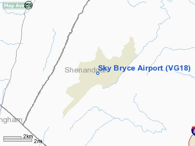
Location & QuickFacts
| FAA Information Effective: | 2008-09-25 |
| Airport Identifier: | VG18 |
| Airport Status: | Operational |
| Longitude/Latitude: | 078-46-13.0730W/38-48-57.4050N
-78.770298/38.815946 (Estimated) |
| Elevation: | 1263 ft / 384.96 m (Surveyed) |
| Land: | 22 acres |
| From nearest city: | 1 nautical miles NE of Basye, VA |
| Location: | Shenandoah County, VA |
| Magnetic Variation: | 08W (1985) |
Owner & Manager
| Ownership: | Privately owned |
| Owner: | Bryce Resort |
| Address: | Po Box 3
Basye, VA 22810 |
| Phone number: | 800-821-1444 |
| Manager: | Robt. D. Robinette |
| Address: | Po Box 3
Basye, VA 22810 |
| Phone number: | 540-856-2121 |
Airport Operations and Facilities
| Airport Use: | Private |
| Wind indicator: | Yes |
| Segmented Circle: | Yes |
| Control Tower: | No |
| Landing fee charge: | No |
| Sectional chart: | Washington
AND CINCINNATI. |
| Region: | AEA - Eastern |
| Traffic Pattern Alt: | 1137 ft |
| Boundary ARTCC: | ZDC - Washington |
| Tie-in FSS: | DCA - Leesburg |
| FSS on Airport: | No |
| FSS Toll Free: | 1-800-WX-BRIEF |
Airport Services
| Airframe Repair: | NONE |
| Power Plant Repair: | NONE |
Runway Information
Runway 05/23
| Dimension: | 2240 x 50 ft / 682.8 x 15.2 m |
| Surface: | ASPH, Fair Condition |
| Weight Limit: | Single wheel: 10000 lbs.
Dual wheel: 10000 lbs. |
| |
Runway 05 |
Runway 23 |
| Traffic Pattern: | Left | Left |
| Markings: | Numbers only, Good Condition | Numbers only, Good Condition |
| Runway End Identifier: | No | No |
| Centerline Lights: | No | No |
| Touchdown Lights: | No | No |
| Obstruction: | 54 ft trees, 980.0 ft from runway, 90 ft left of centerline, 14:1 slope to clear | 15 ft road, 200.0 ft from runway, 90 ft left of centerline |
|
Radio Navigation Aids
| ID |
Type |
Name |
Ch |
Freq |
Var |
Dist |
| LUA | NDB | Caverns | | 245.00 | 09W | 15.6 nm |
| VBW | NDB | Bridgewater | | 241.00 | 07W | 28.5 nm |
| TZ | NDB | Cogan | | 364.00 | 10W | 36.6 nm |
| GDX | NDB | Goodwin Lake | | 227.00 | 08W | 44.7 nm |
| MSQ | NDB | Nailr | | 351.00 | 10W | 46.1 nm |
| CJR | NDB | Culpeper | | 252.00 | 09W | 46.1 nm |
| AZS | NDB | Azalea Park | | 336.00 | 08W | 49.9 nm |
| ESL | VOR/DME | Kessel | 045X | 110.80 | 06W | 26.7 nm |
| LDN | VORTAC | Linden | 090X | 114.30 | 06W | 26.5 nm |
| CSN | VORTAC | Casanova | 110X | 116.30 | 06W | 43.7 nm |
Images and information placed above are from
http://www.airport-data.com/airport/VG18/
We thank them for the data!
| General Info
|
| Country |
United States
|
| State |
VIRGINIA
|
| FAA ID |
VG18
|
| Latitude |
38-48-57.405N
|
| Longitude |
078-46-13.073W
|
| Elevation |
1263 feet
|
| Near City |
BASYE
|
We don't guarantee the information is fresh and accurate. The data may
be wrong or outdated.
For more up-to-date information please refer to other sources.
|
|


